

Landsat TM remote sensing image data cloud removal method and system
A remote sensing image and data technology, applied in image data processing, image enhancement, image analysis, etc., can solve problems such as inconvenient operation, loss of useful information, and consumption
- Summary
- Abstract
- Description
- Claims
- Application Information
AI Technical Summary
Problems solved by technology
Method used
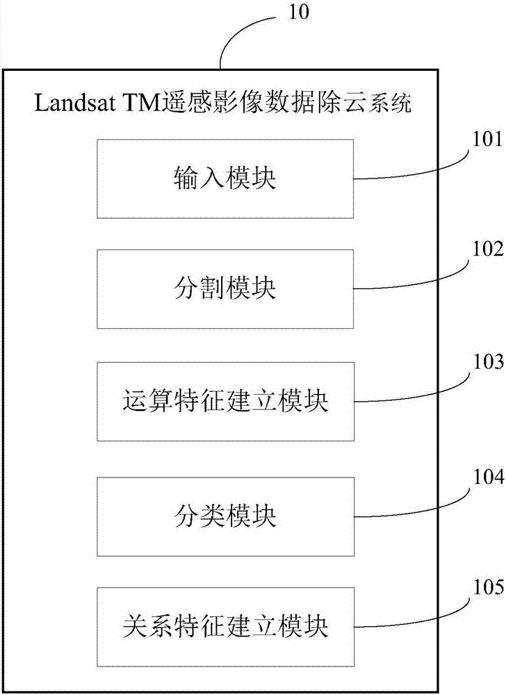
Image


Examples
Embodiment Construction
[0036] The present invention will be described in further detail below in conjunction with the accompanying drawings and specific embodiments.
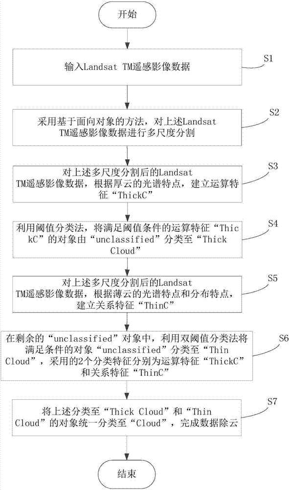
[0037] refer to figure 1 Shown is a flow chart of a preferred embodiment of the method for removing clouds from Landsat TM remote sensing image data according to the present invention.
[0038] Step S1, input Landsat TM remote sensing image data. in:
[0039] The Landsat TM remote sensing image data includes 7 spectral segments, namely: 3 visible spectral segments, 1 near-infrared spectral segment, 2 near-short-wave infrared spectral segments, 1 thermal infrared spectral segment, and the 3 visible spectral segments The segments include: blue-green spectrum, green spectrum, and red spectrum; and the 7 spectrum segments are named in turn: B 1 (blue-green band), B 2 (green band), B 3 (red band), B 4 (near-infrared spectrum), B 5 (near short-wave infrared spectrum), B 6 (thermal infrared spectrum), B 7 (near short-wave infrared s...
PUM
 Abstract
Description
Claims
Application Information