
A method and system for route site protocol management based on satellite remote sensing images

A technology of satellite remote sensing image and satellite remote sensing data, applied in the field of power transmission and transformation, can solve problems such as difficulty in viewing, change of route and site agreement, low efficiency of document management, etc., and achieve the effect of clear agreement and improve efficiency.

Active Publication Date: 2021-07-20
CHINA ELECTRIC POWER RES INST +2
View PDF3 Cites 0 Cited by
  • Summary
  • Abstract
  • Description
  • Claims
  • Application Information

AI Technical Summary

Problems solved by technology

Such a management method often causes problems such as difficult viewing and low efficiency of document management.
In the process of line selection and site selection, there are often problems such as the change and expiration of the route site agreement. The lack of efficient and intuitive management methods will make the designer unclear about the effective time and scope of the route site agreement, which will affect the line, station, etc. Accuracy of site planning

Method used


Image

  • A method and system for route site protocol management based on satellite remote sensing images
  • A method and system for route site protocol management based on satellite remote sensing images

Examples


Embodiment Construction

[0030] Exemplary embodiments of the present invention will now be described with reference to the drawings; however, the present invention may be embodied in many different forms and are not limited to the embodiments described herein, which are provided for the purpose of exhaustively and completely disclosing the present invention. invention and fully convey the scope of the invention to those skilled in the art. The terms used in the exemplary embodiments shown in the drawings do not limit the present invention. In the figures, the same units / elements are given the same reference numerals.

[0031] Unless otherwise specified, the terms (including scientific and technical terms) used herein have the commonly understood meanings to those skilled in the art. In addition, it can be understood that terms defined by commonly used dictionaries should be understood to have consistent meanings in the context of their related fields, and should not be understood as idealized or over...


PUM


Abstract

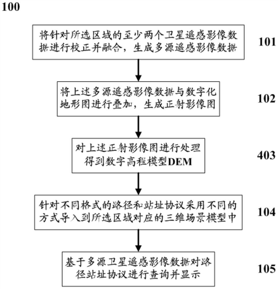
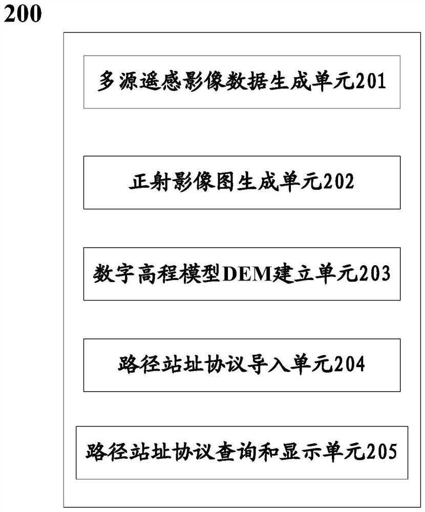
The invention discloses a route site protocol management method based on the temporal and spatial characteristics of satellite remote sensing images. The method includes: correcting and fusing at least two satellite remote sensing image data for a selected area to generate multi-source remote sensing image data; Superimpose the above-mentioned multi-source remote sensing image data with the digital topographic map to generate an orthophoto map; process the above-mentioned orthophoto map to obtain a digital elevation model DEM; use different methods to import the route station protocol into the selected In the 3D scene model corresponding to the area; and based on the multi-source satellite remote sensing image data, the route station protocol is queried and displayed.

Description

technical field [0001] The present invention relates to the technical field of power transmission and transformation, and more specifically, to a route site protocol management method and system based on satellite remote sensing images. Background technique [0002] In the traditional transmission line design, the management of route site agreement is collected and organized manually, and then managed by computer storage and scanning files. Such a management method often causes problems such as difficulty in viewing and low document management efficiency. In the process of line selection and site selection, there are often problems such as the change and expiration of the route site agreement. The lack of efficient and intuitive management methods will make the designer unclear about the effective time and scope of the route site agreement, which will affect the line and station. The accuracy of site planning. Contents of the invention [0003] In order to solve the abov...

Claims


Application Information

Patent Timeline
Patent Type & Authority Patents(China)
IPC IPC(8): G06F16/9537G06F16/9532G06F16/29G06T5/00G06T17/05
CPCG06T5/006G06T17/05G06T2207/10032G06T2207/20221G06F16/29G06F16/9537
Inventor 王轶刘华清武坤费香泽马潇
Owner CHINA ELECTRIC POWER RES INST
Learn More