Mileage pile information making method and device, geographic information acquisition device and navigation chip

A technology of geographic information and production methods, applied in the field of electronic maps, can solve the problems of single mileage pile data content, difficult navigation and positioning ability, and inability to complement each other and correct each other, so as to achieve rich information, wide coverage, and real and reliable mileage pile data. Effect

Inactive Publication Date: 2018-03-09
NAVINFO
View PDF4 Cites 8 Cited by
  • Summary
  • Abstract
  • Description
  • Claims
  • Application Information

AI Technical Summary

Problems solved by technology

Although the solutions in the prior art are easy to implement, they have poor accuracy and may have great deviations from the actual road network conditions. Generally, they are only suitable for expressways with relatively comprehensive and accurate road data; in addition, the solutions in the prior art are completely dependent on road data , the mileage pile data is only an additional attribute of the road data, which has no practical significance and cannot be supplemented and corrected; finally, the content of the mileage pile data obtained by the existing technology scheme is relatively single, and does not have any independent features, so it is difficult to Used to assist in improving navigation and positioning capabilities

Method used


Image

  • Mileage pile information making method and device, geographic information acquisition device and navigation chip
  • Mileage pile information making method and device, geographic information acquisition device and navigation chip
  • Mileage pile information making method and device, geographic information acquisition device and navigation chip

Examples


Embodiment 1

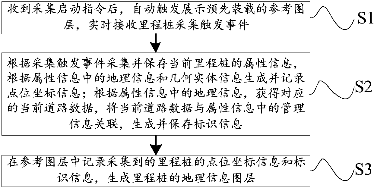
[0051] In one embodiment of the present invention, the collection of mileage pile data is started on demand, that is, in the above step S1, it also includes:

[0052] According to the collection site conditions and collection requirements, comprehensively judge whether to start displaying the reference layer after confirming receipt of the collection start command.

[0053] Furthermore, in step S1, after the electronic map data is read, a graphical display is performed, usually the displayed content includes the current road condition and the current location mark in the electronic map. For example, an electronic map with a navigation function and a GPS cursor at the current position are displayed on the user terminal equipment; When driving on the highway, a GPS cursor will also be displayed on the acquisition device moving along the road shape of an existing piece of map data.

[0054] In addition, in an optional embodiment of the present invention, the mileage pile data ca...

Embodiment 2

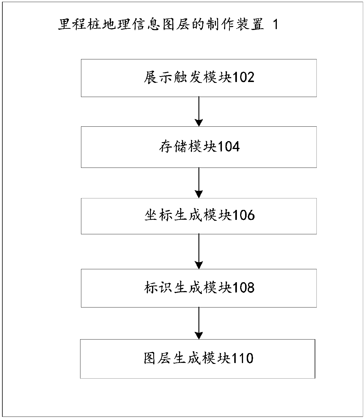
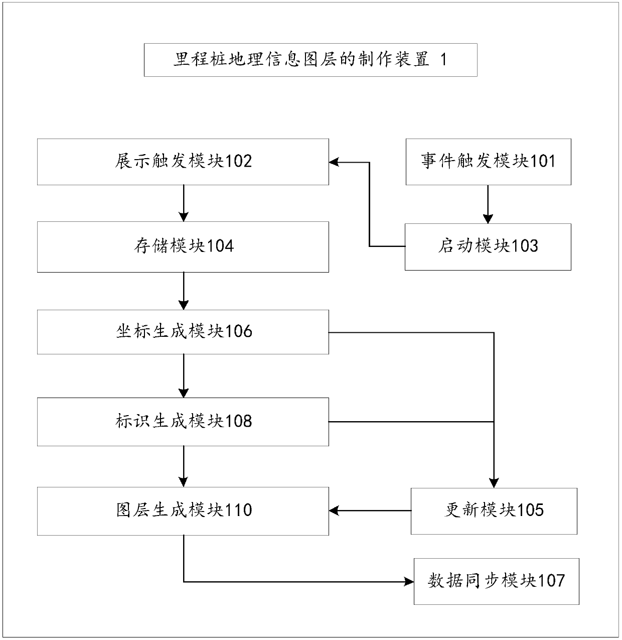
[0060] In another embodiment of the present invention, a device 1 for making a milepost geographic information layer is also provided, such as figure 2 As shown, the device 1 includes the following modules:

[0061] The display trigger module 102 is used to automatically trigger and display the preloaded reference layer after receiving the collection start instruction, and receive the mileage pile collection trigger event in real time;

[0062] The storage module 104 is used to collect and save the attribute information of the current mileage pile according to the received collection trigger event;

[0063] Coordinate generating module 106 is used for generating and recording the point coordinate information of the representative point of current milepost according to geographic information and geometric entity information in the attribute information; And,

[0064] The identification generation module 108 is used to obtain the corresponding current road data in the referenc...

Embodiment 3

[0079] In an alternative embodiment of the present invention, as Figure 4 As shown, the user collects and / or maintains the milepost data through the collection device 2 including the above-mentioned milepost geographical information layer production device 1 . Optionally, the acquisition device 2 is an electronic device including a variety of sensor devices 201, such as notebook computers, tablet computers, vehicle-mounted terminals, mobile phones, handheld navigation devices, vehicle-mounted navigation devices and other mobile terminal devices; The data processing device and various sensor devices can be integrated in the acquisition device, or relatively independent devices and devices can be connected to the acquisition device only when needed to complete their respective functions.

[0080] In a typical application scenario of an optional embodiment of the present invention, the collection device is a notebook computer with a GPS module, which is loaded with an electronic...


PUM


Abstract

The invention relates to the technical field of electronic maps and discloses a mileage pile geographic information coverage making method and device, a geographic information acquisition device and anavigation chip. The method comprises the steps that after an acquisition starting instruction is received, a reference coverage is automatically triggered and displayed, and a mileage pile acquisition triggering event is received in real time; according to the acquisition triggering event, attribute information of a current mileage pile is acquired and saved, and point location coordinate information of the current mileage pile is generated according to geographic information and geometrical entity information; according to the geographic information of the current mileage pile, current roaddata is associated with management information of the current mileage pile, and identifier information of the current mileage pile is generated and saved; the acquired point location coordinate information and identifier information of the current mileage pile are recorded in the reference coverage, and a geographic information coverage of the mileage pile is generated. By carrying out the technical scheme, electronic maps including accurate mileage pile data can be generated through an efficient and accurate acquisition means having very high automation degree.

Description

technical field [0001] The invention relates to the technical field of electronic maps, in particular to a method and device for making a mileage pile geographic information layer, a geographic information collection device and a navigation chip. Background technique [0002] The most basic and important requirement in electronic map data is to present the actual ground conditions as realistically as possible. For example, in the actual road network, the mileage from the starting point to the current position is represented by setting road mileage piles on the side of the road along the route direction. This is a very important landmark in the actual road network, so it also needs to be more accurately reflected in the electronic map data. [0003] Highway mileage piles are of great significance to the actual road network and electronic maps, especially in electronic navigation as important fast positioning information. However, due to the large number of mileage posts in t...

Claims


Application Information

Patent Timeline
Patent Type & Authority Applications(China)
IPC IPC(8): G06F17/30G01C21/32
CPCG01C21/32G06F16/29
Inventor 程晓茜王琦
Owner NAVINFO
Why Eureka
Try Eureka