Method and device for extraction reference points for navigation

An extraction method and a technology of reference points, applied in the field of navigation, can solve the problem of low efficiency of extracting reference points and achieve the effect of improving efficiency

Inactive Publication Date: 2018-05-29
武汉四维图新科技有限公司
View PDF7 Cites 5 Cited by
  • Summary
  • Abstract
  • Description
  • Claims
  • Application Information

AI Technical Summary

Problems solved by technology

[0007] Embodiments of the present invention provide a method and device for extracting reference points for navigation, to solve the problem that in the prior art, in the process of extracting reference points, it can only be determined by manual extraction, resulting in low efficiency of extracting reference points question

Method used


Image

  • Method and device for extraction reference points for navigation
  • Method and device for extraction reference points for navigation
  • Method and device for extraction reference points for navigation

Examples


Embodiment 1

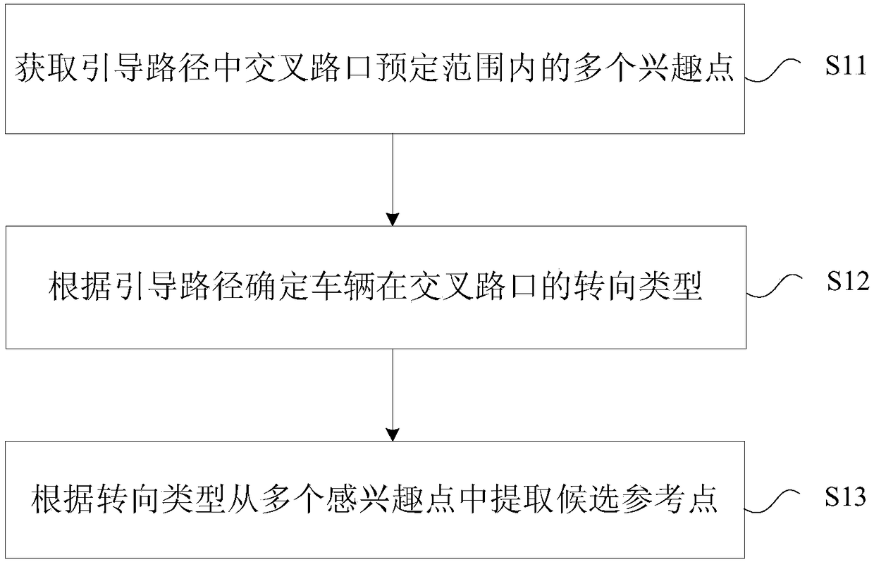
[0035] In this embodiment, a reference point extraction method for navigation is provided, figure 1 Is a flowchart of a method for extracting reference points for navigation according to an embodiment of the present invention, such as figure 1 As shown, the process includes the following steps:

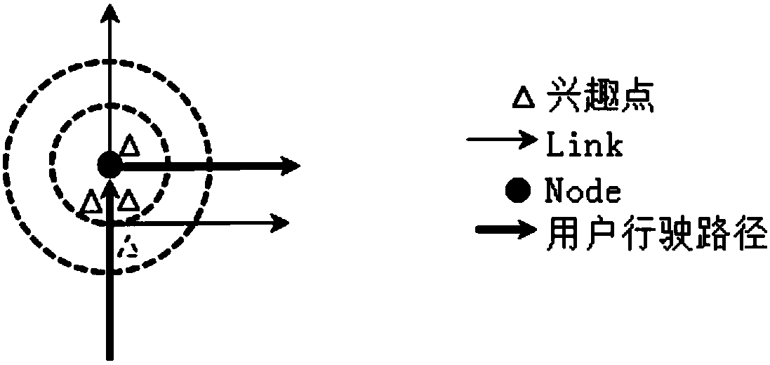
[0036] Step S11, acquiring multiple points of interest within a predetermined range of an intersection in the guidance route; for example, multiple points of interest within the predetermined range can be acquired from the geographic data of the entire map and the POI stored in the navigation system;

[0037] Step S12: Determine the steering type of the vehicle at the intersection according to the guidance path; the steering type may include many types, for example, it may be straight, left turn, right turn, U-turn, P-turn, or circular turn;

[0038] Step S13: Extract candidate reference points from multiple points of interest according to the turning type, that is, the candidate reference po...


PUM


Abstract

The present invention provides a method and a device for extraction reference points for navigation. The method includes the following steps: acquiring a plurality of interest points within a predetermined range of an intersection at a guidance route; determining a steering type of the intersection according to the guidance route; and extracting the candidate reference points from the plurality ofinterest points according to the steering type. The method solves the problem of low efficiency of extracting of the reference points caused for the reason that only manual extraction can be used fordetermination in the process of extracting of the candidate reference points in the prior art, and the efficiency of navigation data production is improved.

Description

Technical field [0001] The present invention relates to the technical field of navigation, in particular to a method and device for extracting reference points for navigation. Background technique [0002] Generally speaking, a navigation system is a system that uses artificial satellites to provide information for transportation equipment, such as vehicles. The navigation system stores geographic data and points of interest (POI) of the entire map. POI includes characteristic features such as buildings on the map, various shopping malls, convenience stores, and gas stations. The navigation system uses the stored geographic data and POI as route navigation information. [0003] The navigation system uses a Global Positioning System (GPS) receiver to receive preset data from GPS satellites above the earth, and calculates its own position based on the received data. The navigation system can also provide the user with the information of the current position of the vehicle based on ...

Claims


Application Information

Patent Timeline
IPC IPC(8): G01C21/36
CPCG01C21/3682
Inventor 王鹏张树清宋可可
Owner 武汉四维图新科技有限公司
Why Eureka
Try Eureka