

Pseudo-range feedback integrated navigation method for reducing multi-path interference
A technology of integrated navigation and multipath interference, which is applied in navigation, surveying and navigation, and navigation through speed/acceleration measurement, etc. It can solve the problems affecting the quality of pseudo-range observations, the decrease of satellite navigation measurement accuracy, and signal loss of lock, etc. , to achieve the effect of improving navigation and positioning accuracy, improving satellite navigation and positioning accuracy, and suppressing errors
- Summary
- Abstract
- Description
- Claims
- Application Information
AI Technical Summary
Problems solved by technology
Method used
Image

Examples
Embodiment Construction
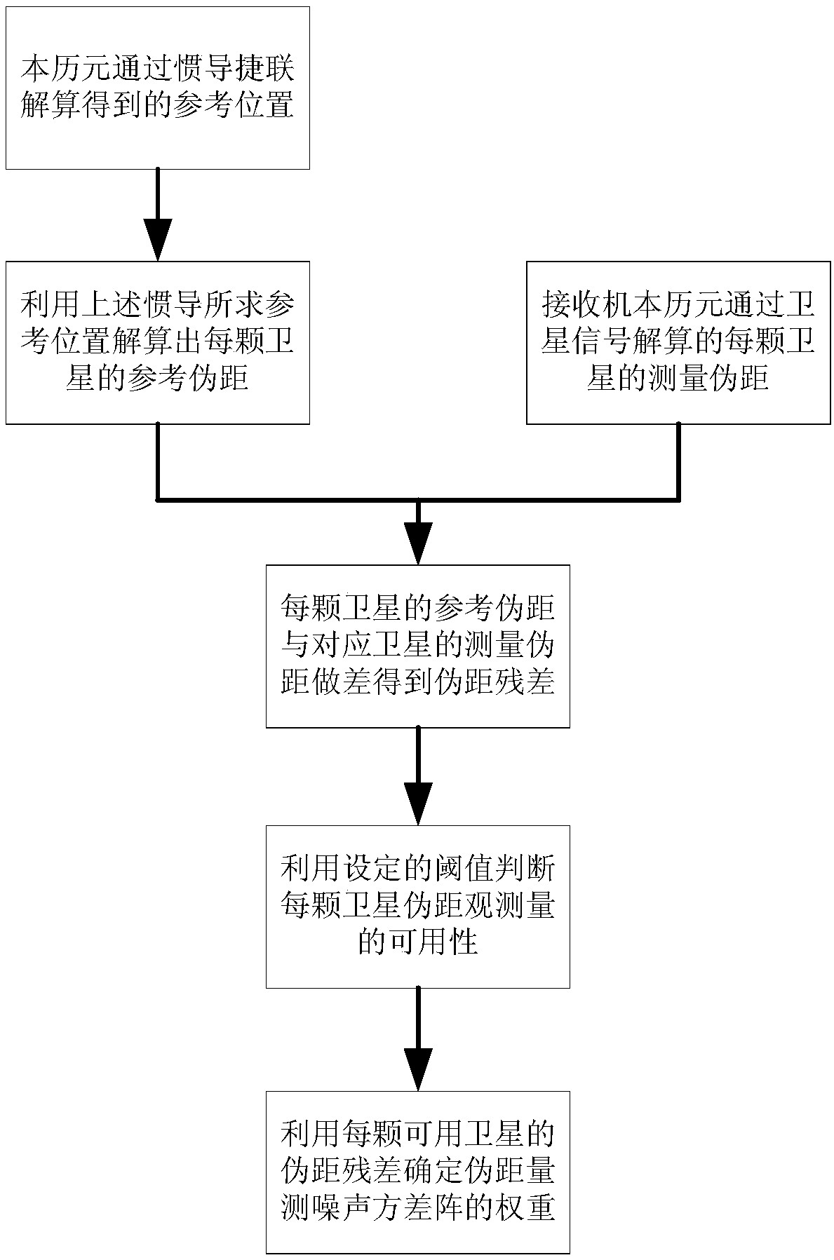
[0017] Below with the accompanying drawings ( figure 1 ) to illustrate the present invention.
[0018] figure 1 It is a schematic flow chart of implementing a pseudo-range feedback integrated navigation method for reducing multipath interference in the present invention. Such as figure 1 Shown, the concrete solution of the present invention is as follows:
[0019] 1. The reference position obtained by the inertial navigation strapdown solution in this epoch: using the combined navigation results of the previous epoch, the angular velocity of three degrees of freedom and the acceleration of three degrees of self-use collected by the three-axis gyroscope and the three-axis accelerometer , using the inertial navigation strapdown algorithm to obtain the 3D reference predicted position coordinates of this epoch.
[0020] 2. Use the reference position obtained by the above inertial navigation to calculate the reference pseudorange of each satellite: use the reference position ob...
PUM
 Abstract
Description
Claims
Application Information