Road infrastructure construction project impact evaluation decision support system and method
A technology of road infrastructure and decision support system, applied in the direction of road vehicle traffic control system, traffic control system, instruments, etc., can solve problems such as poor decision support adaptability, and achieve the effect of reducing human and material resources and improving accuracy
- Summary
- Abstract
- Description
- Claims
- Application Information
AI Technical Summary
Problems solved by technology
Method used
Image
Examples
Embodiment 1
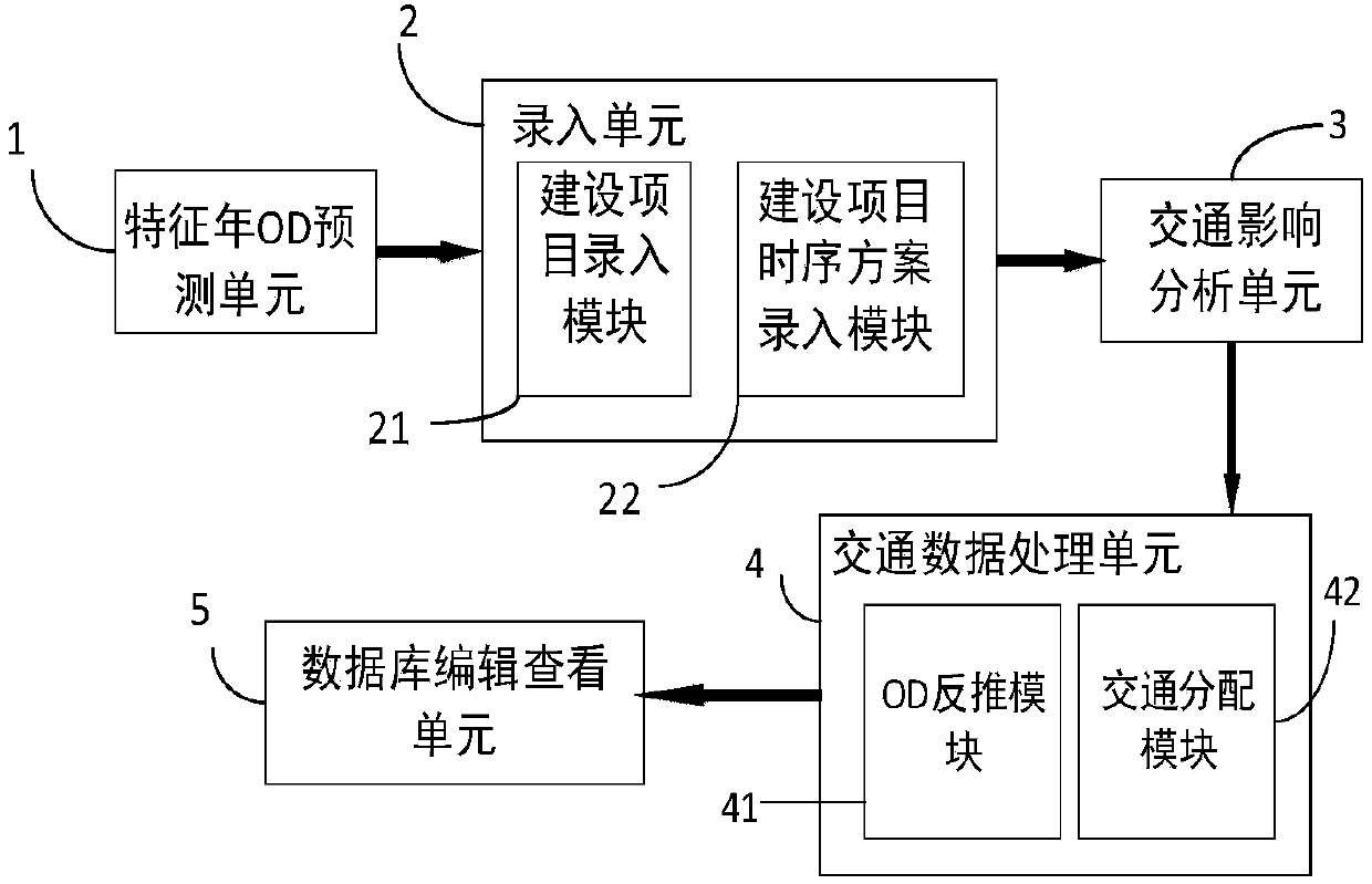
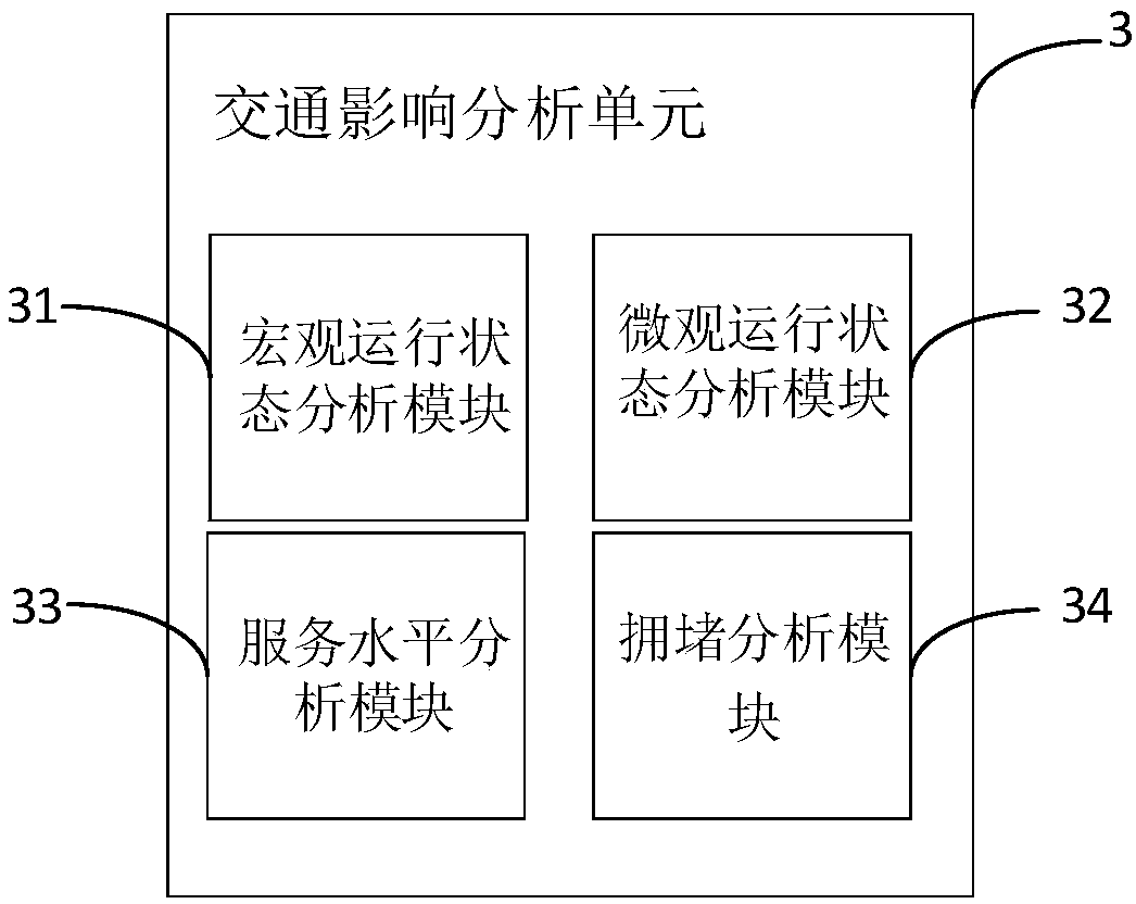
[0041] Such as figure 1 , the road infrastructure construction project impact evaluation decision support system involved in the present invention, the system includes a characteristic year OD prediction unit 1, which is used to predict the traffic between each traffic district in the year when the road is opened for new construction and reconstruction and expansion projects according to the growth rate model. EMU traffic trip volume; input unit 2, such as figure 2 , including a construction project input module 21, used to input the current road network map format file selected by the user, a construction project road network map format file, and a characteristic year OD table, and a construction project timing plan input module 22, used to input the current road network selected by the user. Network map format file, characteristic year OD table, map format file and characteristic year OD table of newly added and cleared multiple construction timing schemes;
[0042] The tr...
Embodiment 2
[0051] Such as figure 2 , a road infrastructure construction project impact evaluation decision support method, the method includes the following steps:
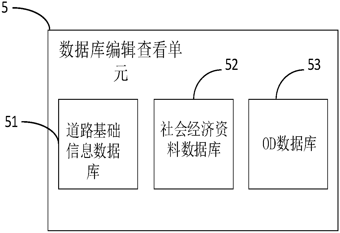
[0052] Step 1. Copy the user-specified file, and update the road basic information database and social economic data database. The cycle of road construction projects is short, and the establishment of an updateable database can increase the amount of data and improve the accuracy of model calculation results. Among them, the road basic information database stores map format files. The map format files include the length of all roads in the road network, the capacity value, the design speed and the traffic volume of the investigated road sections to provide data for the subsequent base year OD back-estimation and traffic allocation. The socio-economic data store the GDP and population data of each traffic district over the years to provide basic data for the OD prediction of the characteristic year. The OD basic database ...
PUM
 Abstract
Description
Claims
Application Information
 - R&D
- Intellectual Property
- Life Sciences
- Materials
- Tech Scout
- Unparalleled Data Quality
- Higher Quality Content
- 60% Fewer Hallucinations
Browse by: Latest US Patents, China's latest patents, Technical Efficacy Thesaurus, Application Domain, Technology Topic, Popular Technical Reports.
© 2025 PatSnap. All rights reserved.Legal|Privacy policy|Modern Slavery Act Transparency Statement|Sitemap|About US| Contact US: help@patsnap.com


