Method and terminal for real-time interactive interpretation of unmanned aerial vehicle

A real-time interaction and unmanned aerial vehicle technology, applied in the field of unmanned aerial vehicles, can solve the problems of insufficient use of surveying and mapping business data, insufficient integration of software use and data, and pilots' inability to record real-time image transmission and interpretation information, etc., to achieve improved Observe the effects of speed, avoiding tidying, and improving accuracy

Active Publication Date: 2018-08-17
FUZHOU TELEWARE ELECTRONICS
View PDF12 Cites 1 Cited by
  • Summary
  • Abstract
  • Description
  • Claims
  • Application Information

AI Technical Summary

Problems solved by technology

[0003] However, the commonly used original flight control software and third-party automatic flight control software have the following shortcomings: the use of software and data are not closely integrated, and the surveying and mapping business data are not fully utilized; apart from taking photos and videos during the flight, the pilot cannot Record the information interpreted from the real-time video transmission, which can only be sorted out after the fact

Method used


Image

  • Method and terminal for real-time interactive interpretation of unmanned aerial vehicle
  • Method and terminal for real-time interactive interpretation of unmanned aerial vehicle

Examples


Embodiment 1

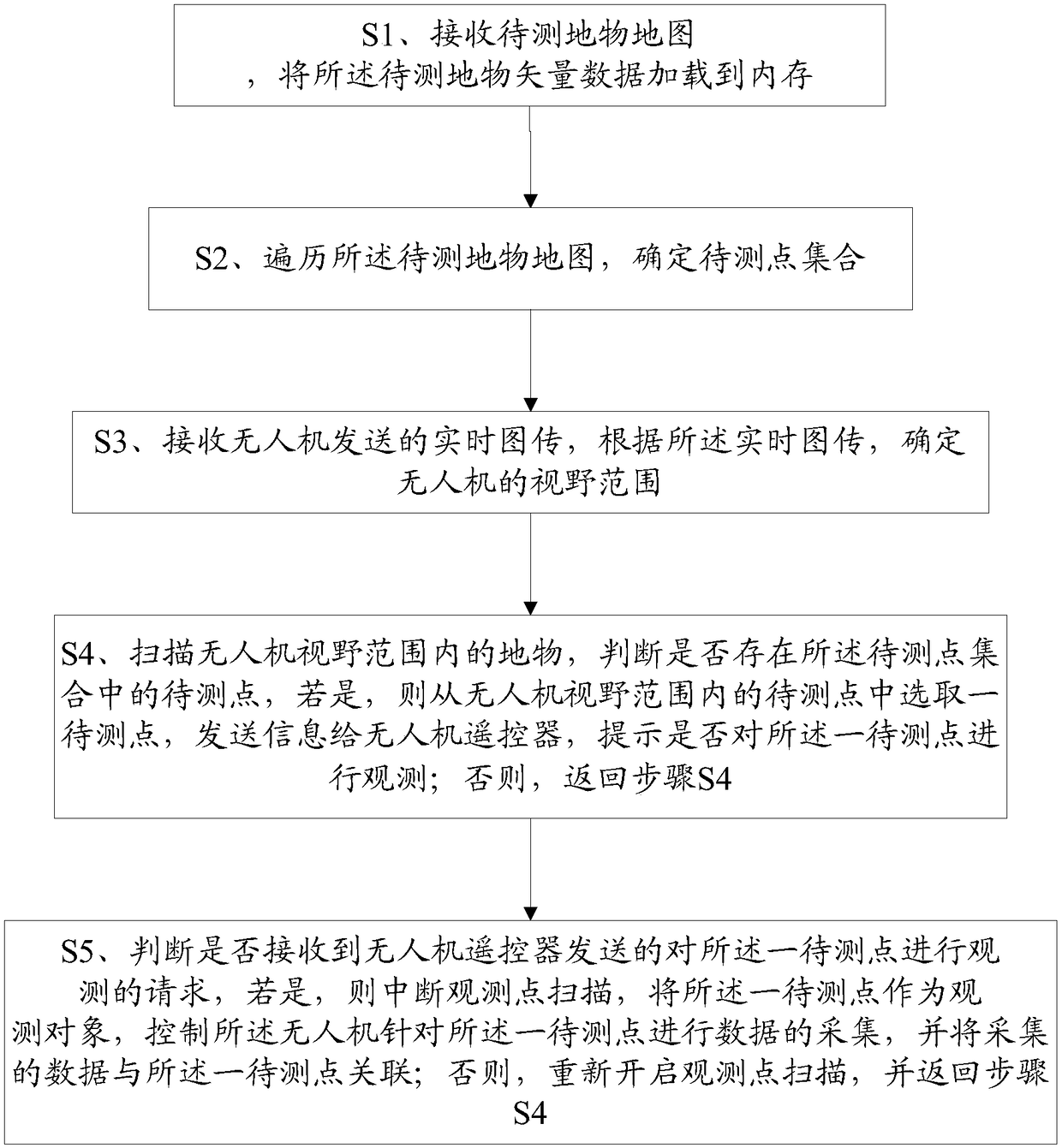
[0067] Please refer to figure 1 , a method for real-time interactive interpretation of unmanned aerial vehicles, comprising steps:

[0068] S1. Receive the map of the ground object to be measured, and load the map of the ground object to be measured into the memory;

[0069] The ground object map to be measured can be completed on the PC side using arcmap software, and the basic data are processed to make a map package to be observed. The basic data includes a high-definition image base map, a digital elevation model DEM, and a vector of ground objects to be observed. data and high-risk areas;

[0070] In order to improve the resolution for easy viewing, the resolution of the image base map should not be lower than 1m, preferably 0.2-0.5m, the DEM resolution should not be lower than 30m, preferably 5m, and the accuracy of vector data collection should not be lower than 2.5m;

[0071] The above basic data are unified to Web Mercator through projection transformation to improv...

Embodiment 2

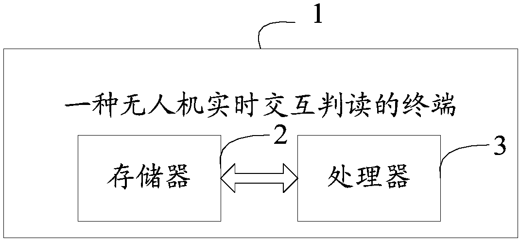
[0099] Please refer to figure 2 , a terminal 1 for real-time interactive interpretation of drones, including a memory 2, a processor 3, and a computer program stored in the memory 2 and operable on the processor 3, and the processor 3 executes the A computer program realizes the steps of the first embodiment.

[0100] To sum up, the method and terminal for real-time interactive interpretation of a drone provided by the present invention first determine the set of points to be measured, and if there are points to be measured in the set of points to be measured within the field of vision of the drone, then Select a point to be measured and send it to the UAV remote controller to prompt whether to observe the point to be measured. After collecting data for a point to be measured, associate the collected data with the point to be measured to realize The real-time interactive interpretation with the UAV can automatically establish the points to be measured, ensuring that all grou...


PUM


Abstract

The invention discloses a method and terminal for the real-time interactive interpretation of an unmanned aerial vehicle (UAV). Firstly, a set of points to be tested is determined, if a point to be tested in the set of the points to be tested exists in a field of view of the UAV, a point to be tested is selected from the set and is sent to a UAV remote controller to prompt whether to observe the point to be tested, after the data collection of the point to be tested is carried out, the collected data and the point to be tested are associated, the real-time interactive interpretation of the UAVis achieved, the semi-automatic selection of the points to be tested is carried out, the data collected by the UAV during flight and the points to be tested are associated in real time, the accuracyof interpretation is improved, the observation speed is improved, and the subsequent sorting of the collected data for the points to be tested is avoided.

Description

technical field [0001] The invention relates to the technical field of unmanned aerial vehicles, in particular to a method and terminal for real-time interactive interpretation of unmanned aerial vehicles. Background technique [0002] With the advantages of low cost and high reliability, consumer drones are widely used in various industries. In the surveying and mapping business, consumer drones can change the "last two kilometers" operation mode of field investigators, and interpret ground features through high-resolution real-time image transmission and photos, reducing the workload and risks of walking. It can effectively improve the working speed of the field. [0003] However, the commonly used original flight control software and third-party automatic flight control software have the following shortcomings: the use of software and data are not closely integrated, and the surveying and mapping business data are not fully utilized; apart from taking photos and videos d...

Claims


Application Information

Patent Timeline
Patent Type & Authority Applications(China)
IPC IPC(8): G05D1/10G01C11/00
CPCG01C11/00G05D1/0011G05D1/101
Inventor 陈曙光彭清新宁波张航张江辉
Owner FUZHOU TELEWARE ELECTRONICS
Why Eureka
Try Eureka