Remote sensing image classification and retrieval method

A technology of remote sensing images and images, applied in image analysis, image data processing, instruments, etc., can solve the problems of inability to express the global characteristics of remote sensing image texture and spatial structure, reduce the classification accuracy of remote sensing images, etc., and improve the retrieval accuracy, Avoid misclassification and omission, the effect of scientific and reasonable principle

Inactive Publication Date: 2018-09-14
崔植源
View PDF7 Cites 20 Cited by
  • Summary
  • Abstract
  • Description
  • Claims
  • Application Information

AI Technical Summary

Problems solved by technology

[0004] In order to improve the classification accuracy and computational efficiency of remote sensing images, the local feature algorithm including the bag of words model is used to reduce the dimensionality of remote sensing images. There are 10 images in the class, each image is divided into patches (it can be rigid segmentation or SIFT-based key point detection), each image is represented by multiple patches, each patch is represented by a feature vector, An image has hundreds or thousands of patches, and the dimension of each patch feature vector is 128. Assume that the Size of the Dictionary dictionary is 100, and use the K-means algorithm to cluster all the patches, k=100, etc. k-means When converging, get the final centroid of each cluster. These 100 centroids (dimension 128) are 100 words in the dictionary. After the dictionary is built, first initialize a histogram h with 100 bins whose initial value is 0, and then Calculate the distance between the patch and each centroid of each image, and see which centroid each patch is closest to, then add 1 to the corresponding bin in the histogram h, and after calculating all the patches of this image, get a The histogram of bin=100 is normalized, and this 100-dimensional vector is used to represent the image; however, the bag-of-words model usually focuses on the extraction of local image features, and cannot express the global features of remote sensing images including texture and spatial structure. Reduced accuracy of remote sensing image classification

Method used


Image

  • Remote sensing image classification and retrieval method
  • Remote sensing image classification and retrieval method
  • Remote sensing image classification and retrieval method

Examples


Embodiment 1

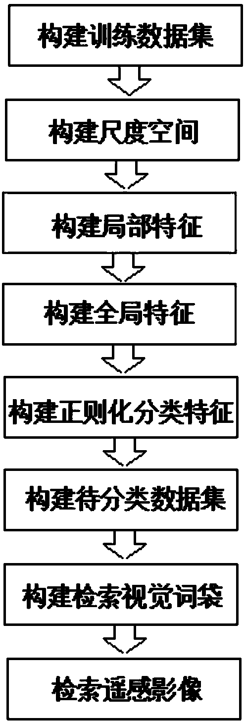
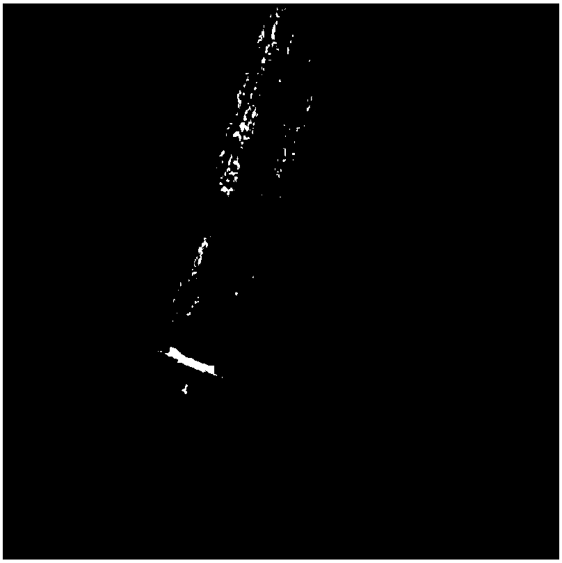
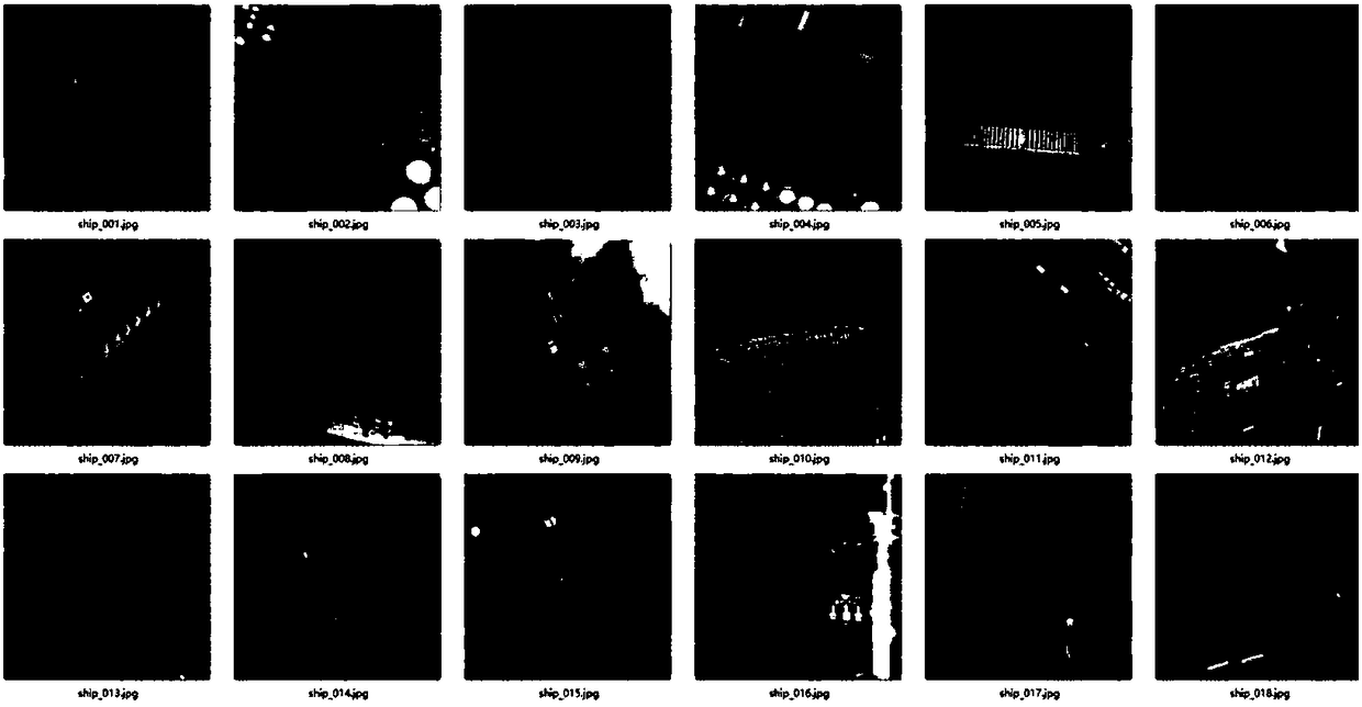
[0035] The specific process flow of the remote sensing image classification and retrieval method involved in this embodiment for retrieving ship remote sensing images includes constructing a training data set, constructing a scale space, constructing local features, constructing global features, constructing regularized classification features, and constructing data to be classified There are eight steps in collecting and constructing search visual word bag and searching remote sensing images:

[0036] (1) Building a training data set: Obtain the original remote sensing image of the ship through satellite or aerial photography, and use ENVI (Complete Remote Sensing Image Processing Platform) to perform geometric correction, de-drying and cutting preprocessing operations on the remote sensing image of the ship to obtain the training data set. Complete the construction of ship remote sensing image training data set;

[0037] (2) Constructing scale space: using formula 1: S(x,y,σ)=G(x...

Embodiment 2

[0045] The specific process flow of the remote sensing image classification and retrieval method involved in this embodiment for retrieving remote sensing images in commercial districts includes constructing a training data set, constructing a scale space, constructing local features, constructing global features, constructing regularized classification features, and constructing to-be-classified There are eight steps in data set, construction of retrieval visual word bag and retrieval of remote sensing images:

[0046] (1) Constructing the training data set: Obtain the original remote sensing image of the commercial area through satellite or aerial photography, and use ENVI (Complete Remote Sensing Image Processing Platform) to perform geometric correction, de-drying and cropping of the remote sensing image of the commercial area to obtain the training data Complete the construction of the remote sensing image training data set in the commercial area;

[0047] (2) Constructing sca...

Embodiment 3

[0055] The specific process flow of the remote sensing image classification and retrieval method involved in this embodiment for retrieving aircraft remote sensing images includes constructing a training data set, constructing a scale space, constructing local features, constructing global features, constructing regularized classification features, and constructing data to be classified There are eight steps in collecting and constructing search visual word bag and searching remote sensing images:

[0056] (1) Constructing the training data set: Obtain the original remote sensing image of the aircraft through satellite or aerial photography, and use ENVI (Complete Remote Sensing Image Processing Platform) to perform the preprocessing operations of geometric correction, de-drying and cropping of the aircraft remote sensing image to obtain the training data set. Complete the construction of aircraft remote sensing image training data set;

[0057] (2) Constructing scale space: using ...


PUM


Abstract

The invention belongs to the technical field of digital image processing and particularly relates to a remote sensing image classification and retrieval method. The remote sensing image classificationand retrieval method comprises the following technological processes: constructing a training data set, constructing a scale space, constructing local features, constructing global features, constructing regularized classification features, constructing a to-be-classified data set, constructing a retrieval visual word bag and retrieving remote sensing images. The remote sensing image classification and retrieval method provided by the invention has the benefits that the local features of classification are found on different scale spaces of the remote sensing images by adopting scale-invariant feature transform; the global features of the remote sensing images are constructed by adopting a generalized search tree, and a Gaussian weight function is introduced for the regularization fusionof the local features and the global features; the classification of the remote sensing images is developed on the basis of the regularized fusion of the local features and the global features, so that the retrieval of the images is finally realized; a principle is scientific and reasonable; the fusion of the local features and the global features of the remote sensing images can comprehensively depict the multi-scale, spatial and textural features of the remote sensing images, so that ground features of different sizes and orientations are completely classified.

Description

Technical field: [0001] The invention belongs to the technical field of digital image processing, and relates to a remote sensing image classification and retrieval method, which adopts a classification method with scale-invariant features, based on a general search tree and an improved word bag model, to realize the classification and retrieval of remote sensing images. Background technique: [0002] With the development of satellite remote sensing and UAV low-altitude digital aerial survey technology, the main obstacle to the application of high-resolution imagery in geoscience understanding and analysis is no longer the lack of data sources, but the richer, more useful and useful extraction of remote sensing images. Technology and ability for more reliable information. Remote sensing image (Remote Sensing Image, RS) refers to the film or photograph that records the electromagnetic wave size of various ground objects. It is mainly divided into aerial photographs and satellite p...

Claims


Application Information

Patent Timeline
Patent Type & Authority Applications(China)
IPC IPC(8): G06K9/46G06K9/62G06T7/40G06T7/90
CPCG06T7/40G06T7/90G06V10/462G06F18/2411G06F18/214
Inventor 崔植源
Owner 崔植源
Why Eureka
Try Eureka