
Method and system for judging postures of electric line pole in earthquake region based on long-distance photographed images

A technology for photographing images and telephone poles, applied in character and pattern recognition, instruments, computer parts, etc., it can solve the problems of low image processing fineness requirements, not suitable for individual soldiers, weak imaging effects, etc. The effect of environmental adaptability, high recognition rate and strong environmental adaptability

Pending Publication Date: 2018-09-21
GENERAL HOSPITAL OF CHINESE PEOPLES ARMED POLICEFORCES
View PDF15 Cites 3 Cited by
  • Summary
  • Abstract
  • Description
  • Claims
  • Application Information

AI Technical Summary

Problems solved by technology

First of all, in terms of system equipment, the UAV system and imaging sensor system used in the traditional method are large in size and heavy in weight, and are not suitable for individual use by disaster rescue teams; secondly, in terms of system information processing capabilities , the traditional method is mainly for data processing and analysis of short-distance targets or long-distance large-scale scene objects. In this case, either the atmospheric environment has a weak influence on imaging, or although the atmosphere will have a certain requires less precision

Method used

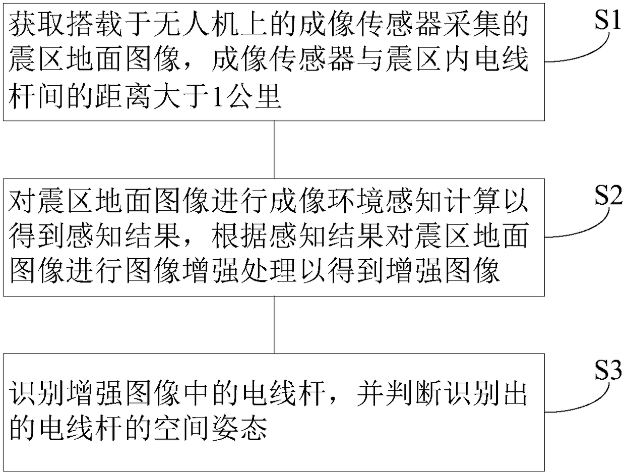
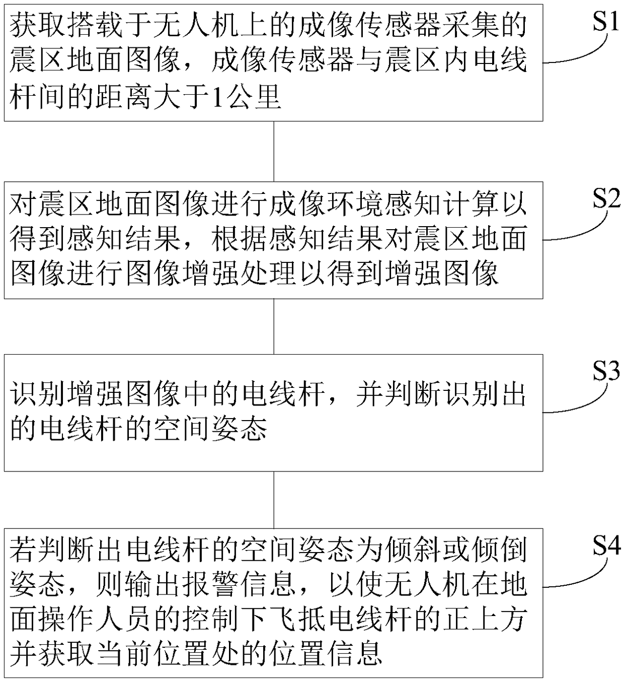
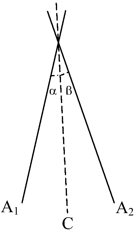

Image

  • Method and system for judging postures of electric line pole in earthquake region based on long-distance photographed images
  • Method and system for judging postures of electric line pole in earthquake region based on long-distance photographed images
  • Method and system for judging postures of electric line pole in earthquake region based on long-distance photographed images

Examples


Embodiment Construction

[0025] In order to make the object, technical solution and advantages of the present invention clearer, the implementation manner of the present invention will be further described in detail below in conjunction with the accompanying drawings.

[0026] After an earthquake disaster occurs, the spatial posture of the power infrastructure poles in the earthquake-stricken area will change, such as from a vertical posture to a tilted or inclined posture, that is, the angle between the power pole and the horizontal plane has changed , which will affect the power transmission in the earthquake area. In order to quickly grasp the spatial attitude of the utility poles after the earthquake, UAVs equipped with imaging sensors are usually used to survey the utility poles in the earthquake area (that is, objects on the ground). If the imaging sensor is too close to the utility pole, the utility pole will appear too large in the image, filling the entire field of view and its attitude cannot ...


PUM


Abstract

The invention discloses a method and a system for judging postures of an electric line pole in an earthquake region based on long-distance photographed images. The method comprises the following steps: acquiring earthquake region ground images acquired by an imaging sensor carried on an unmanned aerial vehicle; carrying out imaging environment sensing calculation on the earthquake region ground images to acquire a sensing result if a distance between the imaging sensor and the electric line pole in the earthquake region is more than 1 kilometer, and carrying out image enhancement processing onthe earthquake region ground images so as to acquire enhanced images; and recognizing the electric line pole in the enhanced images and judging spatial postures of the recognized electric line pole.The system comprises the unmanned aerial vehicle, the imaging sensor and a ground control terminal. According to the technical scheme provided by the invention, the system has the characteristics of strong environmental adaptability and high recognition ratio, and is more suitable for surveying electricity infrastructures under a complicated imaging environment in the earthquake region.

Description

technical field [0001] The invention belongs to the technical field of image processing and pattern recognition, and in particular relates to a method and system for judging electric poles in an earthquake zone based on long-distance photographed images. Background technique [0002] Earthquake rescue refers to the effective actions of quickly organizing human, material and financial resources to search, maintain and rescue important facilities, property and lives in areas damaged by earthquakes after an earthquake occurs. In the early stage of an earthquake, it is an important trend in the development of modern disaster rescue technology to conduct infrastructure surveys in earthquake-stricken areas and quickly formulate disaster rescue plans. Using information technology to survey roads, bridges, power systems, water conservancy systems, communication systems and other infrastructure in earthquake-stricken areas, and to evaluate the degree of earthquake damage, can provide...

Claims


Application Information

Patent Timeline
IPC IPC(8): G06K9/00
CPCG06V20/20
Inventor 吕明刘皓挺高云蒋帆高阳秦洁
Owner GENERAL HOSPITAL OF CHINESE PEOPLES ARMED POLICEFORCES
Learn More