Method for selecting optimal road sign of optical navigation for planet landing

A technology of optical navigation and road signs, which is applied in the direction of integrated navigators, navigation computing tools, etc., and can solve the problems of cumbersome and complicated calculations

Active Publication Date: 2018-11-27
BEIJING INSTITUTE OF TECHNOLOGYGY
View PDF5 Cites 8 Cited by
  • Summary
  • Abstract
  • Description
  • Claims
  • Application Information

AI Technical Summary

Problems solved by technology

[0007] In order to solve the problem of cumbersome and complicated calculations when the current deep-space probes based on landmark navigation independently select multiple navigation landmarks from a large number of landmarks, the invention discloses a method for selecting optimal landmarks for planetary landing optical navigation. The technical problem to be solved is : In a large number of landmarks, it is relatively fast to select the optimal landmark for planetary landing optical navigation, and to determine the position and attitude of the deep space probe in the fixed coordinate system of the target celestial body. It has the advantages of high optimization quality, strong robustness, and small calculation amount.

Method used


Image

  • Method for selecting optimal road sign of optical navigation for planet landing
  • Method for selecting optimal road sign of optical navigation for planet landing
  • Method for selecting optimal road sign of optical navigation for planet landing

Examples


Embodiment Construction

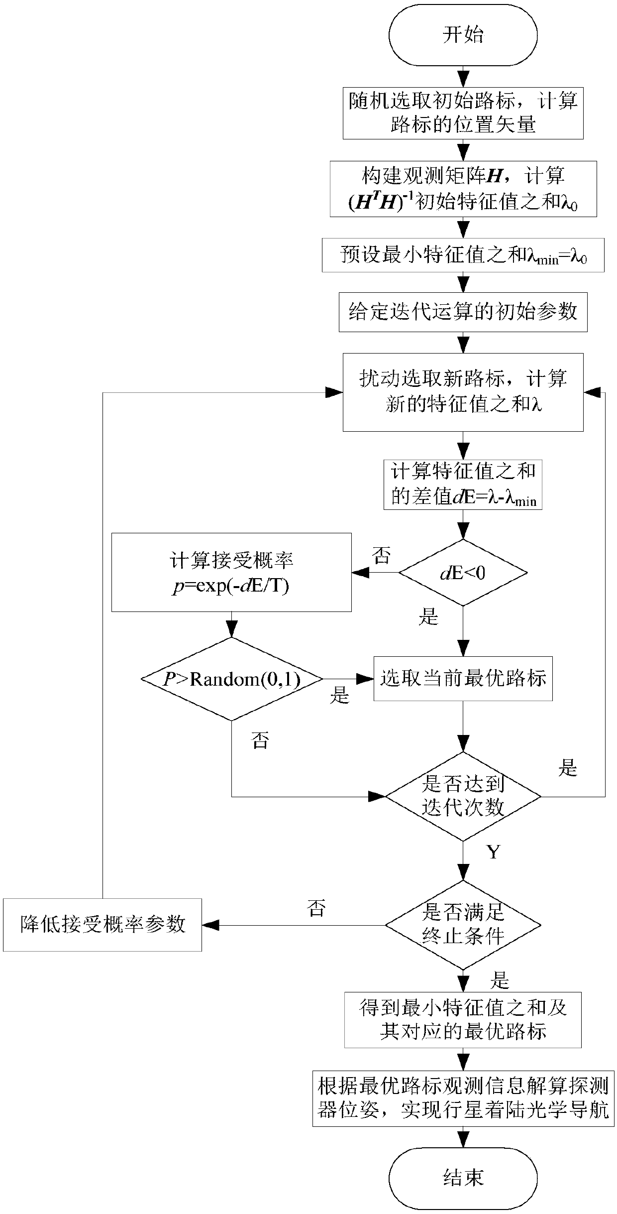
[0081] In order to better illustrate the purpose and advantages of the present invention, the present invention will be further described below in conjunction with the accompanying drawings and examples.

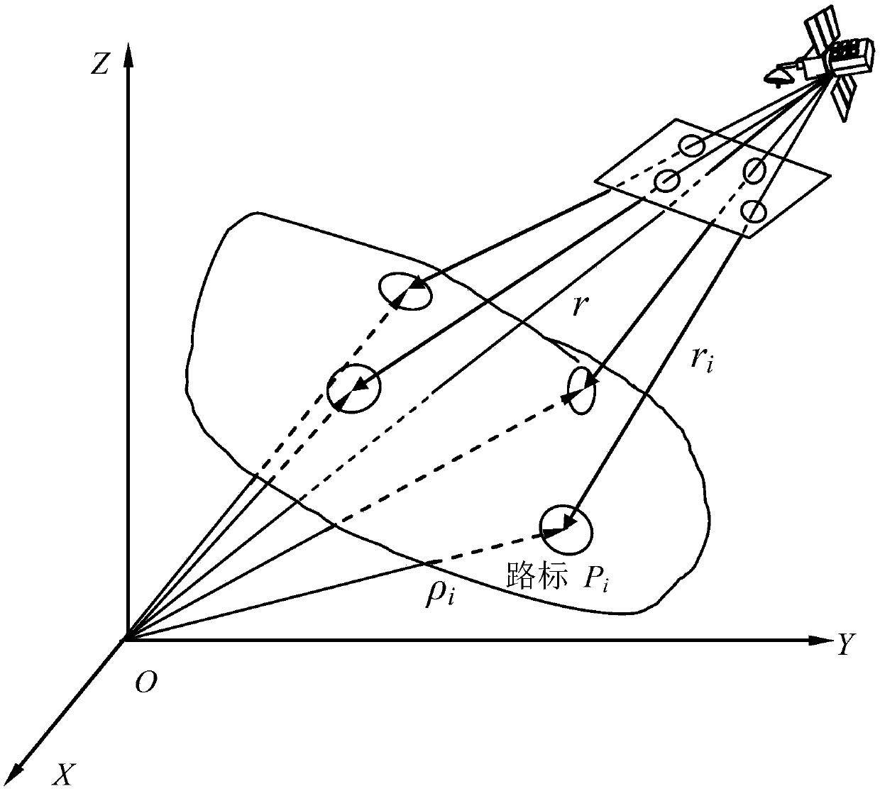
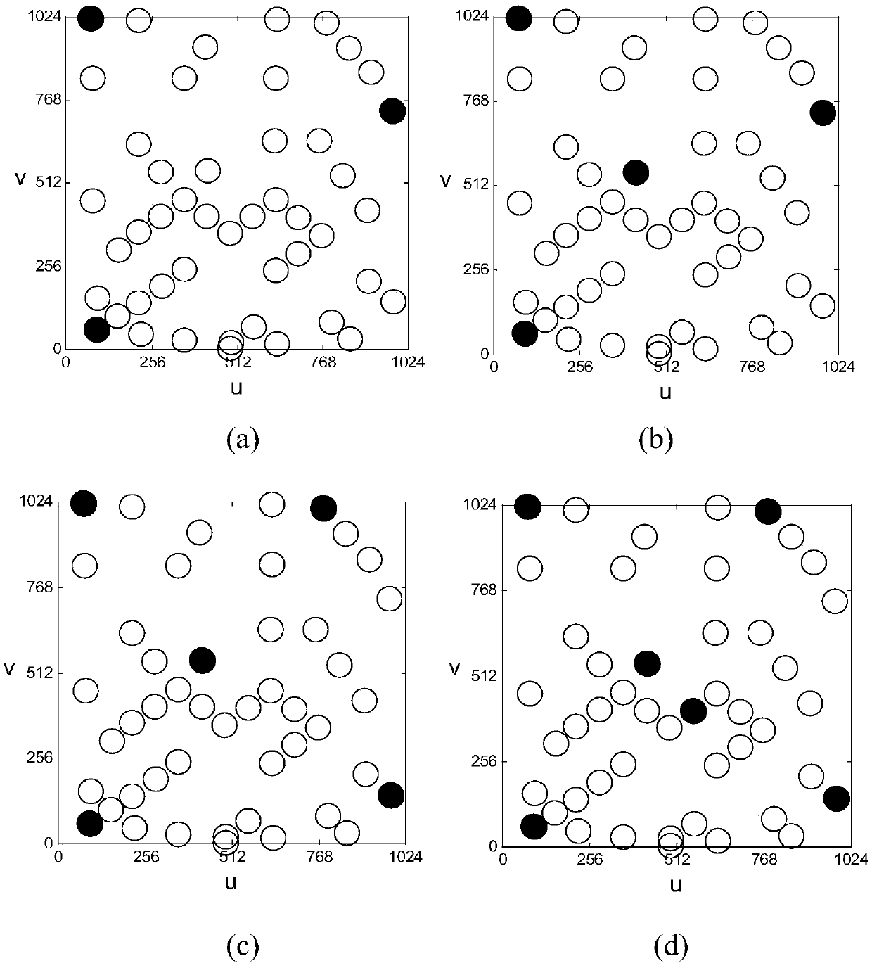
[0082] Let the distance between the probe and the surface of the planet be 7000m, the field of view of the navigation camera be 30°, and the navigation camera capture 47 navigation landmarks.

[0083] Due to the observation noise contained in the captured navigation landmark pixels and image line coordinates, and the existence of errors in determining the position of navigation landmarks, there must be errors in determining the position and attitude of the detector using the pixel information of navigation landmarks. In the following, through the analysis of the observation matrix, the objective function of the landmark optimization algorithm is obtained, and then the selection method of the optimal navigation landmark is given.

[0084] Note that for the least squares probl...


PUM


Abstract

The invention discloses a method for selecting an optimal road sign of optical navigation for planet landing and belongs to the field of autonomous navigation. The method comprises the following steps: randomly selecting n initial road signs and confirming as present optimal road signs, wherein n is more than or equal to 3; constructing a measurement matrix H and calculating the sum Lambda 0 of initial characteristic values of a matrix (HTH)-1; randomly selecting the sum Lambda of calculated characteristic values of new road signs; searching the optimal road sign of optical navigation for planet landing in the manner of iterating and comparing the sum Lambda of characteristic values on the basis of a probability jumping feature when acceptance probability parameters gradually reduce by starting from a higher initial acceptance probability parameter. According to the method disclosed by the invention, the selection for the optimal road sign of optical navigation for planet landing froma large quantity of road signs can be quickly realized and the position and posture of a deep space probe in a fixed coordinate system of a target celestial body can be confirmed; the method has the advantages of high optimizing quality, high robustness, small calculated quantity and the like; the method is suitable for a navigation system for autonomously confirming the position and posture of the deep space probe by adopting pixel information of multiple road signs.

Description

technical field [0001] The invention relates to a method for selecting an optimal landmark for optical navigation during planetary landing, belonging to the field of autonomous navigation. Background technique [0002] Planetary soft landing will be one of the most complex tasks in deep space exploration in the future. Due to communication delays and the complexity of the dynamic environment in deep space, the traditional navigation and control modes based on ground remote control can no longer meet the needs of high-precision soft landing. This requires that the lander must have autonomous navigation capabilities. There are a large number of craters, rocks and other topographical features on the surface of the planet, which have high visibility and resolvability. Scholars from various countries have conducted a lot of research on them. Using these terrains to conduct autonomous optical navigation on landmarks can obtain high Navigation accuracy and performance. [0003] T...

Claims


Application Information

Patent Timeline
Patent Type & Authority Applications(China)
IPC IPC(8): G01C21/24G01C21/20
CPCG01C21/20G01C21/24
Inventor 朱圣英刘东宸崔平远徐瑞高艾于正湜
Owner BEIJING INSTITUTE OF TECHNOLOGYGY
Why Eureka
Try Eureka