

NFC position coordinate navigation system and guiding method
A navigation system and position coordinate technology, applied in navigation, surveying and mapping, navigation, measuring devices, etc., can solve the problems of positioning failure and inability to accurately identify different heights, and achieve the effect of increasing accuracy and solving positioning failure
Pending Publication Date: 2018-11-30
黄 建华
View PDF0 Cites 2 Cited by
- Summary
- Abstract
- Description
- Claims
- Application Information
AI Technical Summary
Problems solved by technology
[0006] The technical problem to be solved by the present invention is that the existing positioning and guiding equipment is easily affected by external factors, resulting in positioning failure and the inability to accurately identify identification targets at different heights
Method used
View moreImage
Smart ImageViewing Examples

Examples
Embodiment 1
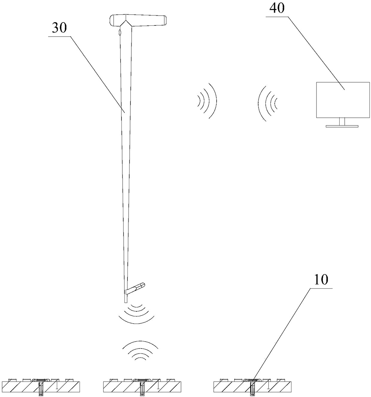
[0045] 1. When the user holding the NFC active communication device 30 arrives in an unfamiliar city, he can connect to the remote server 40 through the mobile network, and download and update the local map database in time.
Embodiment 2
[0047]2. Update information such as road maintenance, traffic control, toilet maintenance and shutdown in some areas, as an important reference for navigation route calculation, to avoid the problem of navigation route failure.
Embodiment 3
[0049] 3. When the user holding the NFC active communication device 30 needs to call for help, the remote server 40 can send an alarm command message to a designated person or organization, so that rescuers can quickly arrive for rescue.
Login to View More PUM
 Abstract
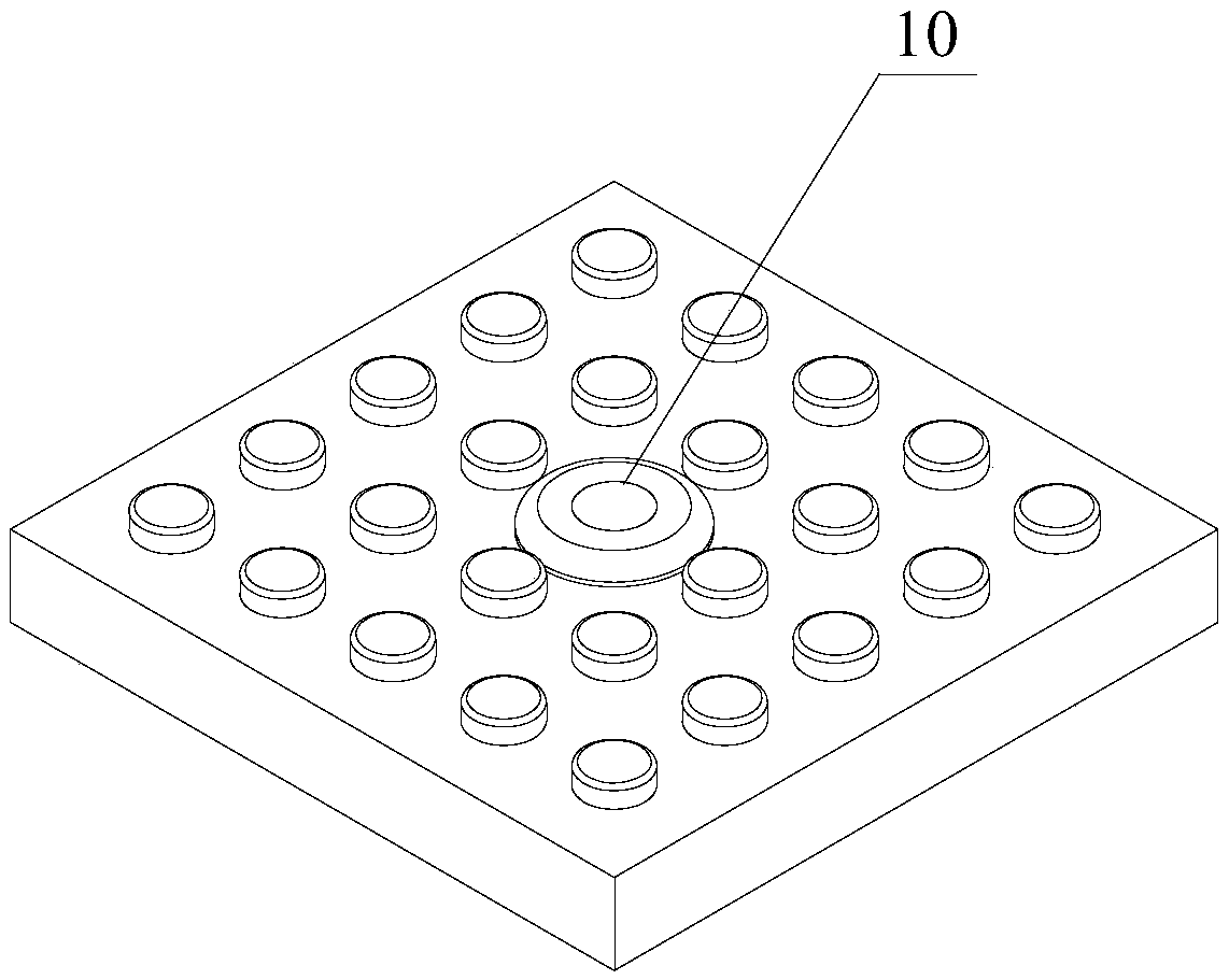
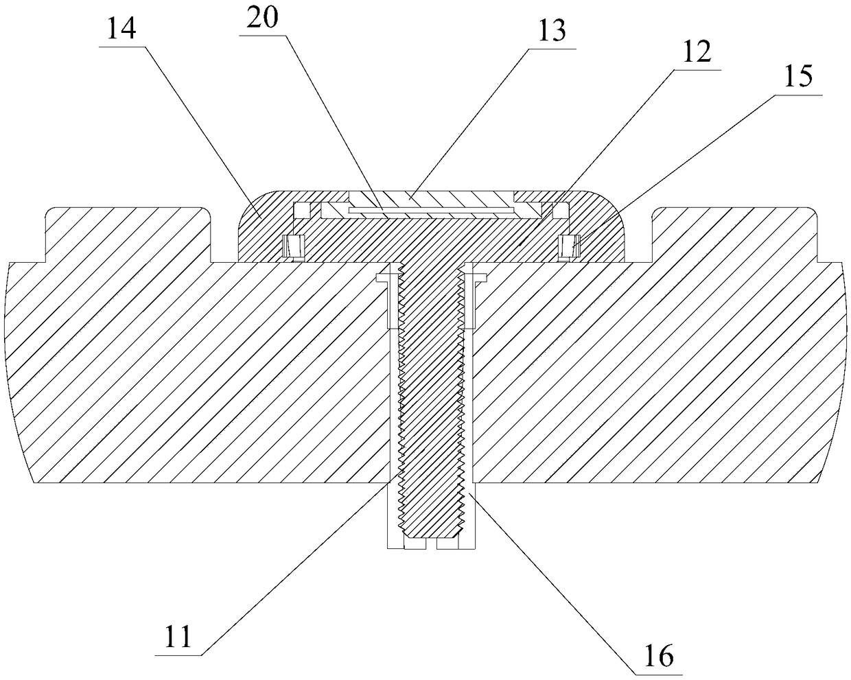
The invention discloses an NFC position coordinate navigation system and a guiding method. The navigation system comprises an NFC active communication device and a plurality of NFC passive communication devices, the NFC passive communication devices are fixedly arranged at corresponding predetermined scene positions respectively, an NFC tag is installed in each NFC passive communication device, and the NFC tag stores an information code of the corresponding predetermined scene position; and the NFC active communication device comprises an NFC card reader and a mobile terminal, the mobile terminal stores a navigation database, and the mobile terminal receives an position information code read by the NFC card reader, and compares the position information code with the navigation database toobtain navigation information. The NFC position coordinate navigation system disclosed by the invention realizes the operations of device offline, non remote communication signal and non satellite positioning signal, and effectively solves the problem of positioning failure caused by external factors, and the NFC tag carries the information code of the corresponding predetermined scene position, so that targets different heights of the same coordinate can be identified, and the accuracy of the positioning i improved.
Description
technical field [0001] The invention relates to the technical field of positioning and guidance, in particular to an NFC position coordinate navigation system and a guidance method. Background technique [0002] Traditional positioning and guidance equipment mainly relies on satellite signals and wireless network signals to achieve guidance. Based on satellite navigation, it can accurately provide information such as target position and time. Nowadays, satellite navigation plays an important role in many fields of civil and military use, but this guidance The device also has the following defects: [0003] (1) Indoors or places where the wireless signal is interfered and cannot be covered, its functions are limited, resulting in errors or even failures in query positioning; [0004] (2) For marking targets at different altitudes (floors, etc.) within the same coordinate, it cannot be accurately identified. [0005] In view of this, it is urgent to improve the existing posi...
Claims
Login to View More Application Information
Patent Timeline
 IPC IPC(8): G01C21/00
CPCG01C21/00
Inventor黄建华黄晔芸
Owner黄 建华