Unmanned aerial vehicle takeoff/landing guiding-oriented deep learning label data generation method

A technology of deep learning and labeling data, which is applied in the direction of electrical digital data processing, special data processing applications, vehicle position/route/altitude control, etc., can solve problems such as weak applicability, sensitive parameters, etc. Broad, Prioritized Scientific Effects

Active Publication Date: 2018-11-30
NAT UNIV OF DEFENSE TECH
View PDF3 Cites 3 Cited by
  • Summary
  • Abstract
  • Description
  • Claims
  • Application Information

AI Technical Summary

Problems solved by technology

[0003] Aiming at the shortcomings of the method of extracting UAV target area and anchor point coordinates from features such as corners and edges, there are shor

Method used


Image

  • Unmanned aerial vehicle takeoff/landing guiding-oriented deep learning label data generation method
  • Unmanned aerial vehicle takeoff/landing guiding-oriented deep learning label data generation method
  • Unmanned aerial vehicle takeoff/landing guiding-oriented deep learning label data generation method

Examples


Embodiment Construction

[0036] The technical solution of the present invention will be further shown and described below in conjunction with the accompanying drawings of the description.

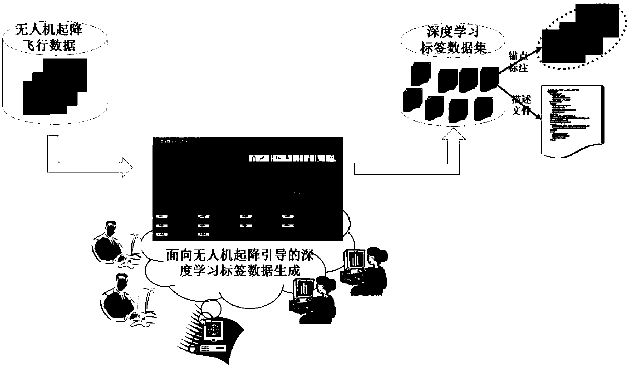
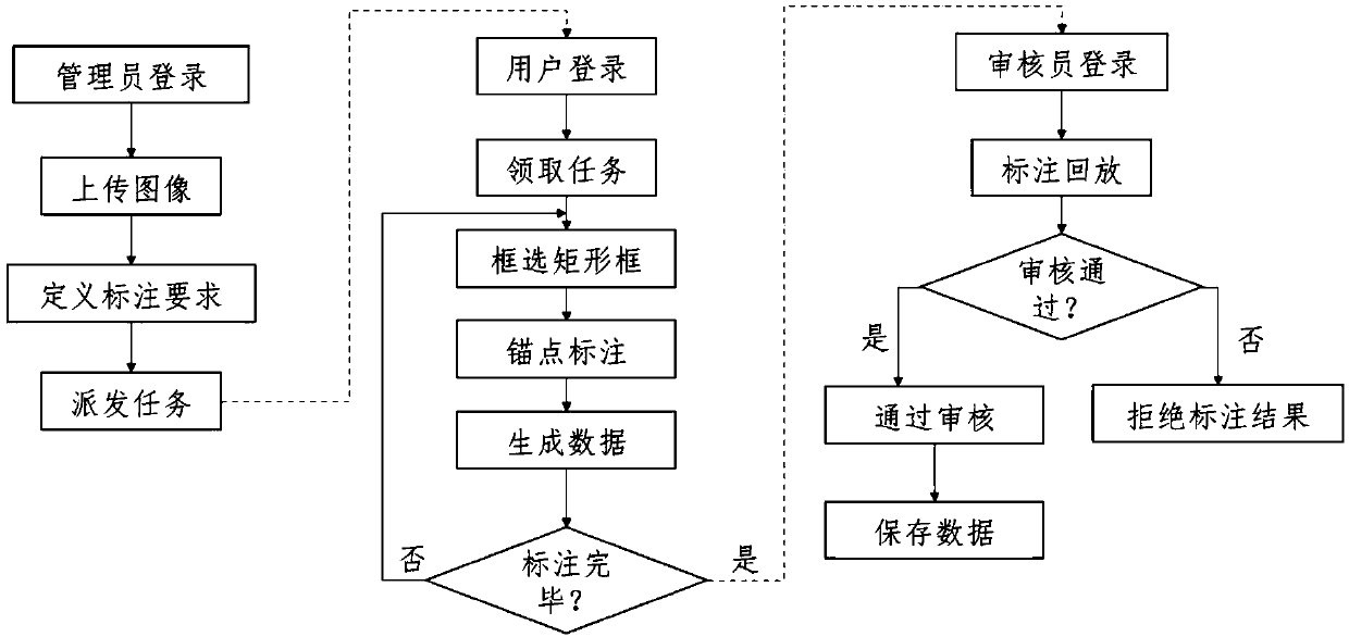
[0037] refer to figure 1 with 2 , a deep learning label data generation method for UAV take-off and landing guidance, the method is as follows;

[0038] (1) Establish a database system,

[0039] The administrator logs in to the administrator client and the administrator client establishes the database system. The administrator client manages the database system, can upload pictures to the database system, can delete pictures in the database system, and can save pictures in the database system. Perform queries and be able to export annotation results.

[0040] All the scene images to be marked are stored in the database system, among which the scene images to be marked include the scene images that contain drone targets during the take-off and landing process of the drone taken by the camera that have never been ...


PUM


Abstract

The invention discloses an unmanned aerial vehicle takeoff/landing guiding-oriented deep learning label data generation method. According to the method, labeling requirements and distributing tasks are defined; users log in labeling clients; the labeling tasks and labeling requirements are received through the labeling clients; each to-be-labelled scene image is manually labelled; the labelled scene image are stored to a database system via an xml format; and the database system is updated in real time. After all the to-be-labelled scene images are completely labeled, an assessor logs in an assessor client and accesses the database system through an assessor client network, and the assessor client assesses the labeling results (namely, each labelled scene image). According to the method, labeling tasks are issued through a network manner, an assessment method is automatically designed to assess the labeling result, so that the data labeling efficiency and labeling result reliability are greatly improved, and the reality demands for deep learning large-scale sample labeling are effectively solved.

Description

technical field [0001] The present invention mainly relates to the design field of a UAV autonomous take-off and landing guidance system, in particular to a deep learning label data generation method for UAV take-off and landing guidance. Background technique [0002] The UAV take-off and landing guidance system is designed to solve the problem of autonomous take-off and landing in weak or GPS-denied environments. The guidance system obtains the scene image containing the UAV target during the take-off and landing process of the UAV through the camera, and extracts the UAV target area and anchor point coordinates in the image, and uses computer vision measurement and filter estimation to solve the UAV's position. The world coordinate pose, so as to realize the autonomous take-off and landing of the guided UAV. Extracting the UAV target area and anchor point coordinates from the image is a necessary function of the guidance system. [0003] Aiming at the shortcomings of the...

Claims


Application Information

Patent Timeline
IPC IPC(8): G06F17/30G05D1/10
CPCG05D1/101
Inventor 胡天江周勇周晗赵框唐邓清常远周正元方强
Owner NAT UNIV OF DEFENSE TECH
Why Eureka
Try Eureka