S band and X band radar networking rainfall measuring method under complex terrain condition

A complex terrain and radar networking technology, applied in the field of radar detection, to achieve the effect of improving accuracy

Active Publication Date: 2018-12-14
CHINA INST OF WATER RESOURCES & HYDROPOWER RES
View PDF4 Cites 0 Cited by
  • Summary
  • Abstract
  • Description
  • Claims
  • Application Information

AI Technical Summary

Problems solved by technology

[0004] The present invention proposes a networked rain measurement method of S-band and X-band radars under complex terrain conditions. The technical problem it solves is to make full use of the detection advantages of S-band and X-band radars to realize radar network measurement under complex terrain conditions. Rain, on the premise of reducing or eliminating observation blind spots, improve the accuracy of rain measurement

Method used


Image

  • S band and X band radar networking rainfall measuring method under complex terrain condition
  • S band and X band radar networking rainfall measuring method under complex terrain condition
  • S band and X band radar networking rainfall measuring method under complex terrain condition

Examples


Embodiment Construction

[0029] The technical solution adopted in the present invention is to interpolate and fuse the reflectance data of the S-band and X-band in space to form complete and high-quality spatial reflectance data covering the target area, and through rainfall inversion, obtain Rainfall observations covering the target area. This method will make up for the problems of poor rainfall observation conditions and lack of rainfall data under complex terrain conditions to a certain extent, reduce or eliminate the blind areas of rainfall observation in hilly areas, and improve the accuracy of radar rain measurement under complex terrain conditions.

[0030] Step 1, radar reflectivity spatial rasterization processing;

[0031] Step 2, judgment of weather situation;

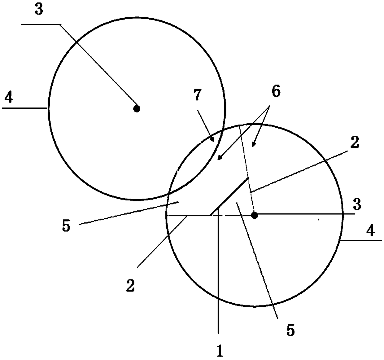
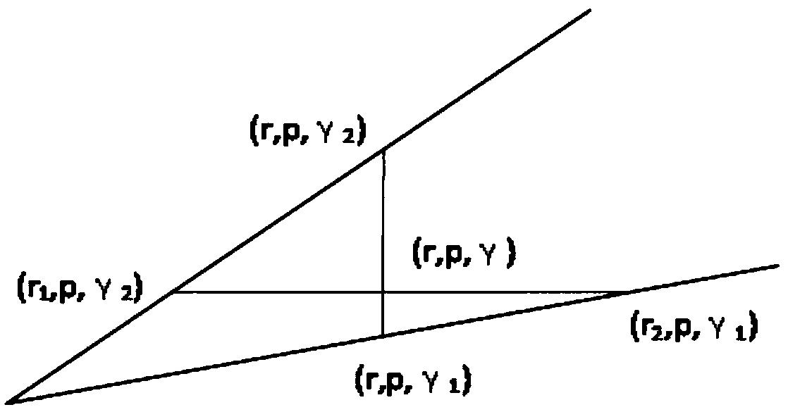
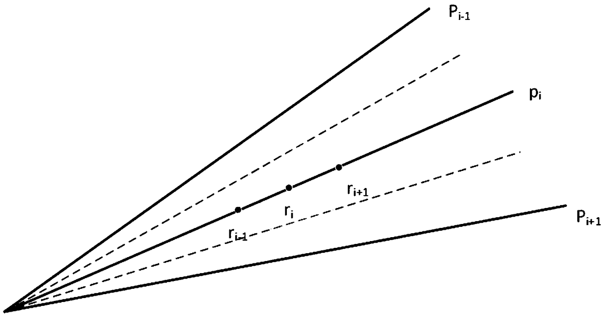
[0032] Step 3, weight determination of overlapping areas under complex terrain conditions;

[0033] Step 4. Determination of non-overlapping area data under complex terrain conditions;

[0034] Step 5, rainfall inversion.

[00...


PUM


Abstract

The invention relates to an S band and X band radar networking rainfall measuring method under a complex terrain condition, comprising the following steps: firstly, performing radar reflectivity spacerasterization processing; secondly, judging weather situation; thirdly, judging weight of an overlapping region under the complex terrain condition; fourthly, determining data of a non-overlapping region under the complex terrain condition; and fifthly, performing inversion on rainfall. The method provided by the invention remedies the problems such as rainfall data missing caused by poor rainfall observation conditions in hilly regions and sparse rainfall stations to a certain extent, can improve radar rainfall measurement accuracy under the complex terrain condition and provides a reliabledata support for storm flood warning and forecasting in a drainage basin under the complex terrain condition.

Description

technical field [0001] The invention relates to a rain measurement method of S-band and X-band radar networks under complex terrain conditions, belongs to the field of radar detection, and is mainly used for meteorological and water conservancy departments to carry out rainfall monitoring, rainstorm and flood early warning and forecasting. Background technique [0002] The area of ​​mountainous areas in my country accounts for about 2 / 3 of the country's land area, and the terrain conditions are complex. Due to the high slopes and deep valleys in the hilly area, when there is heavy rainfall, the production and confluence are fast, and the floods often show the characteristics of rapid rise and fall, resulting in frequent mountain torrent disasters. Coupled with the low coverage of the current rainfall monitoring station network in mountainous areas, it has brought great difficulties to the early warning and forecasting of rainstorm and mountain torrent disasters, and seriousl...

Claims


Application Information

Patent Timeline
Patent Type & Authority Applications(China)
IPC IPC(8): G01W1/14G01S13/95
CPCG01S13/95G01W1/14Y02A50/00Y02A90/10
Inventor 刘佳李传哲田济扬严登华邱庆泰焦裕飞王维刘昱辰刘思妤
Owner CHINA INST OF WATER RESOURCES & HYDROPOWER RES
Why Eureka
Try Eureka