Method for rapidly diagnosing farmland crop growth defect area by remote sensing aft land consolidation

A rapid diagnosis technology for farmland crops, applied in the direction of instruments, character and pattern recognition, scene recognition, etc., can solve the problems of consuming a lot of manpower and financial resources, timely detection and remediation of crop growth defect areas, and increasing costs, etc., to achieve The effect of high practical value

Active Publication Date: 2018-12-21
CHINA UNIV OF MINING & TECH
View PDF5 Cites 13 Cited by
  • Summary
  • Abstract
  • Description
  • Claims
  • Application Information

AI Technical Summary

Benefits of technology

This technology allows for quicker identification of crops that may have problems growing up inside it before being settled down or relocated into another place. It uses advanced technologies like radar imagery and geospatial analysis techniques to gather detailed environmental factors such as soil conditions at different locations around an agricultural field. These technical features help identify potential issues earlier by providing real-time feedback during landshealing efforts.

Problems solved by technology

This patents discuss how we must detect and fix issues related to long term plant healthy development (LCD) caused by environmental factors like soil composition changes during land use restoration activities before they become established overseverts. Current methods require manual laborious work and involve expensive equipment. Additionally, these techniques only help discover problematic regions within an agricultural region without taking into account their impact upon future cash flow patterns.

Method used


Image

  • Method for rapidly diagnosing farmland crop growth defect area by remote sensing aft land consolidation
  • Method for rapidly diagnosing farmland crop growth defect area by remote sensing aft land consolidation
  • Method for rapidly diagnosing farmland crop growth defect area by remote sensing aft land consolidation

Examples


Embodiment 1

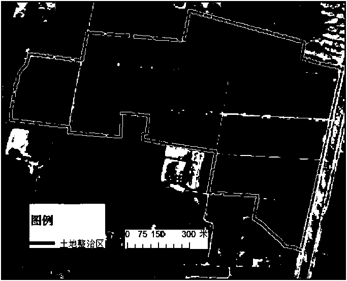
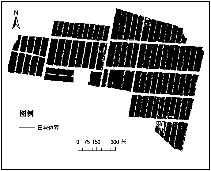
[0031] Taking the improvement of basic farmland in a certain place in Jintan City, Jiangsu Province as an example, the implementation of the present invention will be further described in detail. The land improvement project in this area was completed in May 2017, followed by rice planting. The following examples are used to illustrate the present invention, but are not intended to limit the scope of the present invention.

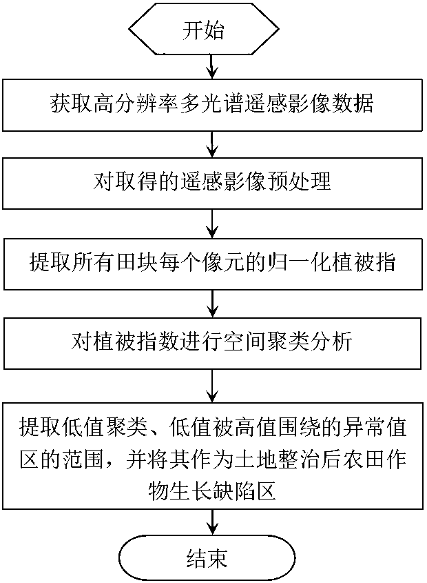
[0032] like figure 1 , the invention provides a remote sensing rapid diagnosis method for crop growth defects in farmland after land consolidation, the specific implementation steps are as follows:

[0033] Step 1) Determine the detection area, and obtain a high-resolution remote sensing image based on the Geo-eye-01 satellite in the first rice growing season (heading stage) after land consolidation. The multi-spectral spatial resolution is 1.65 meters, with blue and green , red, and near-infrared bands. The remote sensing data was acquired on August 23,...


PUM


Abstract

The invention discloses a remote sensing rapid diagnosis method for farmland crop growth defect area after land consolidation, which comprises the following steps: 1, obtaining high-resolution multi-spectral images of crop growth season after land consolidation; 2, preprocessing the corresponding remote sensing images, and obtaining the remote sensing images of all the fields in the renovation project area by combining the cutting of the engineering construction drawings; 3, calculating the normalized vegetation index NDVI of each pixel in each field; 4, carrying out spatial clustering analysis; 5, separating that spatial ranges of two type of low-value clustering and low-value anomaly, and taking them as the crop growth defect areas aft land consolidation. This method can quickly and conveniently realize the detection of crop growth defect areas after land consolidation, and provide the basis for the improvement of land consolidation planning and fine post-conservation management.

Description


Claims


Application Information

Patent Timeline
Owner CHINA UNIV OF MINING & TECH
Why Eureka
Try Eureka