

Virtual reality technology-based indoor navigation method and system
A virtual reality technology, indoor navigation technology, applied in navigation, surveying and mapping and navigation, navigation calculation tools, etc., can solve the problems of troublesome layout of identification codes, inconvenient real-time correction, and low accuracy, so as to improve user experience, navigation efficiency and The effect of high precision and improved precision
- Summary
- Abstract
- Description
- Claims
- Application Information
AI Technical Summary
Problems solved by technology
Method used
Image

Examples
Embodiment 1
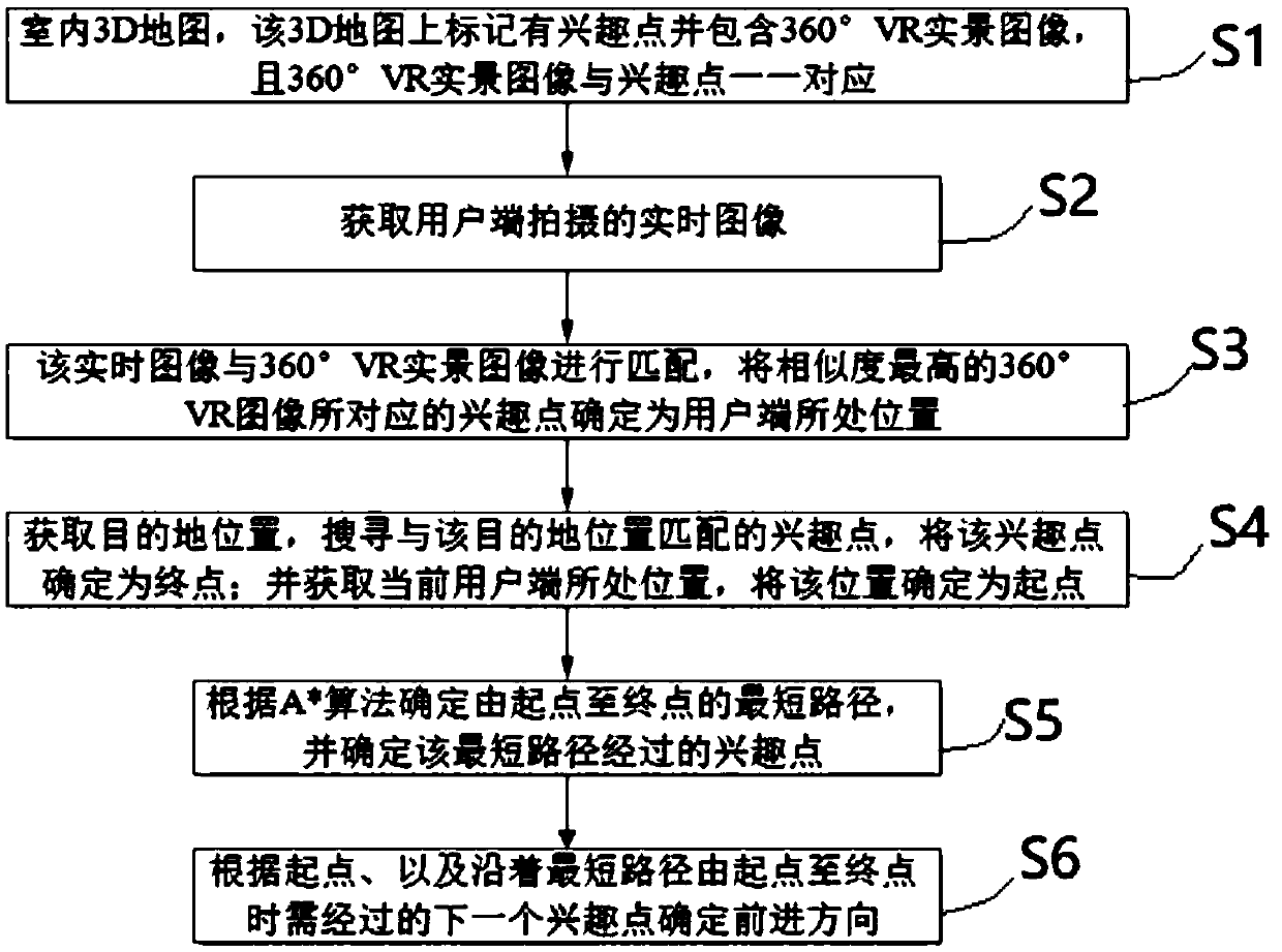
[0049] Such as figure 1 As shown, an indoor navigation method based on virtual reality technology, including:
[0050] S1. Indoor 3D map, the 3D map is marked with points of interest and contains 360° VR real-scene images, and the 360° VR real-scene images correspond to the points of interest one by one;
[0051]One of the ways to draw the indoor 3D map in this step is: combine the architectural CAD drawing information and the actual environment on site, and draw according to an appropriate scale; mark points of interest on the 3D map, and select key points in the actual indoor activity space to shoot 360° VR real scenes The image, the key points correspond to the points of interest marked on the 3D map, and then the captured 360° VR real-world images and points of interest are stored in the indoor 3D map in one-to-one correspondence.
[0052] In this step, the point of interest can be marked in the following manner: the 3D map and the indoor actual activity space are divided...
Embodiment 2
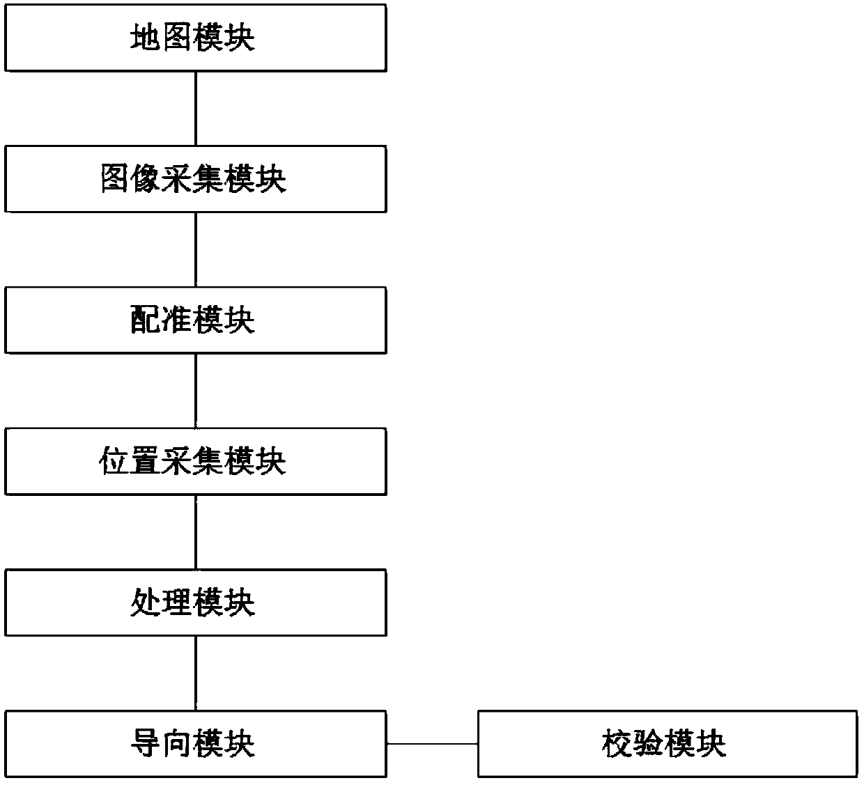
[0079] Such as figure 2 , this embodiment provides an indoor navigation system based on virtual reality technology corresponding to Embodiment 1, including:
[0080] The map module is used to store an indoor 3D map, the 3D map is marked with points of interest and contains 360 ° VR real scene images, and the 360 ° VR real scene images are in one-to-one correspondence with the points of interest;
[0081] One of the drawing methods of the indoor 3D map in this module is: combining the architectural CAD drawing information and the actual environment of the site, drawing according to an appropriate scale; marking points of interest on the 3D map, and selecting key points in the actual indoor activity space to shoot 360°VR real scenes The image, the key points correspond to the points of interest marked on the 3D map, and then the captured 360° VR real-world images and points of interest are stored in the indoor 3D map in one-to-one correspondence.
[0082] The method of marki...
PUM
 Abstract
Description
Claims
Application Information