Method and device for calculating soil attribute value

A calculation method and attribute value technology, which is applied in the field of calculation of soil attribute values, can solve the problems of large error of interpolation points, decline of prediction accuracy and accuracy, etc.

Active Publication Date: 2019-03-29
BEIJING RES CENT FOR INFORMATION TECH & AGRI
View PDF10 Cites 9 Cited by
  • Summary
  • Abstract
  • Description
  • Claims
  • Application Information

AI Technical Summary

Problems solved by technology

[0005] Most of the current methods for obtaining the spatial distribution of soil attributes are interpolation methods based on soil sampling point data, such as inverse distance weighted averaging (IDWA: inverse distance weighted averaging), spline function method (Spline), multiple regression method (Polynomial regression), Trend surface analysis (TSA: trend surface analysis), ordinary kriging (Kriging) and co-kriging method (Co-kriging), hierarchical kriging, etc., these methods are related to the number and spatial distribution of sampling points However, these methods have the following problems: 1) only use the spatial correlation information between soil sampling points (distance between sampling points, the overall change trend of sampling points), while ignoring the effective information such as soil attribute characteristics and environmental auxiliary factors, 2) The interpolation method is easily affected by factors such as the number of sample points, sample point configuration (sampling point distance, spatial structure and uniformity), and sample point attribute value characteristics. When the sampling point spacing is greater than the soil attribute variation In the case of low sampling density, or complex regional changes and sparse sampling points, it will cause the decline of prediction precision and accuracy

Method used


Image

  • Method and device for calculating soil attribute value
  • Method and device for calculating soil attribute value
  • Method and device for calculating soil attribute value

Examples


Embodiment Construction

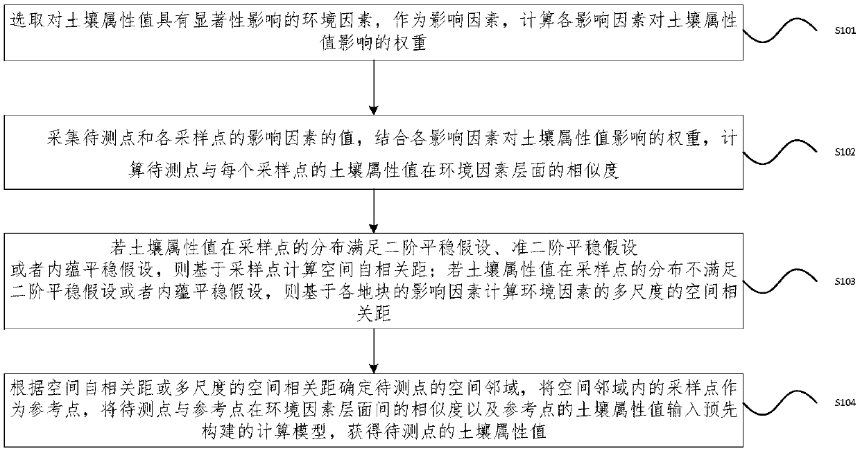
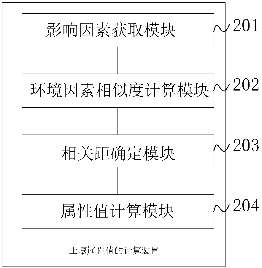
[0026] In order to make the purpose, technical solutions and advantages of the embodiments of the present invention clearer, the technical solutions in the embodiments of the present invention will be clearly and completely described below in conjunction with the drawings in the embodiments of the present invention. Obviously, the described embodiments It is a part of embodiments of the present invention, but not all embodiments. Based on the embodiments of the present invention, all other embodiments obtained by persons of ordinary skill in the art without creative efforts fall within the protection scope of the present invention.

[0027] In order to overcome the above-mentioned problems in the prior art, an embodiment of the present invention provides a method for calculating soil attribute values. The inventive idea is: first, collect the soil attribute values ​​and environmental factors of the sampling points in the research area, and obtain Environmental factors that hav...


PUM


Abstract

The embodiment of the invention provides a method and a device for calculating the soil attribute value. The method comprises the following steps: calculating the weight of each influence factor on the soil property value; collecting the values of the influence factors of each to-be-measured point and each sampling point, and calculating the similarity between the soil property value of the to-be-measured point and the soil property value of the sampling point at the environmental factor level; determining the spatial neighborhood of the to-be-measured point according to the spatial self-correlation distance or the multi-scale spatial correlation distance, inputting the similarity between the soil property value of the to-be-measured point and the soil property value of the sampling pointat the environmental factor level and the soil property values of the sampling point in the neighborhood into a soil attribute value calculation model which gives consideration to both environmental factor similarity and space self-correlation, and obtaining the soil property value of the to-be-measured point. According to the embodiment of the invention, the environmental factor information related to the soil property of the to-be-measured point and the attribute value information of the space adjacent to the known sampling point are fully utilized. The spatial variation of the soil propertyat the mutation boundary can be better depicted, and the soil property value is ensured to be closer to the actual condition.

Description

technical field [0001] The invention relates to the technical field of soil digital mapping, and more specifically, to a calculation method and device for soil attribute values. Background technique [0002] Due to the comprehensive influence of natural factors such as soil-forming parent material, soil type, topography, regional climate, and biological environment, and human activities (land use methods such as mining, smelting, industrial production emissions, farmland cultivation, and agricultural management measures, etc.), soil properties It has certain spatial distribution characteristics, and shows certain spatial structure and randomness. Regional soil attribute values ​​(continuous) have both spatial differentiation and spatial autocorrelation, and at the same time, there is interaction with environmental factors. Fine agricultural management needs to master the soil fertility of each point in the field for differential fertilization and pesticide application, so as...

Claims


Application Information

Patent Timeline
Patent Type & Authority Applications(China)
IPC IPC(8): G01N33/24
CPCG01N33/24
Inventor 郜允兵高秉博李晓岚李淑华潘瑜春吴彦澎董士伟任艳敏杨晶
Owner BEIJING RES CENT FOR INFORMATION TECH & AGRI
Why Eureka
Try Eureka