

Topomap surveying and mapping method and device
A topographic map and topographic technology, which is applied in the directions of surveying devices, surveying and navigation, section drawing, etc., can solve the problems that the operation is affected by various factors and the cost is high
- Summary
- Abstract
- Description
- Claims
- Application Information
AI Technical Summary
Problems solved by technology
Method used
Image

Examples
Embodiment 1
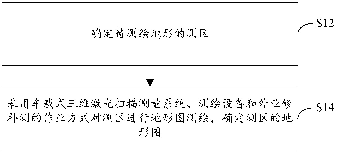
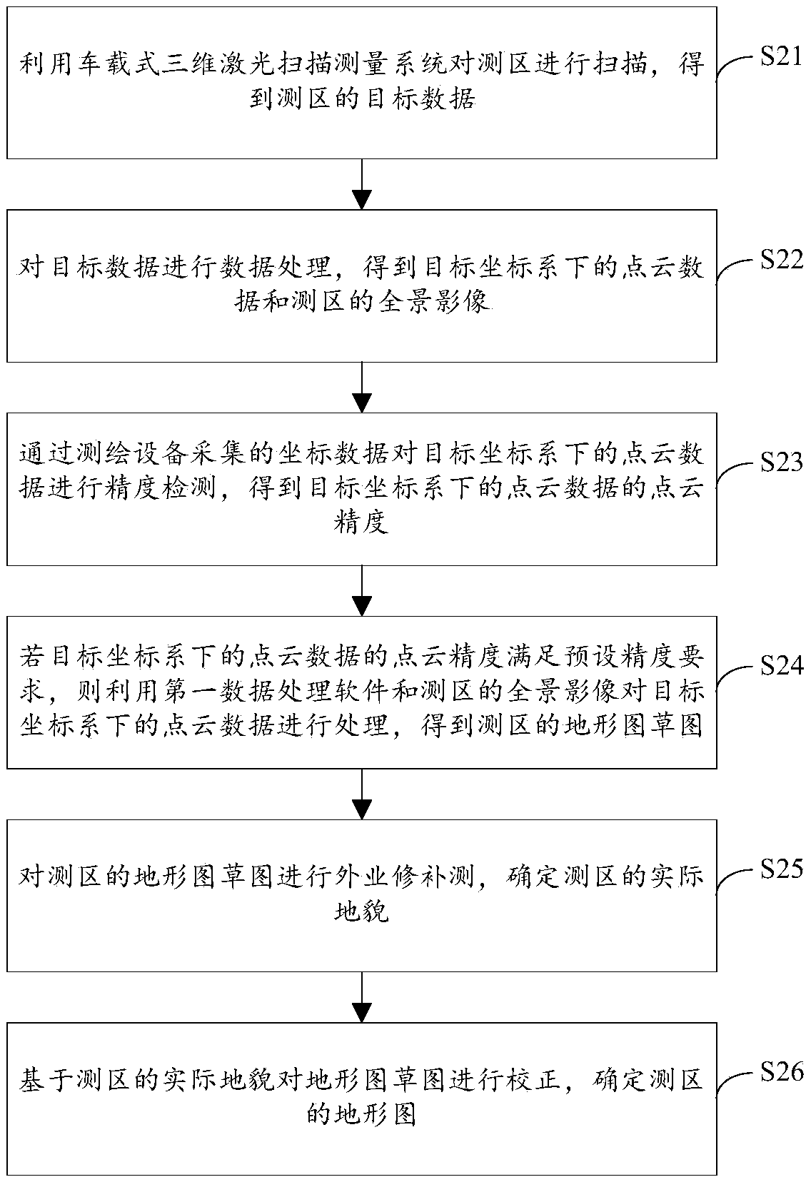
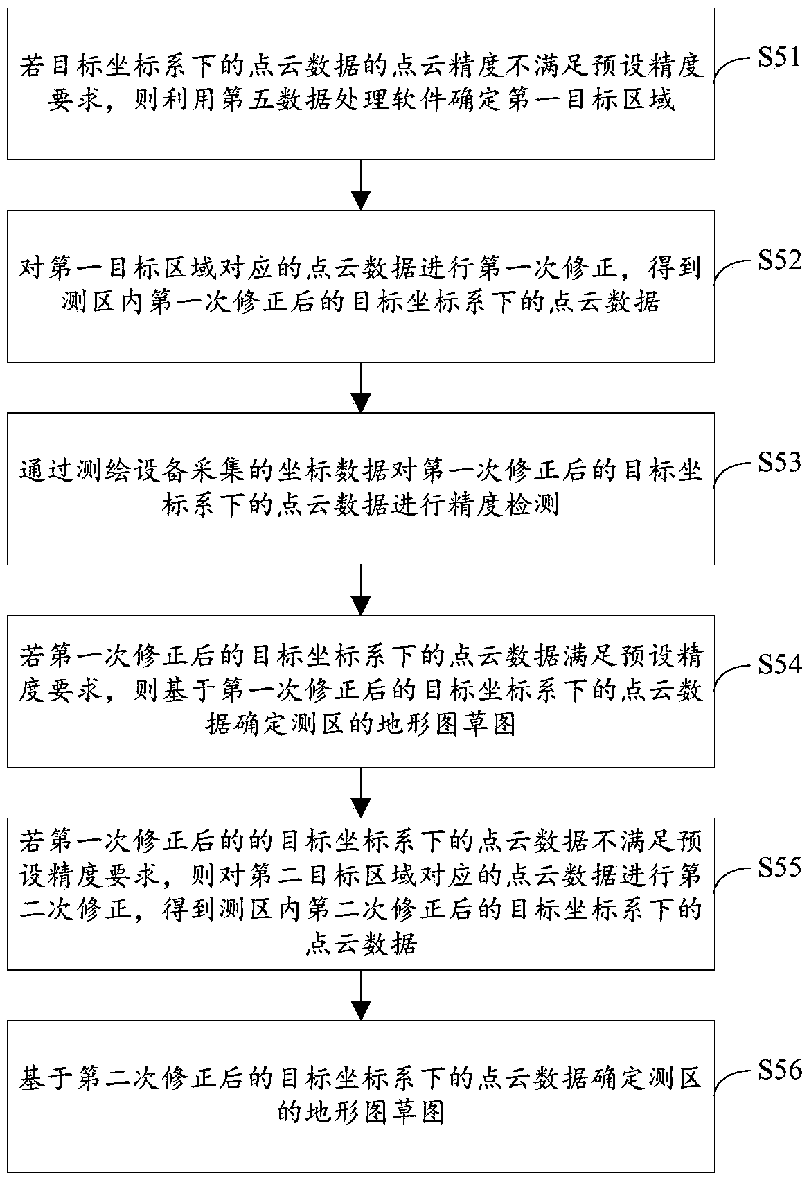
[0060] figure 1 is a flow chart of a topographic map surveying and mapping method according to an embodiment of the present invention, such as figure 1 As shown, the method includes the following steps:
[0061] Step S12, determining the survey area of the terrain to be surveyed and mapped, wherein the survey area is an established road within the terrain to be surveyed and mapped;
[0062] In the embodiment of the present invention, to perform topographic map surveying of the terrain to be surveyed and mapped, the survey area of the terrain to be surveyed and mapped must first be confirmed. In the present invention, the built roads in the terrain to be surveyed and mapped are taken as the survey area.
[0063] Step S14, using the vehicle-mounted 3D laser scanning measurement system, surveying and mapping equipment, and field repair surveying to perform topographic map surveying and mapping of the survey area, and determine the topographic map of the survey area, wherein ...
Embodiment 2
[0149] The embodiment of the present invention also provides a topographic map surveying and mapping device. The topographic map surveying and mapping device is mainly used to implement the topographic map surveying and mapping method provided in the above-mentioned content of the embodiment of the present invention. The topographic map surveying and mapping device provided by the embodiment of the present invention will be described in detail below introduce.
[0150] Figure 4 is a schematic diagram of a topographic map surveying device according to an embodiment of the present invention, such as Figure 4 As shown, the topographic map surveying and mapping device mainly includes a determination module 10 and a surveying and mapping module 20, wherein:
[0151] A determining module, configured to determine the survey area of the terrain to be surveyed and mapped, wherein the survey area is an established road within the terrain to be surveyed and mapped;
[0152] The sur...
PUM
 Abstract
Description
Claims
Application Information