
A high-precision terrain establishment method based on UAV-based webgis platform

A construction method and technology of drones, applied in the field of drone surveying and mapping, can solve the problems of construction control elements buried in the terrain or suspended, no terrain display mode, browser crashes, etc., to simplify the data process and processing efficiency , The generation process is convenient and efficient, achieving convenient effects

Active Publication Date: 2021-04-30
SINOHYDRO BUREAU 14 CO LTD
View PDF5 Cites 0 Cited by
  • Summary
  • Abstract
  • Description
  • Claims
  • Application Information

AI Technical Summary

Problems solved by technology

Geographic information data is the core of WebGIS. There are two main ways to display geographic information on the traditional 3D-WebGIS platform. The first way is to import the processed satellite image data into the platform. The terrain accuracy produced by this way is too low. It often causes some construction control elements to be buried in the terrain or in a suspended state, which cannot be well combined with the terrain; the second way is to import the terrain as a whole, which has high precision but slow loading speed, which can easily cause the browser to crash
[0004] The existing WebGIS-based construction management visualization platform still does not have a reasonable and effective terrain display method

Method used


Image

  • A high-precision terrain establishment method based on UAV-based webgis platform
  • A high-precision terrain establishment method based on UAV-based webgis platform
  • A high-precision terrain establishment method based on UAV-based webgis platform

Examples


Embodiment Construction

[0051] The following will clearly and completely describe the technical solutions in the embodiments of the present invention in combination with the embodiments of the present invention and the accompanying drawings. Apparently, the described embodiments are only part of the embodiments of the present invention, not all of them. Based on the embodiments of the present invention, all other embodiments obtained by persons of ordinary skill in the art without making creative efforts belong to the protection scope of the present invention.

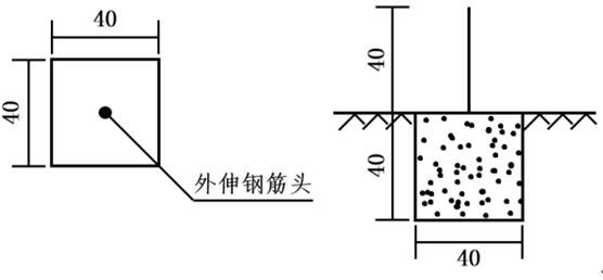
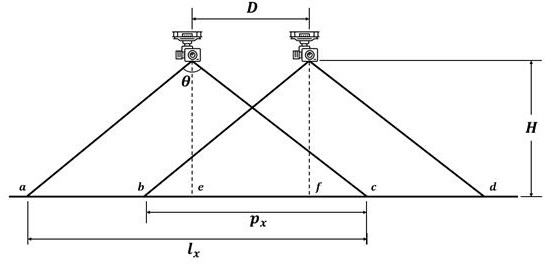
[0052] As shown in the figure, the realization of the present invention mainly includes the following steps:

[0053] Step 1, layout and positioning of aerial survey base points:

[0054] Layout of aerial survey base points: The aerial survey base points are used to convert the generated terrain coordinate system into the local engineering coordinate system. During the layout process, the aerial survey base points should be set as far as poss...


PUM


Abstract

The invention discloses a method for establishing high-precision terrain based on a UAV-based WebGIS platform, which belongs to the field of terrain surveying and mapping. The purpose of the invention is to provide a refined and lightweight terrain establishment and application method based on WebGIS. The steps Step 1. Aerial survey base point layout and positioning; Step 2. UAV image acquisition; Step 3. Image recognition and point cloud generation; Step 4. DEM model generation; Step 5. Terrain tile data generation; Step 6. Terrain Web-side parsing of tile data. The invention provides high-precision terrain information for the construction of the entire construction management visualization platform.

Description

technical field [0001] The invention belongs to the field of unmanned aerial vehicle surveying and mapping, and more specifically relates to a method for establishing high-precision terrain under an unmanned aerial vehicle-based WebGIS platform. Background technique [0002] With the continuous improvement of the informatization level of engineering construction in our country, more and more engineering projects have begun to use visualization means to carry out refined management of the construction process. Usually, the visual elements are collected by the Internet of Things platform, transmitted to the database through wireless transmission, and then transmitted to the front end through background processing, so as to realize the interaction with users. There are many elements in the construction control of large-scale projects. In order to ensure the efficiency of data processing and smooth display, most of the traditional construction visualization management platforms ...

Claims


Application Information

Patent Timeline
Patent Type & Authority Patents(China)
IPC IPC(8): G01C15/00G06F16/29
CPCG01C15/00
Inventor 李竹有李艳生张社荣王超姜佩奇孙洪稳王晓莉孔买群张玉彬刘山川朱罗方樊贵明浦瑞杨国华
Owner SINOHYDRO BUREAU 14 CO LTD
Learn More