Local precision constrained three-dimensional landform generation method
A three-dimensional terrain, precision-constrained technology, applied in the field of three-dimensional visualization, achieves good real-time performance, simple structure, and solves the problem of memory space allocation.
- Summary
- Abstract
- Description
- Claims
- Application Information
AI Technical Summary
Problems solved by technology
Method used
Image
Examples
Embodiment Construction
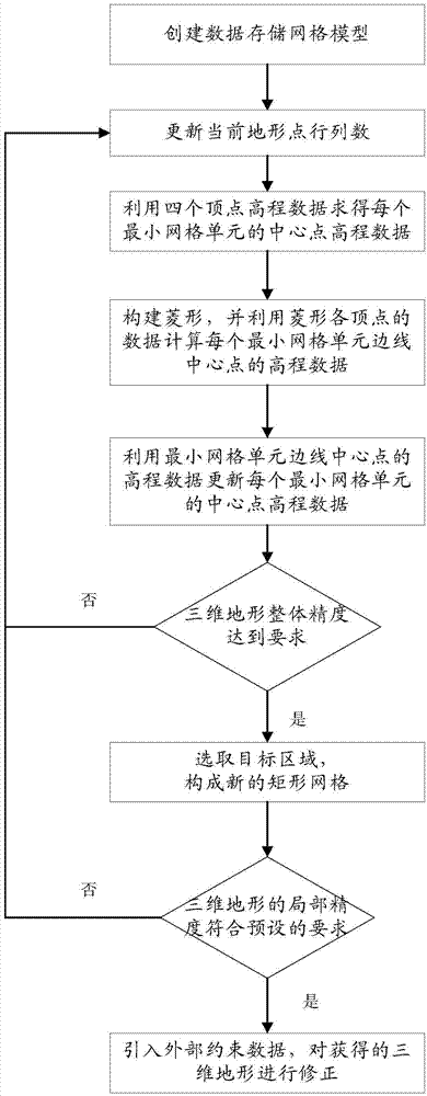
[0053] The present invention provides a three-dimensional terrain generation method with local precision constraints, and the present invention will be further described below in conjunction with the accompanying drawings.
[0054] For ease of understanding, before introducing the principle of 3D terrain generation, the principle of 2D terrain generation in the rhombus-square algorithm is taken as an example to illustrate. In one-dimensional space, the midpoint displacement is performed as follows:
[0055] (1) Start with a line segment AB, such as figure 2 As shown, for some appropriate dHeight, take the midpoint C of line segment AB and replace it with a random value between -dHeight and +dHeight, as in image 3 As shown, point C is a point newly generated from points A and B after replacement;
[0056] (2) Reduce the value of dHeight and recursively process the line segments AC and CB, such as Figure 4 As shown, points D and E are points newly generated from points A, ...
PUM
 Abstract
Description
Claims
Application Information
 - R&D
- Intellectual Property
- Life Sciences
- Materials
- Tech Scout
- Unparalleled Data Quality
- Higher Quality Content
- 60% Fewer Hallucinations
Browse by: Latest US Patents, China's latest patents, Technical Efficacy Thesaurus, Application Domain, Technology Topic, Popular Technical Reports.
© 2025 PatSnap. All rights reserved.Legal|Privacy policy|Modern Slavery Act Transparency Statement|Sitemap|About US| Contact US: help@patsnap.com


