A Calibration Method for All-Sky Imager Based on Sun Azimuth

An all-sky imager and calibration method technology, applied in the direction of instruments, etc., can solve the problems of the complex calibration process of the all-sky imager, the processing technology error, the low calibration efficiency, etc., and achieve the auxiliary prediction of cloud changes around the sun. low cost effect

Active Publication Date: 2020-12-08
ZHEJIANG SUPCON SOLAR TECHNOLOGY CO LTD
View PDF4 Cites 0 Cited by
  • Summary
  • Abstract
  • Description
  • Claims
  • Application Information

AI Technical Summary

Problems solved by technology

[0004] The calibration of the traditional all-sky imager needs to introduce a checkerboard for calibration, but the processing error of the checkerboard will directly cause the calibration error, resulting in insufficient accuracy. Secondly, the calibration process of the traditional all-sky imager is complicated and the calibration efficiency is low

Method used


Image

  • A Calibration Method for All-Sky Imager Based on Sun Azimuth
  • A Calibration Method for All-Sky Imager Based on Sun Azimuth
  • A Calibration Method for All-Sky Imager Based on Sun Azimuth

Examples


Embodiment Construction

[0050] A method for calibrating an all-sky imager based on the sun azimuth proposed by the present invention will be further described in detail below in conjunction with the accompanying drawings and specific embodiments. Advantages and features of the present invention will be apparent from the following description and claims.

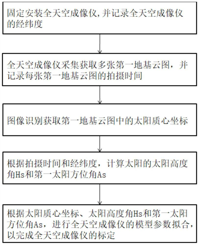
[0051] see figure 1 , the present embodiment provides a method for calibrating an all-sky imager based on the sun azimuth, comprising the following steps:

[0052] S1: Fixedly install the all-sky imager, and record the latitude and longitude of the all-sky imager;

[0053] S2: The all-sky imager collects multiple first ground-based cloud images, and records the shooting time of each first ground-based cloud image;

[0054] S3: Image recognition to obtain the coordinates of the sun's barycenter in the first ground-based cloud image;

[0055] S4: Calculate the solar altitude Hs and the first solar azimuth As of the sun according to the shooting tim...


PUM


Abstract

The invention discloses a total sky imager calibration method based on solar azimuth. The method comprises the following steps that: S1: a total sky imager is fixedly installed, and the longitude andthe latitude of the total sky imager can be recorded; S2: the total sky imager collects and obtains a plurality of first foundation cloud atlases, and the photographing time of each first foundation cloud atlas is recorded; S3: a solar center-of-mass coordinate in each foundation cloud atlas can be obtained through image recognition; S4: according to the photographing time as well as the longitudeand the latitude, the solar elevating angle Hs and the first solar azimuth angle As of the sun are calculated; and S5: according to the solar center-of-mass coordinate, the solar elevating angle Hs and the first solar azimuth angle As, the model parameter fitting of the total sky imager can be carried out to finish the calibration of the total sky imager. The method has the technical characteristics of being accurate, efficient and convenient in calibration and low in calibration cost, and assists in cloud atlas prediction.

Description

technical field [0001] The invention belongs to the technical field of solar thermal power generation, and in particular relates to a method for calibrating an all-sky imager based on the sun azimuth. Background technique [0002] Weather changes, especially the occlusion of the sun by clouds, is an important factor affecting the efficiency of tower-type solar thermal power plants. The change of the power generation efficiency of the mirror field is an important part of the daily operation of the tower solar thermal power station. [0003] In order to predict the changes in the cloud area around the sun, realize the prediction of the changes in the solar radiation value, and then effectively regulate the power generation of the mirror field, the existing tower-type solar thermal power plants mostly use all-sky imagers for ground-based cloud image monitoring. The basis for accurate cloud prediction based on the ground-based cloud image of the all-sky imager lies in the calib...

Claims


Application Information

Patent Timeline
Patent Type & Authority Patents(China)
IPC IPC(8): G01W1/18
Inventor 白帆倪杭飞李伟曾明胡中刘文闯
Owner ZHEJIANG SUPCON SOLAR TECHNOLOGY CO LTD
Why Eureka
Try Eureka