A set and structure modeling and quantitative description method for surface temperature spatial variability
A technology of spatial variability and surface temperature, which is applied in the direction of instruments, calculations, electrical digital data processing, etc., and can solve problems such as quantitative parameter errors
- Summary
- Abstract
- Description
- Claims
- Application Information
AI Technical Summary
Problems solved by technology
Method used
Image
Examples
Embodiment Construction
[0026] The technical solutions in the embodiments of the present invention will be described clearly and in detail below with reference to the drawings in the embodiments of the present invention. The described embodiments are only some of the embodiments of the invention.
[0027] The technical scheme that the present invention solves the problems of the technologies described above is:
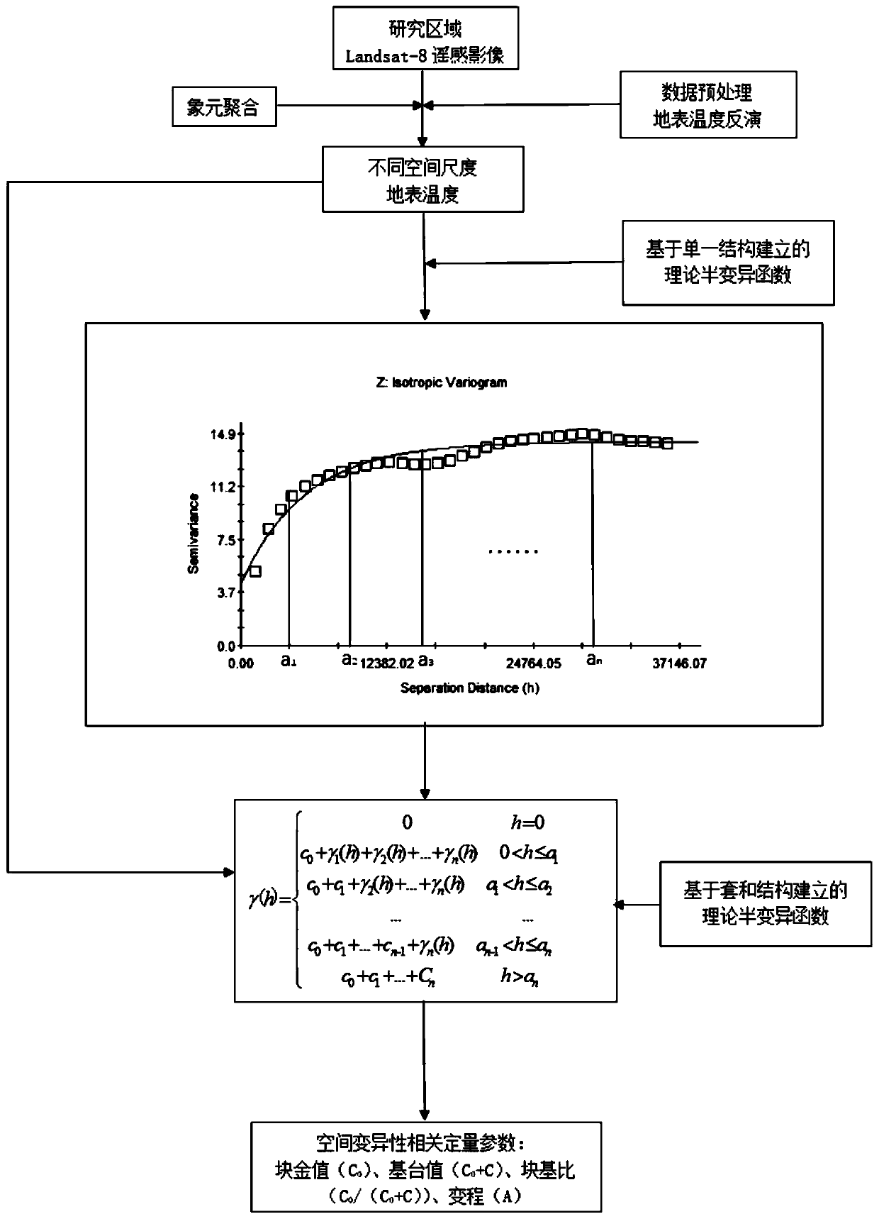
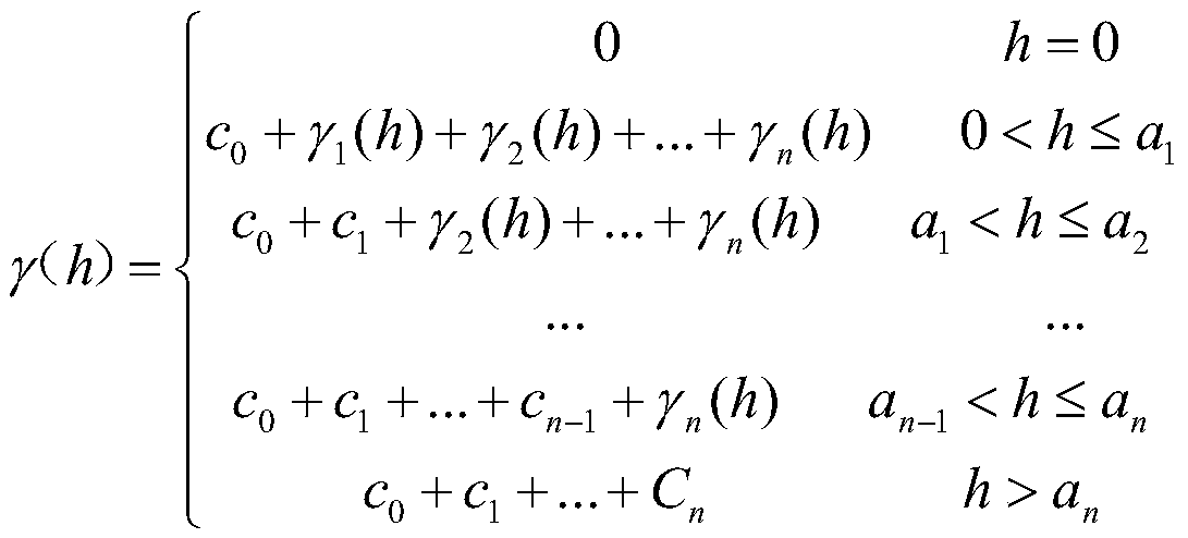
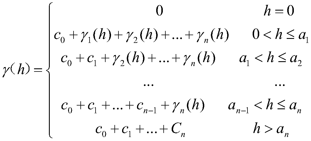
[0028]A method for nesting and structural modeling and quantitative description of the spatial variability of surface temperature, comprising the following steps:
[0029] (1) Obtain the Landsat8 remote sensing image data of the study area;
[0030] (2) Remote sensing image data preprocessing, including atmospheric correction, geometric correction, etc.;
[0031] (3) Surface temperature inversion, use the classic surface temperature inversion algorithm to invert the surface temperature, and obtain the surface temperature data of the research area;
[0032] (4) Establish a theoretical semi...
PUM
 Abstract
Description
Claims
Application Information
 - R&D
- Intellectual Property
- Life Sciences
- Materials
- Tech Scout
- Unparalleled Data Quality
- Higher Quality Content
- 60% Fewer Hallucinations
Browse by: Latest US Patents, China's latest patents, Technical Efficacy Thesaurus, Application Domain, Technology Topic, Popular Technical Reports.
© 2025 PatSnap. All rights reserved.Legal|Privacy policy|Modern Slavery Act Transparency Statement|Sitemap|About US| Contact US: help@patsnap.com


