Geographic information mapping system

A technology of geographic information and shaft rotation, applied in the field of geographic surveying and mapping, can solve the problems of time-consuming and laborious, exposed, low surveying and mapping efficiency, etc., and achieve the effects of convenient use, simple retraction and high surveying and mapping efficiency

Inactive Publication Date: 2019-07-26
JILIN NORMAL UNIV
View PDF5 Cites 1 Cited by
  • Summary
  • Abstract
  • Description
  • Claims
  • Application Information

AI Technical Summary

Problems solved by technology

[0003] During the use of the surveying instrument, although the support rod at the bottom has a certain stabilizing effect on the body itself, under the influence of a huge external force, such as a collision with a person or a machine, it will also cause the surveying instrument to fall, and the precision measurement at the upper end of the surveying instrument The instrument is e

Method used


Image

  • Geographic information mapping system
  • Geographic information mapping system
  • Geographic information mapping system

Examples


Embodiment

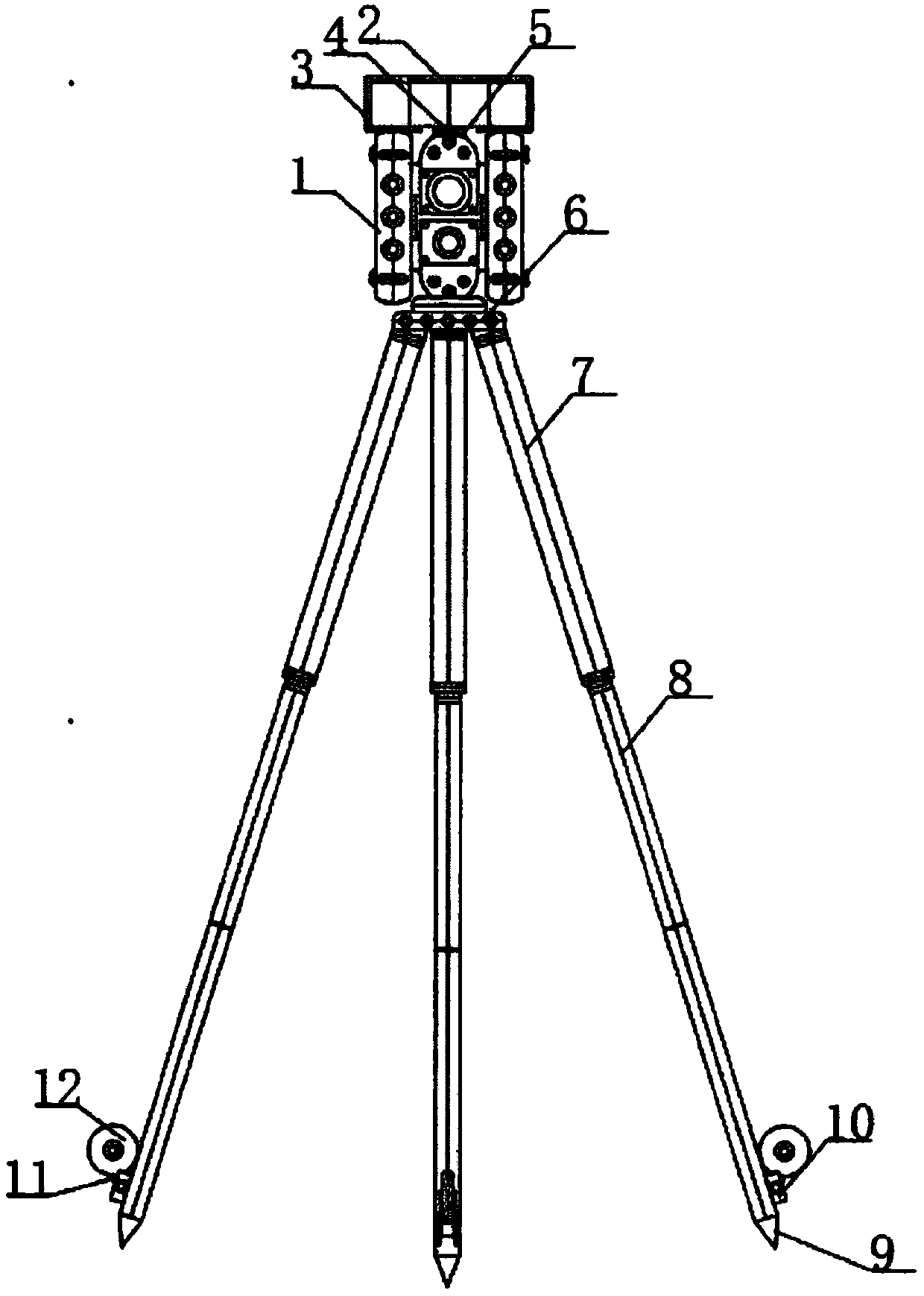
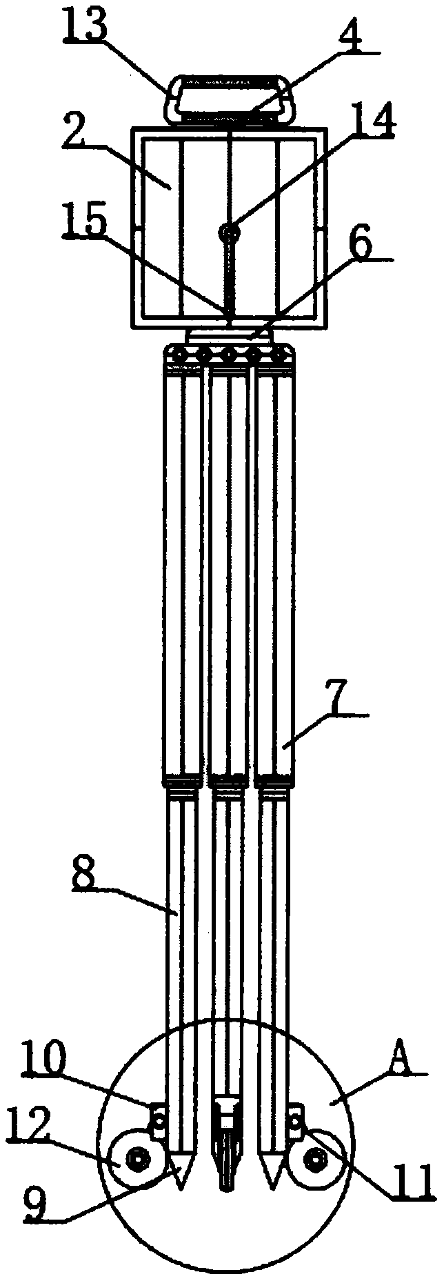
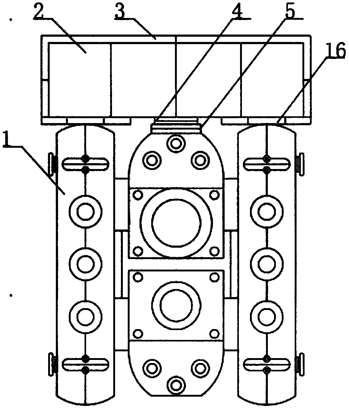
[0022] see Figure 1-5 , the present invention provides the following technical solutions: a geographical information surveying and mapping system, comprising a body 1, the two sides of the upper surface of the body 1 are connected with a connecting shaft 16 through a rotating shaft, and the upper end of the connecting shaft 16 is connected with a protective shell 2 through a rotating shaft to protect Shell 2 comprises No. 1 shell 17 and No. 2 shell 18, and the bottoms of No. 1 shell 17 and No. 2 shell 18 are all provided with magnetic stripe 3 around, and the upper surface center position of body 1 is provided with movable groove 5, and the movable groove 5 The upper end is connected with a movable shaft 4 by screwing, the upper end of the movable shaft 4 is fixedly connected with a handle 13, the center position of the bottom end of the body 1 is connected with a support seat 6 through a rotating shaft, and the bottom end of the support seat 6 is connected with a rotating sha...


PUM


Abstract

The invention belongs to the technical field of geographic mapping, in particular to a geographic information mapping system. The geographic information mapping system comprises a machine body, wherein two sides of an upper surface of the machine body are rotationally connected with a connection shaft through a rotary shaft; an upper end of the connection shaft is connected with a protection shellthrough the rotary shaft; a movable slot is formed at the center of the upper surface of the machine body; an upper end of the movable slot is connected with a movable shaft through rotary connection; an upper end of the movable shaft is fixedly connected with a handle; a support base is rotationally connected to the center of a bottom end of the machine body through the rotary shaft; a bottom end of the support base is rotationally connected with a No.1 rod through the rotary shaft; one side surface of the No.1 rod is fixedly connected with a fixed shaft; a protection shell is arranged on the periphery of the outside of a precise instrument at an upper end of a mapping instrument for protecting the precise instrument and preventing the mapping instrument from being damaged under the action of external force; one side of each of support rods at three positions of the bottom end of the mapping instrument is provided with a retractable wheel; and a movable handle is arranged at the upper end of the mapping instrument. The geographic information mapping system is easy to retract, and convenient to use.

Description

technical field [0001] The invention belongs to the technical field of geographic surveying and mapping, and in particular relates to a geographic information surveying and mapping system. Background technique [0002] Geographic information system is a specific and very important spatial information system. It is supported by computer hardware and software systems to collect, store, manage, calculate, analyze, A technical system for display and description. A simple latitude and longitude coordinate will only be recognized and understood by the user after it is placed in specific geographic information, represented as a certain location, sign, or orientation. After the user obtains the location information through related technologies , it is also necessary to understand the geographical environment, query and analyze environmental information, so as to provide information support and services for user activities. Geographic information system is a comprehensive discipline,...

Claims


Application Information

Patent Timeline
IPC IPC(8): G01C15/00
CPCG01C15/00
Inventor 张丽杜会石
Owner JILIN NORMAL UNIV
Why Eureka
Try Eureka