Coal mining subsidence water area calculation method

A calculation method and coal mining subsidence technology, applied in the field of surveying and mapping science, can solve problems such as difficult interpretation of water body area and complex environment, achieve effective decision-making and solve extraction difficulties

Active Publication Date: 2019-08-09
ANHUI UNIV OF SCI & TECH
View PDF3 Cites 5 Cited by
  • Summary
  • Abstract
  • Description
  • Claims
  • Application Information

AI Technical Summary

Problems solved by technology

[0005] The purpose of the present invention is to overcome the deficiencies of the prior art and provide a method for calculating the area of ​​coal mining subsidence waters to solve the problems in the prior art that the interpretation of the area of ​​the water body is difficult due to the complexity and irregularity of the environment of the subsidence area.

Method used


Image

  • Coal mining subsidence water area calculation method
  • Coal mining subsidence water area calculation method
  • Coal mining subsidence water area calculation method

Examples


Embodiment Construction

[0021] Hereinafter, the present invention will be described with reference to examples, but the present invention is not limited to the following examples.

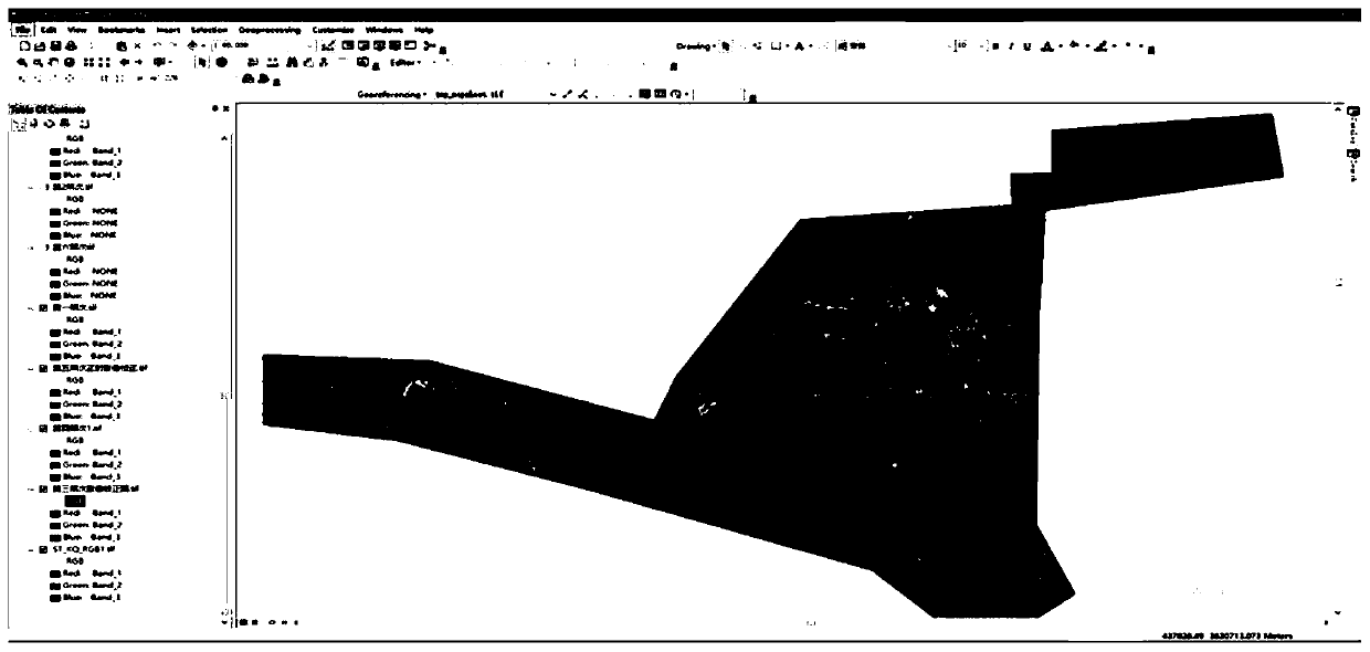
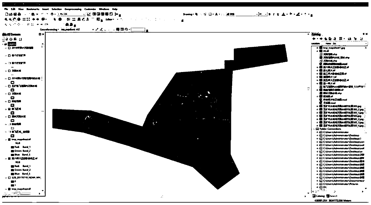
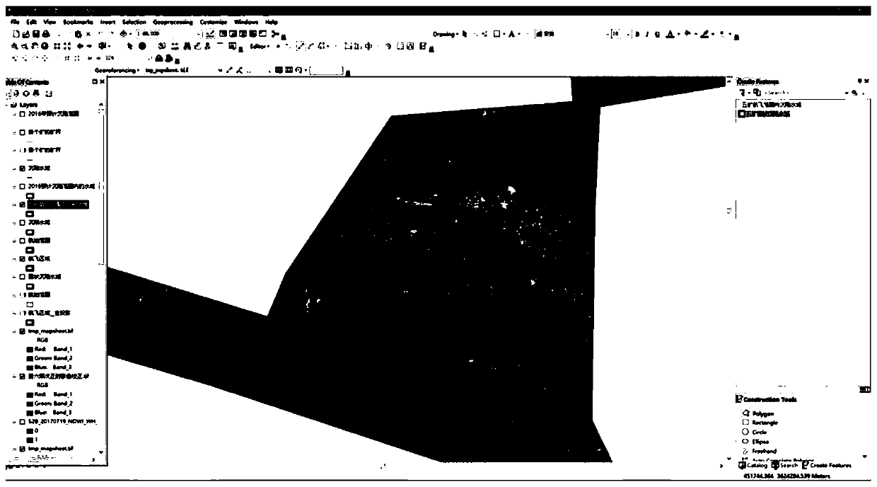
[0022] After obtaining the high-resolution image data of low-altitude photography through UAV aerial photogrammetry, the orthophoto map of the coal mining area was created through image distortion correction, cloud light processing, and aerial three-encryption using aerial three-dimensional software.

[0023] Import the orthophoto map of the coal mining area into ArcGIS software, the characteristics of the orthophoto obtained through field investigation and aerial photography, although there are plankton on the surface of some waters, there are Houses that have not sunk, but where the distribution of water can still be clearly identified. Create a new layer under ArcGIS, use the visual interpretation method to collect water boundary feature point data, and calculate the subsidence water area based on the boundary feature ...


PUM


Abstract

The invention discloses a coal mining subsidence water area calculation method, and relates to the field of surveying and mapping science and technology, and the method comprises the steps: carrying out aerial photography above the coal mining subsidence water area by using an unmanned aerial vehicle, and sequentially carrying out image distortion correction, cloud light processing and aerial triangulation encryption on an image to obtain a coal mining area ortho-image map; importing an orthographic image of a coal mining area into ArcGIS software, creating a new Shapefile file in Catalog of the ArcGIS software, carrying out surface editing, collecting water area boundary feature point data by using a visual interpretation method, and calculating a subsidence water area based on the boundary feature point data. The method solves the problems that the extraction of the subsidence water area is difficult due to the irregular subsidence water area terrain and the special humanistic environment of the coal mining area, and finally the calculation precision of the coal mining subsidence water area is low. A more effective decision is made for accounting the water resource quantity of the mining area and planning the application of the subsidence water area.

Description

technical field [0001] The invention relates to the field of surveying and mapping science and technology, in particular to a method for calculating the area of ​​a coal mining subsidence water area. Background technique [0002] The coal mine subsidence area is that after the underground coal is extracted, a goaf will be formed in situ. As the area of ​​the goaf increases, the overlying strata will move and deform. When the area of ​​the goaf reaches a certain level, the upper The deformation and destruction of the overlying strata will affect the surface, causing ground subsidence, groundwater will continue to overflow into the ground, or as time goes by, rain and snow will flow in, eventually forming a subsidence area, with the increase of the excavation surface , the subsidence area has also increased, and the accumulated water on the surface has also continued to deepen, which has caused certain difficulties in the measurement of the surface. [0003] In the process of...

Claims


Application Information

Patent Timeline
Patent Type & Authority Applications(China)
IPC IPC(8): G06T7/33G06T7/62G06Q50/06
CPCG06T7/62G06T7/33G06Q50/06
Inventor 徐良骥李科张传才张坤牛亚超宋承运
Owner ANHUI UNIV OF SCI & TECH
Why Eureka
Try Eureka