Farmland three-dimensional terrain real-time measurement device and method

A technology of three-dimensional terrain and real-time measurement, which is applied in the direction of measuring devices, agricultural machinery and implements, and radio wave measurement systems. It can solve the problems of time-consuming and labor-consuming, repeated rolling of fields, etc., and achieve the effect of convenient operation and simple structure.

Active Publication Date: 2019-08-27
SOUTH CHINA AGRI UNIV
View PDF5 Cites 1 Cited by
  • Summary
  • Abstract
  • Description
  • Claims
  • Application Information

AI Technical Summary

Problems solved by technology

However, measuring the three-dimensional topography of the farmland after the leveling operation is easy to repeatedly crush the field, which is time-consuming and labor-intensive.
[0005] Therefore, there is no technology in the prior art to level the ground and measure the three-dimensional topography of the farmland in real time when the automatic control state is in the state, that is, when the telescopic mechanism dynamically adjusts the state

Method used


Image

  • Farmland three-dimensional terrain real-time measurement device and method
  • Farmland three-dimensional terrain real-time measurement device and method
  • Farmland three-dimensional terrain real-time measurement device and method

Examples


Embodiment Construction

[0033] The present invention will be described in further detail below in conjunction with specific embodiments.

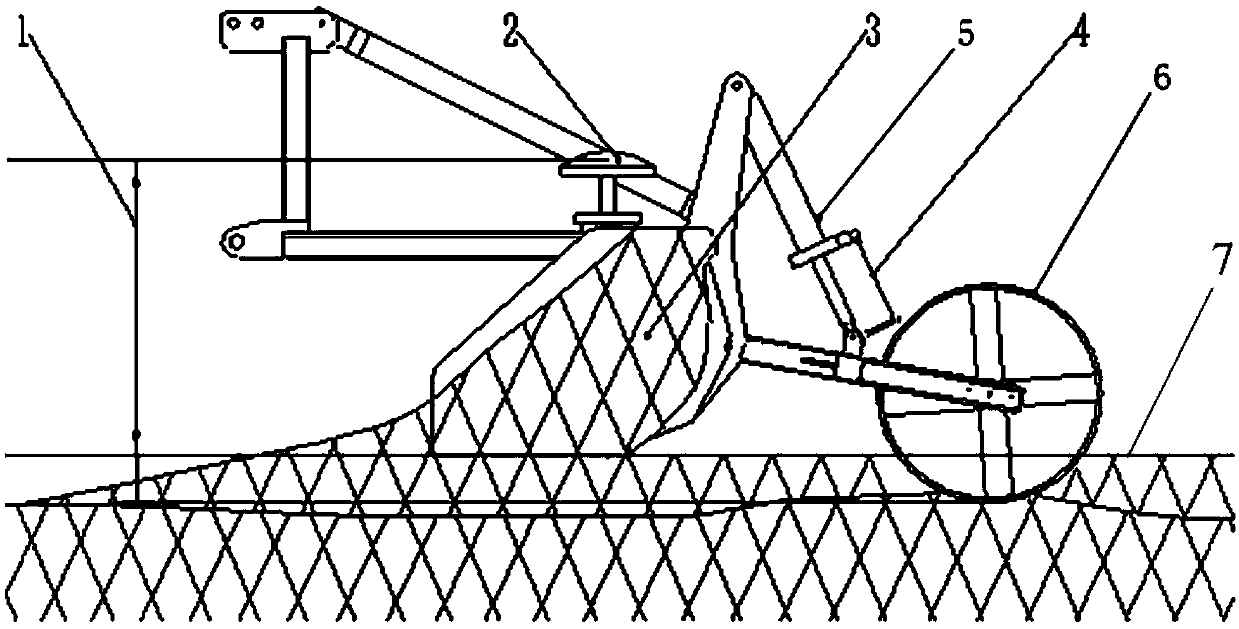
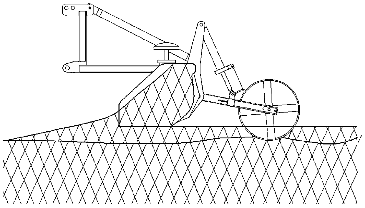
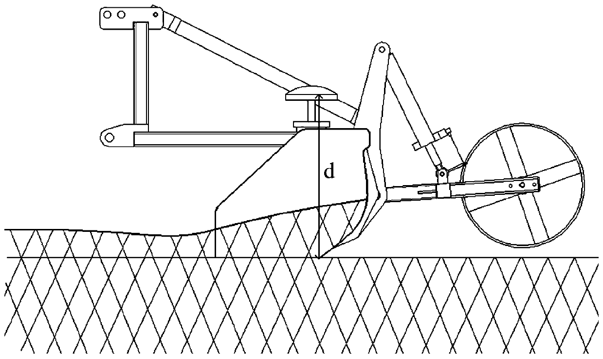
[0034] The dry land leveler includes a leveling shovel connected with a tractor through a three-point suspension mechanism. The leveling shovel includes a leveling blade, a telescopic mechanism, and a supporting wheel. The leveling blade and the supporting wheel are connected through a telescopic mechanism. The blade drops below the support wheels. When the grader is in the automatic control mode, the oil cylinder will expand and contract in real time according to the field conditions, and control the lifting of the blade. When working, the support wheels travel on the soil surface, and the support wheels support the operation of the blade. This embodiment adopts the leveling shovel disclosed by a kind of suspended dry land laser leveler disclosed in CN208807030U. The telescopic mechanism includes an elevation adjustment frame, a support wheel connecting frame, ...


PUM


Abstract

The invention relates to a farmland three-dimensional terrain real-time measurement device. The device comprises a GNSS positioning system, an extension and contraction quantity sensor, a data collection module and a leveling shovel; the leveling shovel comprises a leveling shovel blade, a telescopic mechanism and a supporting wheel, wherein the leveling shovel blade is connected with the supporting wheel through the telescopic mechanism, the telescopic mechanism comprises an oil cylinder, the leveling shovel blade is raised to be higher than the supporting wheel through extension of the oil cylinder, and the leveling shovel blade is dropped to be lower than the supporting wheel through contraction of the oil cylinder; and a positioning antenna of the GNSS positioning system is fixed abovethe leveling shovel blade, the extension and contraction quantity sensor is installed on the oil cylinder to detect the extension quantity of the oil cylinder, and the data collection module is connected with both the GNSS positioning system and the extension and contraction quantity sensor. The invention further relates to a farmland three-dimensional terrain real-time measurement method. The device is suitable for modern agricultural machinery, simple in structure and convenient to operate and guarantees that field collection precision can meet a precise leveling requirement.

Description

technical field [0001] The invention relates to farmland topography measurement technology, in particular to a farmland three-dimensional topography real-time measurement device, and also relates to a farmland three-dimensional topography real-time measurement method using the farmland three-dimensional topography real-time measurement device. Background technique [0002] Before leveling operations, the 3D terrain of farmland is the data basis for algorithms such as intelligent leveling earthwork calculation, leveling depth estimation, and path planning. After leveling operations, the 3D terrain is an important indicator for evaluating the quality of operations. [0003] The existing leveling shovel comprises a leveling blade, a support wheel, and a telescopic mechanism. The leveling blade is fixed with a three-point suspension mechanism, and is connected with the agricultural machinery vehicle body through the three-point suspension mechanism, and the support wheel is conn...

Claims


Application Information

Patent Timeline
IPC IPC(8): G01S19/14A01B49/04
CPCA01B49/04G01S19/14
Inventor 胡炼唐灵茂罗锡文杜攀毛婷贺静蒙世博苏洪毅
Owner SOUTH CHINA AGRI UNIV
Why Eureka
Try Eureka