
Real-time acquisition method for early warning range applicable to low-altitude drone

A real-time acquisition, unmanned aerial vehicle technology, applied in the field of unmanned aerial vehicles, can solve the problems of increased collision risk, greater impact on the quality of wireless signals, and impact on the operation efficiency of unmanned aerial vehicles, and achieves the effect of improving operation efficiency.

Inactive Publication Date: 2019-09-10
飞牛智能科技(南京)有限公司 +1
View PDF18 Cites 8 Cited by
  • Summary
  • Abstract
  • Description
  • Claims
  • Application Information

AI Technical Summary

Problems solved by technology

[0008] But in practical application, firstly, the signal sent by the UAV is controlled by the clock signal, and secondly, the sent signal needs to reach the control server through the base station, the control server processes the received signal, and then sends the processing result of the control server to the For drones, signal transmission and calculation take time, and finally, signal transmission is greatly affected by the quality of wireless signals
[0009] When the early warning range is too large, it will affect the operating efficiency of the UAV, and when the early warning range is too small, the risk of collision will increase

Method used


Image

  • Real-time acquisition method for early warning range applicable to low-altitude drone
  • Real-time acquisition method for early warning range applicable to low-altitude drone
  • Real-time acquisition method for early warning range applicable to low-altitude drone

Examples


Embodiment Construction

[0046] In order to better understand the technical content of the present invention, specific embodiments are given together with the attached drawings for description as follows.

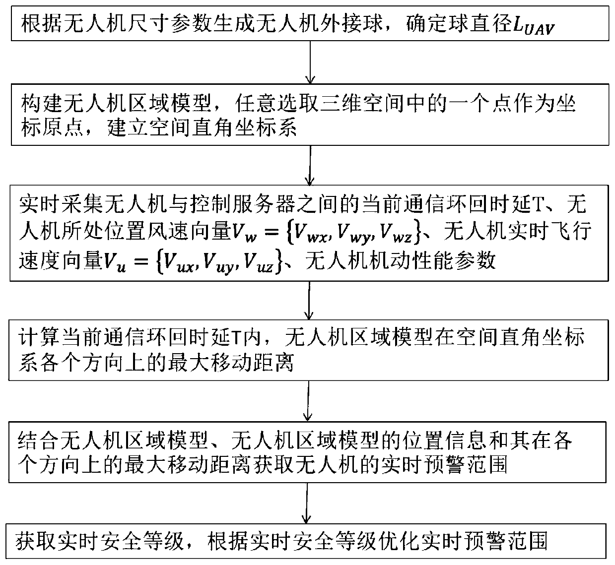
[0047] combine figure 1 , the present invention mentions a method for real-time acquisition of early warning range suitable for low-altitude unmanned aerial vehicles, said method comprising:

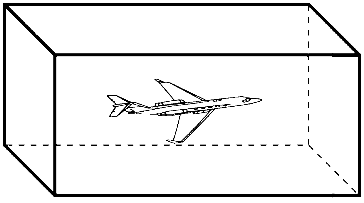
[0048] S1: Generate the circumscribed ball of the drone according to the size parameters of the drone, and determine the diameter L of the ball UAV .

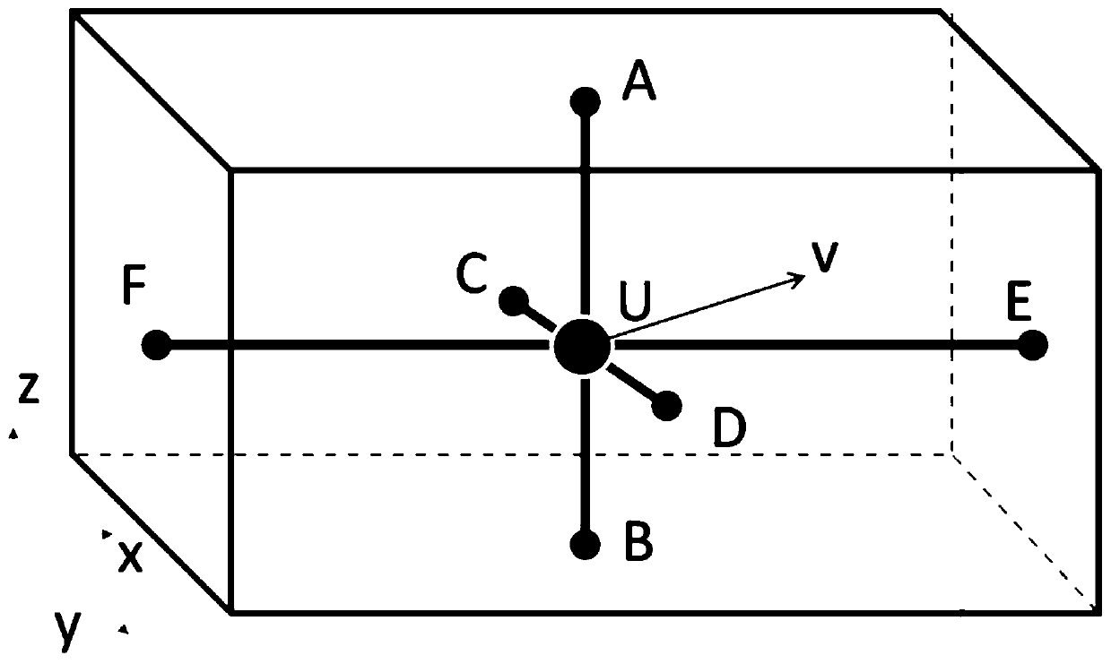
[0049] S2: Construct the UAV area model, arbitrarily select a point in three-dimensional space as the coordinate origin, and establish a spatial rectangular coordinate system, which includes the x-axis and y-axis in the horizontal direction and the vertical axis in the vertical direction. z-axis.

[0050] S3: Real-time collection of the current communication loopback delay T between the drone and the control server, and the wind speed vector V of the drone'...


PUM


Abstract

The present invention discloses a real-time acquisition method for an early warning range applicable to a low-altitude drone. The method comprises: generating a UAV circumscribed ball according to a drone size parameter, and determining a ball diameter; constructing a UAV area model, and arbitrarily selecting a point in a three-dimensional space as the coordinate origin to establish a space rectangular coordinate system; performing real-time acquisition on a current communication loopback delay between the drone and a control server, a wind speed vector of the drone position, a real-time flight speed vector of the drone, and maneuverability parameters of the drone, and calculating the maximum moving distance of the UAV area model in all directions of the space rectangular coordinate systemin the current communication loopback delay; and combined with the UAV area model, the position information of the UAV area model and the maximum moving distance in all directions, obtaining a real-time early warning range of the drone. According to the method provided by the present invention, a real-time early warning range can be generated reasonably, and the operating efficiency of the dronecan be improved as much as possible while ensuring that the collision risk meets the risk level requirement.

Description

technical field [0001] The invention relates to the technical field of unmanned aerial vehicles, in particular to a method for real-time acquisition of early warning ranges suitable for low-altitude unmanned aerial vehicles. Background technique [0002] Unmanned aerial vehicles, referred to as unmanned aerial vehicles, as an emerging technological product, have developed rapidly in recent years. Unmanned aerial vehicles have not only been widely used in fire protection, inspection, agriculture, logistics and other fields, but also gradually accepted by ordinary people. Companies like DJI, Zero Degree, Haoxiang, 3DR, etc. have gradually launched many consumer-grade products. [0003] However, as more and more drones fly at low altitudes, the number of drones in the low altitudes becomes denser and the risk of drone collisions becomes greater. Unified management of drones in flight and orderly flight of drones will be an effective way to solve this problem. Among them, how ...

Claims


Application Information

Patent Timeline
Patent Type & Authority Applications(China)
IPC IPC(8): G08G5/04G05D1/10
CPCG05D1/101G08G5/04
Inventor 赵民强陶志军
Owner 飞牛智能科技(南京)有限公司
Learn More