Method for preparing production, living and ecological water for inland river basin in arid area
An arid area, ecological technology, applied in the field of water resources utilization, can solve the problems that are not involved, not in-depth quantification of BEEWR and TEEWR, not considered, etc.
- Summary
- Abstract
- Description
- Claims
- Application Information
AI Technical Summary
Problems solved by technology
Method used
Image
Examples
Embodiment 1
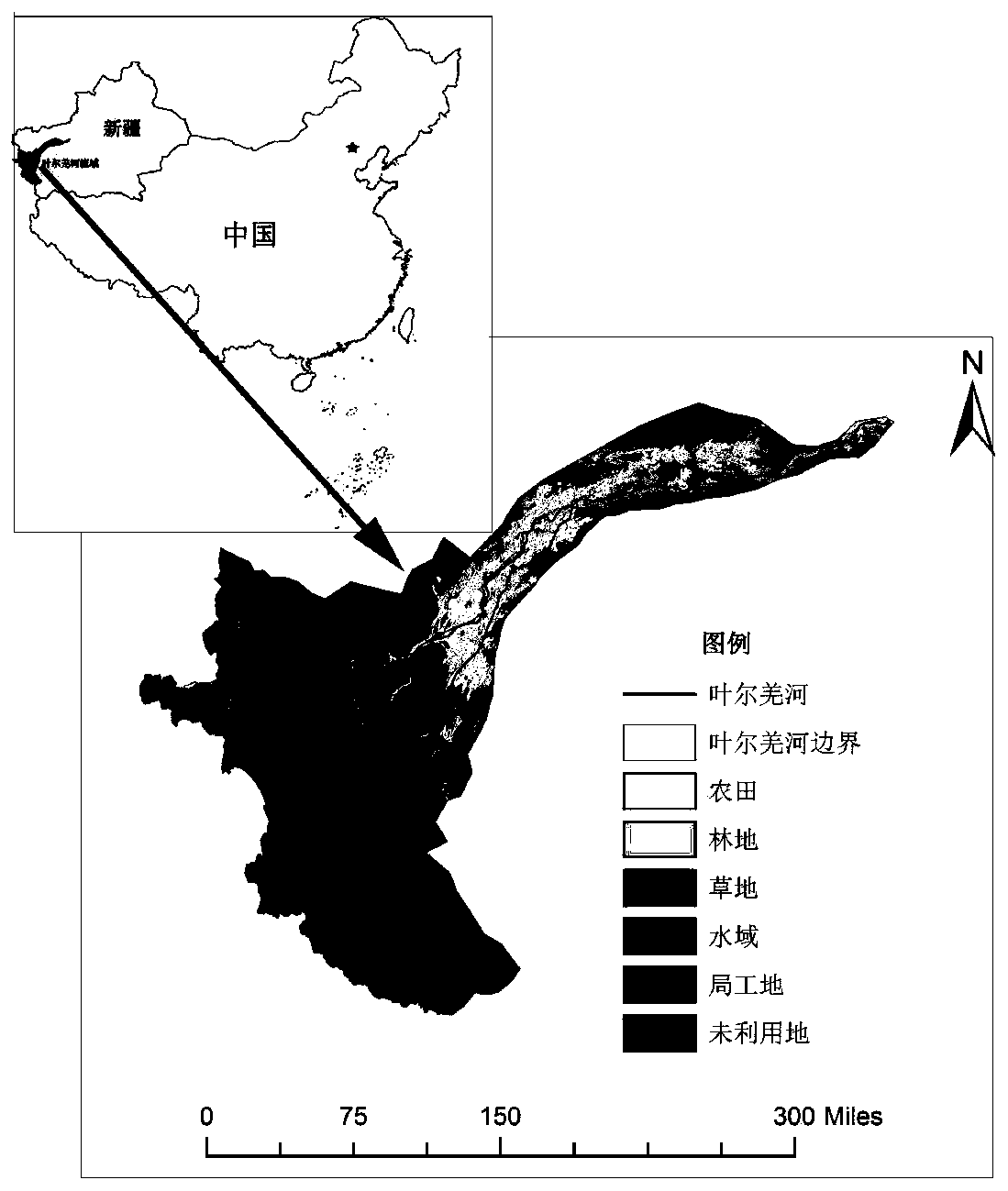
[0068] Take the Yarkand River Basin in Xinjiang, China as an example to implement the method of the present invention. The Yarkant River is located in the inland river basin in the arid area of Northwest my country, and is a typical inland river in my country. Implement the river basin figure of the present invention as figure 2 shown.
[0069] (1)X 生 OK for:
[0070] Obtain the Yarkand River Basin X by consulting the Kashgar Administration of Tarim River Basin, Xinjiang 生 5.143 billion m 3 , the value is determined according to the "three red lines" standard.
[0071] (2) The section from Kaqun to Henyaz River of Yarkand River X 河损 OK for:
[0072] By consulting the Kashgar Administration Bureau of the Tarim River Basin in Xinjiang, the X 河损 1.507 billion m 3 .
[0073] (3) Calculate BEEWR:
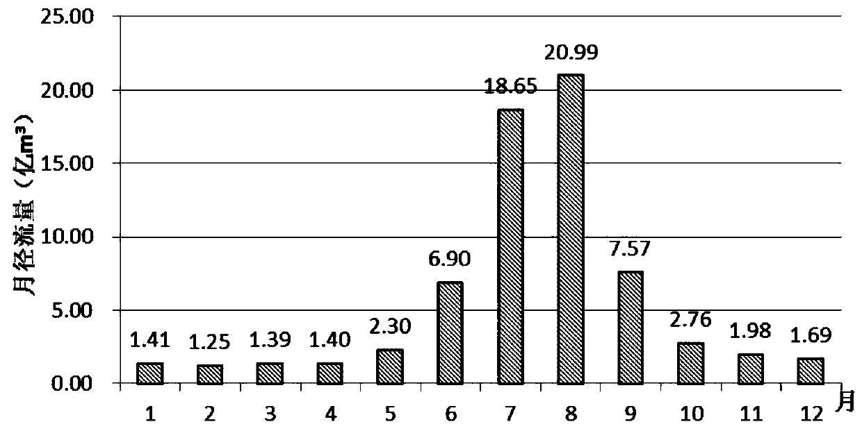
[0074] A. Determining the flood season and non-flood season: the monthly average runoff trend of the Kaqun section in the past 50 years is as follows image 3 shown by i...
Embodiment 2
[0118] Taking the main stream of the Tarim River Basin in Xinjiang, China (from Alar to the Chala River section, excluding the lower reaches of the Tarim River) as an example, the method of the present invention is implemented. Tarim River is located in the inland river basin of my country's Northwest arid region, and the drainage basin diagram of implementing the present invention is as follows Figure 4 shown.
[0119] (1)X 生 OK for:
[0120] Obtain the main stream of the Tarim River X by consulting the Xinjiang Tarim River Basin Administration 生 1.081 billion m 3 , the value is determined according to the "three red lines" standard.
[0121] (2) The main stream of the Tarim River from Alar to Qiala River X 河损 OK for:
[0122] By consulting the Xinjiang Tarim River Basin Administration, the X 河损 983 million m 3 .
[0123] (3) Calculate BEEWR:
[0124] A. Determining the flood season and non-flood season: the monthly average runoff trend of the Alar section in the p...
Embodiment 3
[0178] Taking the main stream of the Aksu River Basin in Xinjiang, China (from the confluence of the Kumarak River and the Tuoshigan River to Ima Pasha) as an example, the method of the present invention is implemented. The Aksu River is located in the inland river basin in the arid area of Northwest my country. Implement the river basin figure of the present invention as Figure 6 shown.
[0179] (1)X 生 OK for:
[0180] By consulting the Tarim River Basin Administration of Xinjiang, the main stream of the Aksu River X 生 3.123 billion m 3 , the value is determined according to the "three red lines" standard.
[0181] (2) From the confluence of the two rivers on the main stream of the Aksu River to the section of the Yima Pasha River X 河损 OK for:
[0182] By consulting the Xinjiang Tarim River Basin Administration, the X 河损 176.4 million m 3 .
[0183] (3) Calculate BEEWR:
[0184] A. Determination of flood season and non-flood season: the change trend of the month...
PUM
 Abstract
Description
Claims
Application Information
 - R&D
- Intellectual Property
- Life Sciences
- Materials
- Tech Scout
- Unparalleled Data Quality
- Higher Quality Content
- 60% Fewer Hallucinations
Browse by: Latest US Patents, China's latest patents, Technical Efficacy Thesaurus, Application Domain, Technology Topic, Popular Technical Reports.
© 2025 PatSnap. All rights reserved.Legal|Privacy policy|Modern Slavery Act Transparency Statement|Sitemap|About US| Contact US: help@patsnap.com


