Unmanned aerial vehicle tilt photography fine grid earthwork measurement method

A technology of oblique photography and measurement methods, which is applied in photogrammetry/video measurement, calculation, and measurement devices, etc., can solve the problems of measurement result errors and inability to solve the problems of surface vegetation, so as to improve accuracy, save manpower and time costs, The effect of improving correctness and accuracy

Active Publication Date: 2019-09-27
SHANDONG TRAFFIC PLANNING DESIGN INST
View PDF6 Cites 35 Cited by
  • Summary
  • Abstract
  • Description
  • Claims
  • Application Information

AI Technical Summary

Problems solved by technology

[0005] At present, the method of earthwork measurement based on multi-rotor drone equipped with camera to collect information often cannot solve the influence of factors such as ground vegetation and houses on the calculation of earthwork, which makes the measurement results have errors. This disclosure effectively solves the problem through model repair technology. solved the problem

Method used


Image

  • Unmanned aerial vehicle tilt photography fine grid earthwork measurement method
  • Unmanned aerial vehicle tilt photography fine grid earthwork measurement method
  • Unmanned aerial vehicle tilt photography fine grid earthwork measurement method

Examples


Embodiment Construction

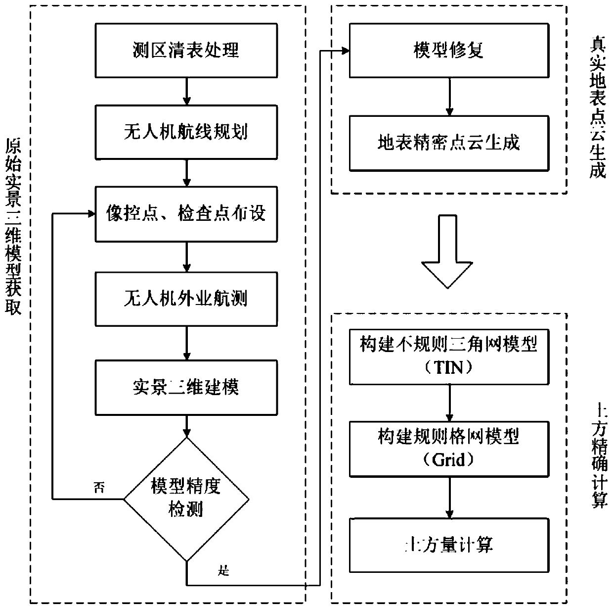
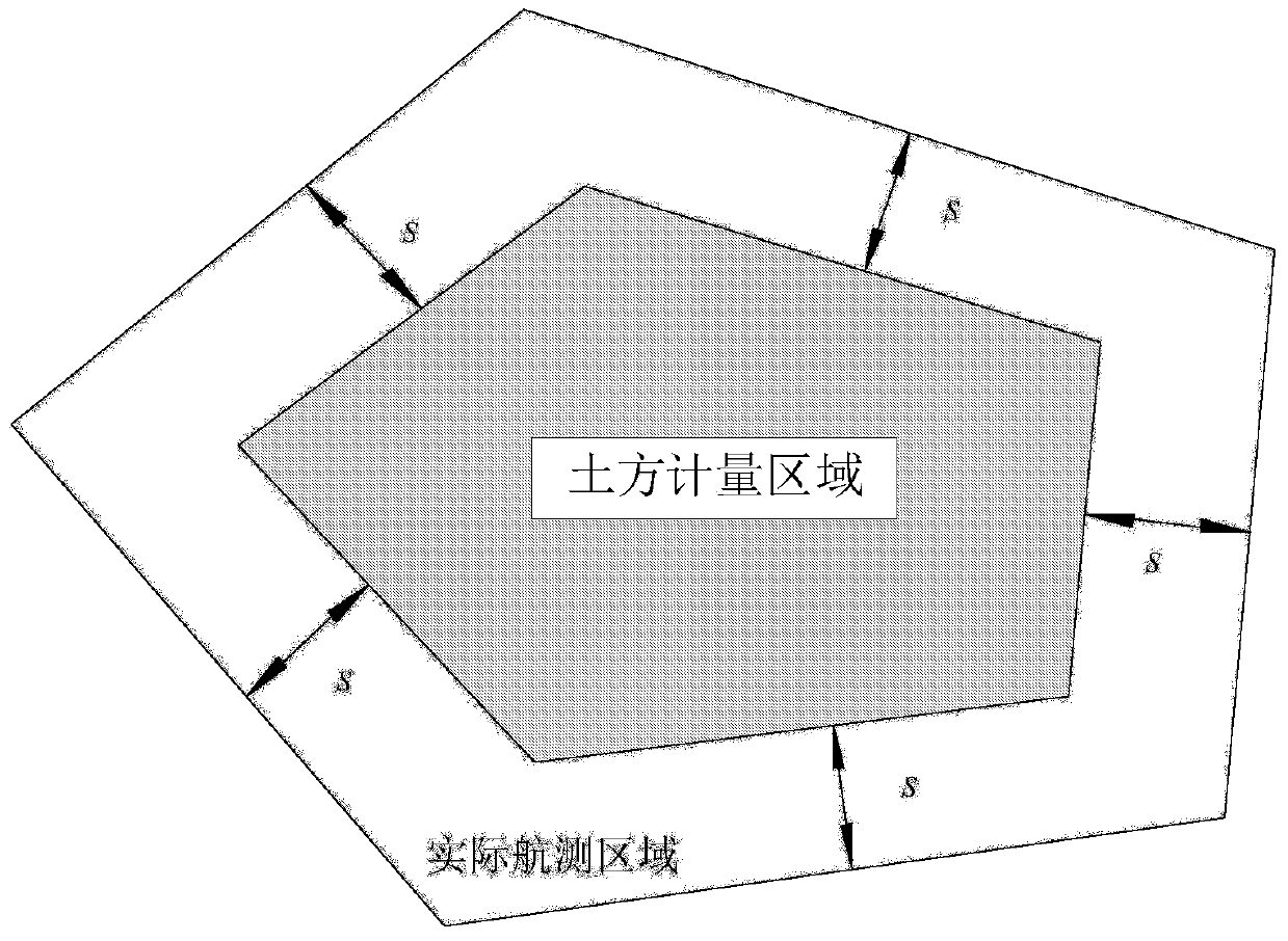
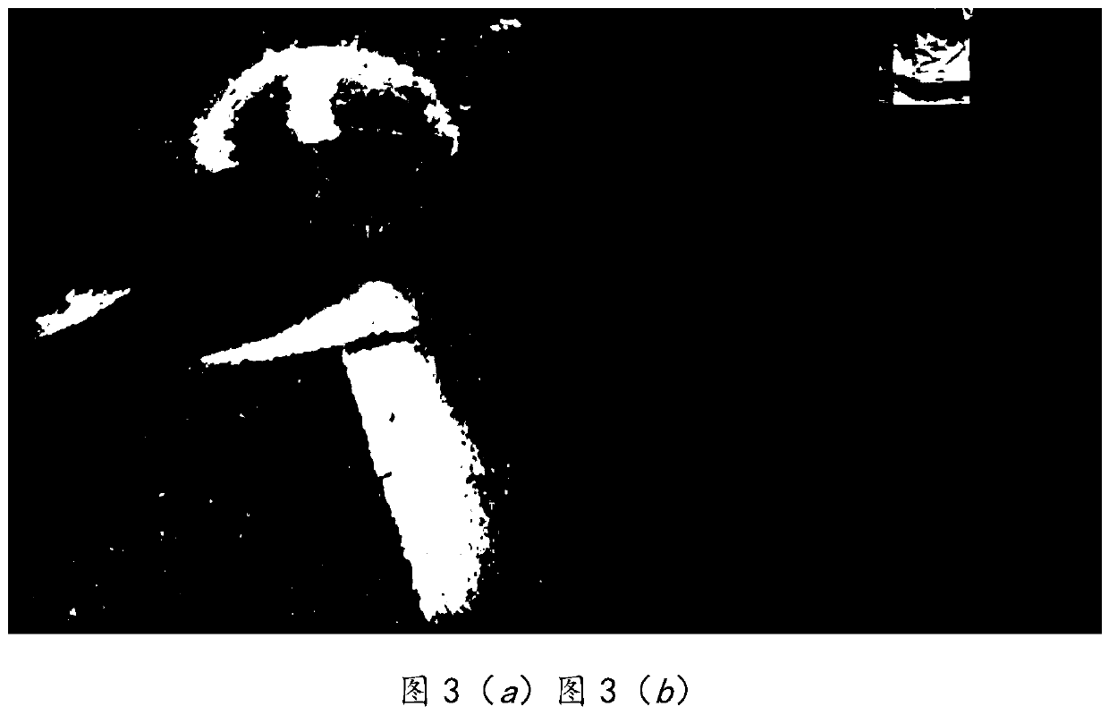
[0041] The present disclosure will be further described below in conjunction with the accompanying drawings and embodiments.

[0042] It should be noted that the following detailed description is exemplary and intended to provide further explanation of the present disclosure. Unless defined otherwise, all technical and scientific terms used herein have the same meaning as commonly understood by one of ordinary skill in the art to which this disclosure belongs.

[0043] It should be noted that the terminology used herein is only for describing specific embodiments, and is not intended to limit the exemplary embodiments according to the present disclosure. As used herein, unless the context clearly dictates otherwise, the singular is intended to include the plural, and it should also be understood that when the terms "comprising" and / or "comprising" are used in this specification, they mean There are features, steps, operations, means, components and / or combinations thereof.

...


PUM


Abstract

The invention provides an unmanned aerial vehicle tilt photography fine grid earthwork measurement method. The aerial survey data are obtained by aerial survey of the unmanned aerial vehicle and the data are integrated and processed so as to obtain a three-dimensional model of a real scene; the model restoration technology is applied to eliminate the interference objects such as trees and houses in the real scene three-dimensional model, the elevation around the pores left after the interference objects are deleted is applied to fit the curved surface, and the pores are filled with the curved surface so that the restored real scene three-dimensional model is finally obtained, and the real surface point cloud is generated based on the restored real scene three-dimensional model; and an irregular triangular network model is constructed according to the point cloud and then a regular grid model is further constructed, and the earthwork calculation value is obtained through a fine grid earthwork measurement formula based on the regular grid model. The accurate calculation of earthwork filling and excavation can be realized based on the fine grid, and the method has the advantages of high accuracy, safe operation and saving manpower and time cost.

Description

technical field [0001] The disclosure belongs to the field of highway survey design and construction, and relates to a fine grid earthwork measurement method of UAV oblique photography. Background technique [0002] The statements in this section merely provide background information related to the present disclosure and do not necessarily constitute prior art. [0003] Earthwork calculation is an important process in the field of highway design and construction. At present, there are many calculation methods for earthwork, including section method, grid method, DTM method, etc. In recent years, UAV oblique photography technology has gradually emerged. As a high-tech developed in the field of international photogrammetry in recent years, it can not only truly reflect the situation of ground objects, obtain the texture information of ground objects with high precision, but also pass advanced Advanced positioning, fusion, modeling and other technologies to generate a real 3D ...

Claims


Application Information

Patent Timeline
Patent Type & Authority Applications(China)
IPC IPC(8): G01C11/00G06T17/20
CPCG01C11/00G06T17/20
Inventor 相诗尧李振江徐润王甲勇张涛赵杰张常勇
Owner SHANDONG TRAFFIC PLANNING DESIGN INST
Why Eureka
Try Eureka