
Traffic cell demographic method based on raster data and area ratio correction

A traffic area and grid data technology, applied in the field of traffic big data and traffic simulation, can solve the problems of grid values ​​not being counted, errors, etc., to achieve the effect of ensuring integrity and improving statistical accuracy

Active Publication Date: 2019-10-01
SOUTHEAST UNIV
View PDF5 Cites 4 Cited by
  • Summary
  • Abstract
  • Description
  • Claims
  • Application Information

AI Technical Summary

Problems solved by technology

The existing problems are: because a single point is not in the traffic area, the value of the entire grid is not counted, or the grid with a small overlap with the traffic area is counted as the entire grid, which will cause a large error

Method used


Image

  • Traffic cell demographic method based on raster data and area ratio correction
  • Traffic cell demographic method based on raster data and area ratio correction
  • Traffic cell demographic method based on raster data and area ratio correction

Examples


specific Embodiment

[0075] Specific embodiments: Take the statistics of the population of each administrative region in Nanjing in 2016 as an example. The city has a total of 11 administrative districts. The larger administrative districts are divided into multiple traffic districts according to the actual situation, a total of 16 traffic districts. As shown in the table below, due to space limitations, only part of the data is selectively displayed below.

[0076]

[0077]

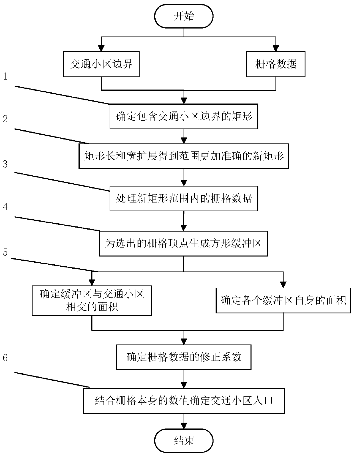
[0078] combine figure 1 As shown, a kind of traffic community population statistics method based on raster data and area ratio correction provided by the present invention comprises the following steps:

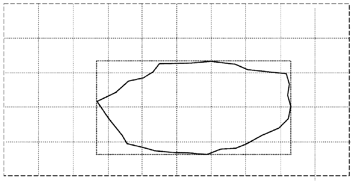
[0079] S1: figure 2 It is a schematic diagram of a traffic area and a rectangle containing it as an example of the present invention.

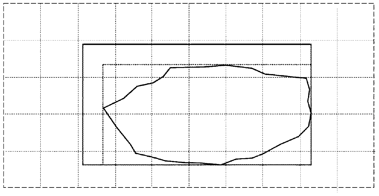
[0080] Convert the boundary coordinates of the traffic area into latitude and longitude coordinates, respectively determine the minimum longitude value minlon, maximum latitude val...


PUM


Abstract

The invention discloses a traffic cell demographic method based on raster data and area ratio correction. The method comprises: properly adjusting a rectangle containing a traffic cell boundary; accurately determining a rectangular region grid data set completely containing a traffic cell range in the integral grid data set; representing a grid by replacing points with a square buffer area, correcting the population elevation value of the grid through the ratio of the overlapping area of the buffer area and a traffic cell to the area of the buffer area, performing accumulation on the population elevation value, and finally obtaining the total population of the traffic zone. The technology changes the statistical method of the traffic cell population, comprehensively considers the accuratepositioning of the traffic cell in a grid data set area and the correction of the grid population value by an area comparison method, and better improves the efficiency and precision of the traffic cell population statistics.

Description

technical field [0001] The invention relates to the fields of traffic simulation, traffic big data, etc., in particular to a population statistics method of traffic districts based on grid data and area ratio correction. Background technique [0002] The transportation system has complex characteristics such as interdisciplinary, cross-field, huge scale, and high experimental cost. With the continuous development of computer and network technology, the concept and method of intelligent transportation are becoming more and more mature, and the transportation system is also moving towards informatization, networking, automation and intelligence. development continues. An important technology in the intelligent transportation system is the traffic simulation technology, that is, the technical method of using modern computer technology to establish a computer model that can replace the real traffic system. The premise of traffic simulation is to obtain traffic-related data, and...

Claims


Application Information

Patent Timeline
IPC IPC(8): G06Q50/26G06F17/18
CPCG06Q50/26G06F17/18
Inventor 王炜王宇航屠雨金坤梁鸣璋
Owner SOUTHEAST UNIV
Learn More