

Land utilization change analysis and prediction method and device
A technology of change analysis and prediction method, applied in the field of remote sensing information, can solve the problem of low prediction accuracy and achieve the effect of improving accuracy
- Summary
- Abstract
- Description
- Claims
- Application Information
AI Technical Summary
Problems solved by technology
Method used
Image

Examples
Embodiment Construction
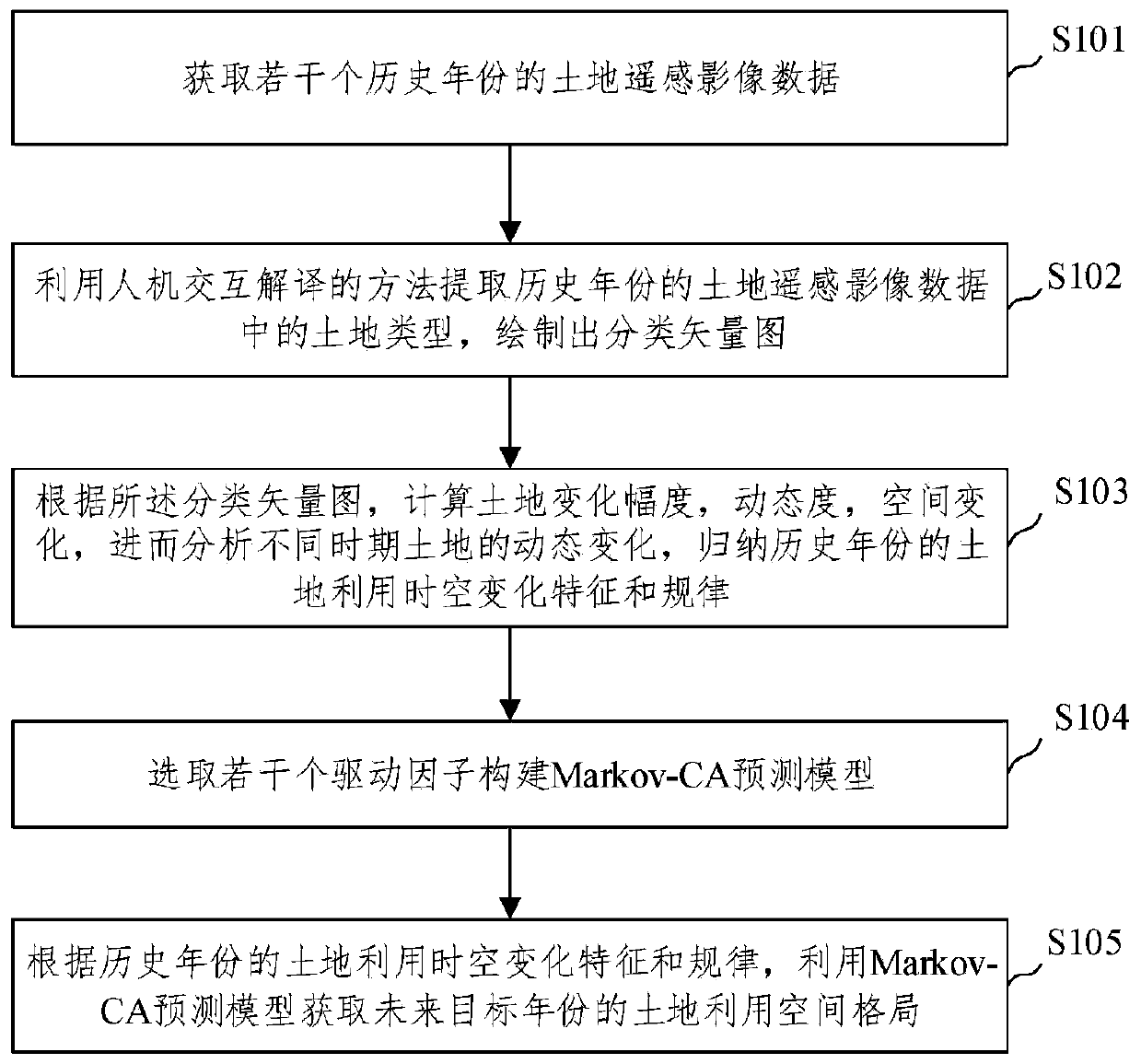
[0039] The implementation mode of the present invention is illustrated by specific specific examples below, and those who are familiar with this technology can easily understand other advantages and effects of the present invention from the contents disclosed in this description. Obviously, the described embodiments are a part of the present invention. , but not all examples. Based on the embodiments of the present invention, all other embodiments obtained by persons of ordinary skill in the art without making creative efforts belong to the protection scope of the present invention.
[0040] figure 1 The schematic diagram of the method for analyzing and predicting land use change provided by the embodiment of the present invention, such as figure 1 As shown, the embodiment of the present invention provides a method for analyzing and predicting land use change, the execution subject of which is a device for analyzing and predicting land use change, and the method includes:
...
PUM
 Abstract
Description
Claims
Application Information