Forest three-layer scattering model determination and analysis method suitable for PolInSAR inversion

A technology of scattering model and analysis method, applied in the field of remote sensing image processing, can solve the problems such as errors and affect the inversion accuracy, and achieve the effect of high-precision vegetation parameter inversion

Active Publication Date: 2019-12-13
HARBIN INST OF TECH
View PDF4 Cites 10 Cited by
  • Summary
  • Abstract
  • Description
  • Claims
  • Application Information

AI Technical Summary

Problems solved by technology

[0004] The purpose of the present invention is to solve the problem that the scattering process of the existing vegetation coherent scattering model still has errors compared with the real scattering process, which affects the inversion

Method used


Image

  • Forest three-layer scattering model determination and analysis method suitable for PolInSAR inversion
  • Forest three-layer scattering model determination and analysis method suitable for PolInSAR inversion
  • Forest three-layer scattering model determination and analysis method suitable for PolInSAR inversion

Examples


specific Embodiment approach 1

[0026] Specific implementation mode 1: This implementation mode discloses a determination and analysis method for a forest three-layer scattering model suitable for PolInSAR inversion, including the following steps:

[0027] Step 1: Analyze the scattering characteristics of the surface layer and determine its vertical structure function form;

[0028] Step 2: Analyze the scattering characteristics of the trunk layer and determine its vertical structure function form;

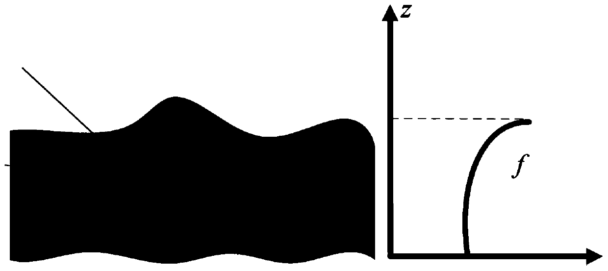
[0029] Step 3: Analyze the scattering characteristics of the vegetation canopy and determine its vertical structure function form;

[0030] Step 4: Combining the vertical structure functions of the surface layer, trunk layer and vegetation canopy on the vertical structure of vegetation, derive the general three-layer scattering model of vegetation, determine the expression of interference coherence coefficient, and analyze the influence of height parameters on coherence.

specific Embodiment approach 2

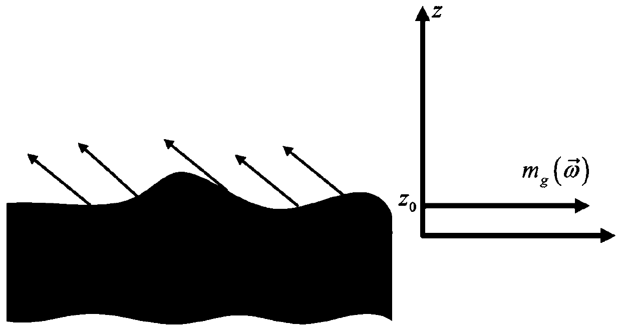
[0031] Specific implementation mode two: this implementation mode is a further description of specific implementation mode one, and the step one is specifically (see figure 1 ):

[0032] Surface scattering usually occurs in a discontinuous medium. In the L-band, electromagnetic waves can often penetrate the vegetation canopy to reach the surface, so surface scattering occurs on the surface. For surface scattering, the scattering center is at a constant height, and the vertical structure The function is reflected in the horizontal direction, so its vertical structure function is modeled as an impulse response, the expression is as follows:

[0033]

[0034] Among them, z 0 Indicates the terrain height, f g (z) represents the distribution function of the electromagnetic scattering amplitude of surface scattering in the vertical direction, Indicates the electromagnetic scattering amplitude of the surface layer, δ indicates the impulse response function, and z indicates the...

specific Embodiment approach 3

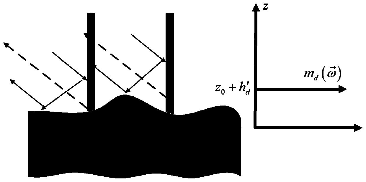
[0035] Specific implementation mode three: this implementation mode is a further description of specific implementation mode one, and the step two is specifically (see figure 2 ):

[0036] Let the height of the trunk layer be h d (Note that the height of the trunk layer here is not equal to the height of the bottom of the canopy). Even scattering is caused by the interaction of electromagnetic waves between the trunk, branches and the ground. Under the L-band, because electromagnetic waves can penetrate The canopy, so the even-order scattering exists, and the even-order scattering between the trunk, branches and the ground is equivalent to the surface scattering at a certain height from the ground surface to the bottom of the canopy, and its equivalent scattering center h d 'defined as

[0037]

[0038] Among them, h′ d Indicates the height of the equivalent scattering center of the trunk layer, θ indicates the radar incidence angle;

[0039] The corresponding vertical...


PUM

PropertyMeasurementUnit
Extinction coefficientaaaaaaaaaa

Abstract

The invention discloses a forest three-layer scattering model determination and analysis method suitable for PolInSAR inversion, and belongs to the technical field of remote sensing image processing.The objective of the invention is to solve the problem that an error still exists in a scattering process of an existing vegetation coherent scattering model compared with a real scattering process, and the inversion precision is affected. The method comprises the following steps: step 1, analyzing scattering characteristics of a ground surface layer and determining a vertical structure function form of the ground surface layer; step 2, analyzing scattering characteristics of a trunk layer and determining a vertical structure function form of the trunk layer; step 3, scattering characteristicsof the vegetation canopy are analyzed, and determining a vertical structure function form of the vegetation canopy; and step 4, deriving a vegetation general three-layer scattering model by combiningvertical structure functions of a ground surface layer, a trunk layer and a vegetation canopy on the vegetation vertical structure, determining an expression of an interference coherence coefficient,and analyzing the influence of height parameters on coherence. The method can be applied to the field of remote sensing image processing, and high-precision polarization interference SAR image vegetation parameter inversion is realized.

Description

technical field [0001] The invention belongs to the technical field of remote sensing image processing, in particular to a method for determining and analyzing a forest three-layer scattering model suitable for PolInSAR inversion. Background technique [0002] In recent years, with the aggravation of global climate problems, people have paid more and more attention to the ecological environment and natural resources, and forest areas are an important part of ecological resources. The result release cycle is about several years, which cannot meet the needs of fast data acquisition. Remote sensing technology is not affected by time and climate, and can monitor in a large area. It has become an important data source for forest resource monitoring. [0003] Polarimetric Interferometric Synthetic Aperture Radar (PolInSAR) is currently a major technology for obtaining forest vertical structure information. Regional vertical structure information. The study of coherent scatterin...

Claims


Application Information

Patent Timeline
IPC IPC(8): G06F17/50G01S13/90G01S7/41
CPCG01S13/9023G01S7/411G01S13/9076
Inventor 张腊梅庄迪邹斌
Owner HARBIN INST OF TECH
Why Eureka
Try Eureka