
A Smart City Mapping Instrument Based on the Internet of Things

A smart city, surveying and mapping technology, applied in the field of surveying and mapping, can solve the problems of inability to meet user needs, time-consuming and labor-intensive

Active Publication Date: 2020-12-04
JIANGSU FOOD & PHARMA SCI COLLEGE
View PDF11 Cites 0 Cited by
  • Summary
  • Abstract
  • Description
  • Claims
  • Application Information

AI Technical Summary

Problems solved by technology

[0008] Aiming at the above-mentioned shortcomings in the prior art, the present invention provides a smart city surveying instrument based on the Internet of Things, which can effectively overcome the time-consuming and labor-intensive disassembly of the traditional urban surveying instrument existing in the prior art. And the defects that cannot meet the needs of users

Method used


Image

  • A Smart City Mapping Instrument Based on the Internet of Things
  • A Smart City Mapping Instrument Based on the Internet of Things
  • A Smart City Mapping Instrument Based on the Internet of Things

Examples


Embodiment Construction

[0036] In order to make the purpose, technical solutions and advantages of the embodiments of the present invention more clear, the technical solutions in the embodiments of the present invention will be clearly and completely described below in conjunction with the drawings in the embodiments of the present invention. Apparently, the described embodiments are some, but not all, embodiments of the present invention. Based on the embodiments of the present invention, all other embodiments obtained by persons of ordinary skill in the art without creative efforts fall within the protection scope of the present invention.

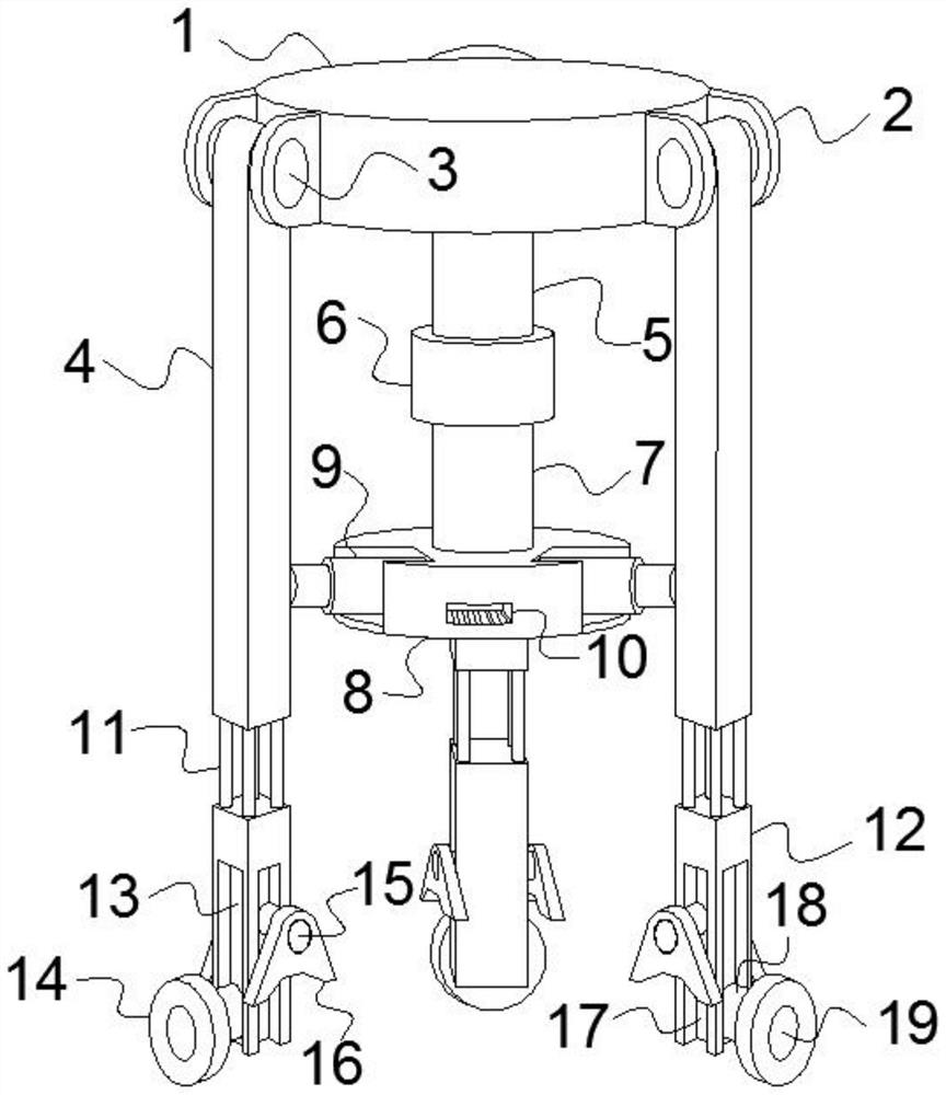
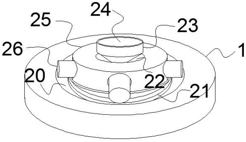
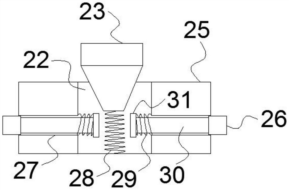
[0037] An IoT-based smart city mapper such as Figure 1-5 As shown, the surveying instrument support 1 is included, and the side walls of the surveying instrument support 1 are evenly spaced with three groups of left and right symmetrically arranged rotating seats 2, and a first rotating shaft 3 is rotationally connected between the left and right rotating seat...


PUM


Abstract

The present invention relates to the technical field of surveying and mapping, in particular to a smart city surveying and mapping instrument based on the Internet of Things, which includes a surveying and mapping instrument bracket. The rotation is connected with a first rotating shaft, and the center of the outer wall of the rotating shaft is fixedly connected with an upper support column, and a lower support column is provided directly below the upper support column, and four groups of first micro electro-hydraulic valves evenly distributed are passed between the upper support column and the lower support column. The push rods are connected, and the lower part of the outer wall of one side of the three sets of lower support columns is equipped with a slide rail. The inner cavity of the slide rail is slidably connected to the electric slider, and the end of the electric slider is connected to the second rotating shaft through the rotating connector. The outer wall of the second rotating shaft is fixed with walking wheels; the present invention can effectively overcome the defect that the traditional city surveying instrument in the prior art needs to be disassembled and assembled many times during use, which is time-consuming and laborious and cannot meet the needs of users.

Description

technical field [0001] The invention relates to the technical field of surveying and mapping, in particular to an intelligent city surveying and mapping instrument based on the Internet of Things. Background technique [0002] Surveying and mapping refers to the measurement, collection and drawing of the shape, size, spatial location and attributes of natural geographical elements or surface artificial facilities. [0003] Surveying and mapping research measures and calculates the geometric position of ground points, the shape of the earth and the earth's gravity field, based on which the natural shape of the earth's surface and the geometric distribution of artificial facilities are measured, and combined with the geographical distribution of certain social information and natural information, the compilation of global and local The theoretical and technical discipline of maps of various scales and thematic maps of regions, also known as surveying. It includes surveying an...

Claims


Application Information

Patent Timeline
Patent Type & Authority Patents(China)
IPC IPC(8): F16M11/04F16M11/32F16M11/42H04L29/08
CPCF16M11/04F16M11/32F16M11/42H04L67/12H04L67/141
Inventor 房亚群安进张丹
Owner JIANGSU FOOD & PHARMA SCI COLLEGE
Learn More