Real-time collapse region area measuring method based on unmanned aerial vehicle

A measurement method and unmanned aerial vehicle technology, applied in the field of measurement, can solve problems such as poor real-time performance, affecting the speed of rescue, and affecting the timeliness of disaster assessment, so as to achieve the effect of improving timeliness and speed of rescue

Pending Publication Date: 2020-01-17
成都携恩科技有限公司
View PDF8 Cites 5 Cited by
  • Summary
  • Abstract
  • Description
  • Claims
  • Application Information

AI Technical Summary

Problems solved by technology

[0002] Emergency surveying and mapping is the basic support for providing geographic information and modern surveying and mapping technology for various public emergencies. It is an important part of the national emergency response system and the guarantee and basis for command decision-making and emergency rescue. Real-time surveying and mapping information is of great significance for carrying out emergency rescue in emergencies. At present, the common method is to use drones to take orthophoto/3D images at geological disaster sites. After the

Method used


Image

  • Real-time collapse region area measuring method based on unmanned aerial vehicle
  • Real-time collapse region area measuring method based on unmanned aerial vehicle

Examples


Example Embodiment

[0013] To make the objectives, technical solutions, and advantages of the embodiments of the present invention clearer, the technical solutions in the embodiments of the present invention will be described clearly and completely in conjunction with the accompanying drawings in the embodiments of the present invention. Obviously, the described embodiments are part of the embodiments of the present invention, rather than all of the embodiments. The components of the embodiments of the present invention generally described and illustrated in the drawings herein may be arranged and designed in various different configurations.

[0014] Therefore, the following detailed description of the embodiments of the present invention provided in the accompanying drawings is not intended to limit the scope of the claimed invention, but merely represents selected embodiments of the present invention. Based on the embodiments of the present invention, all other embodiments obtained by those of or...


PUM


Abstract

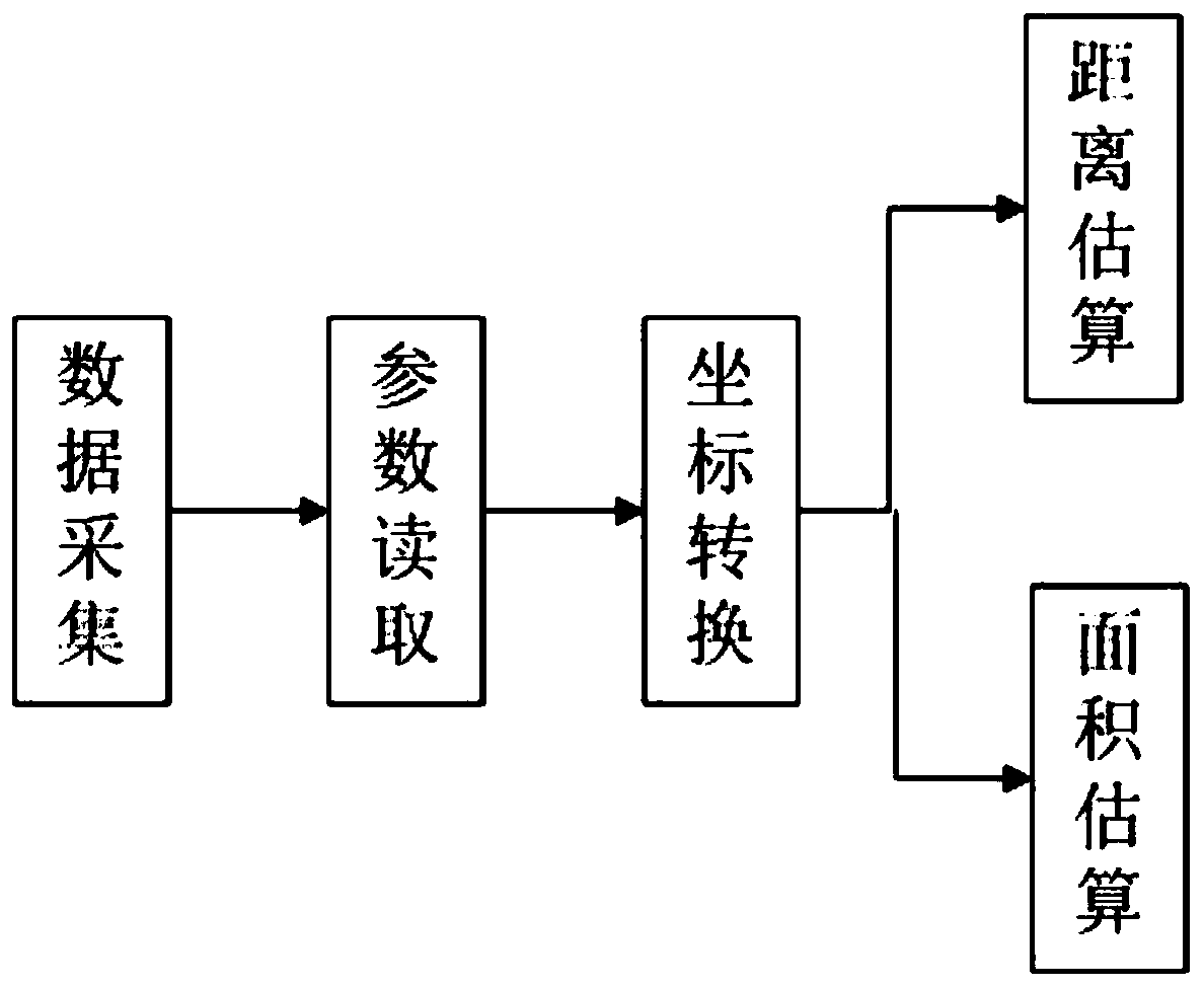
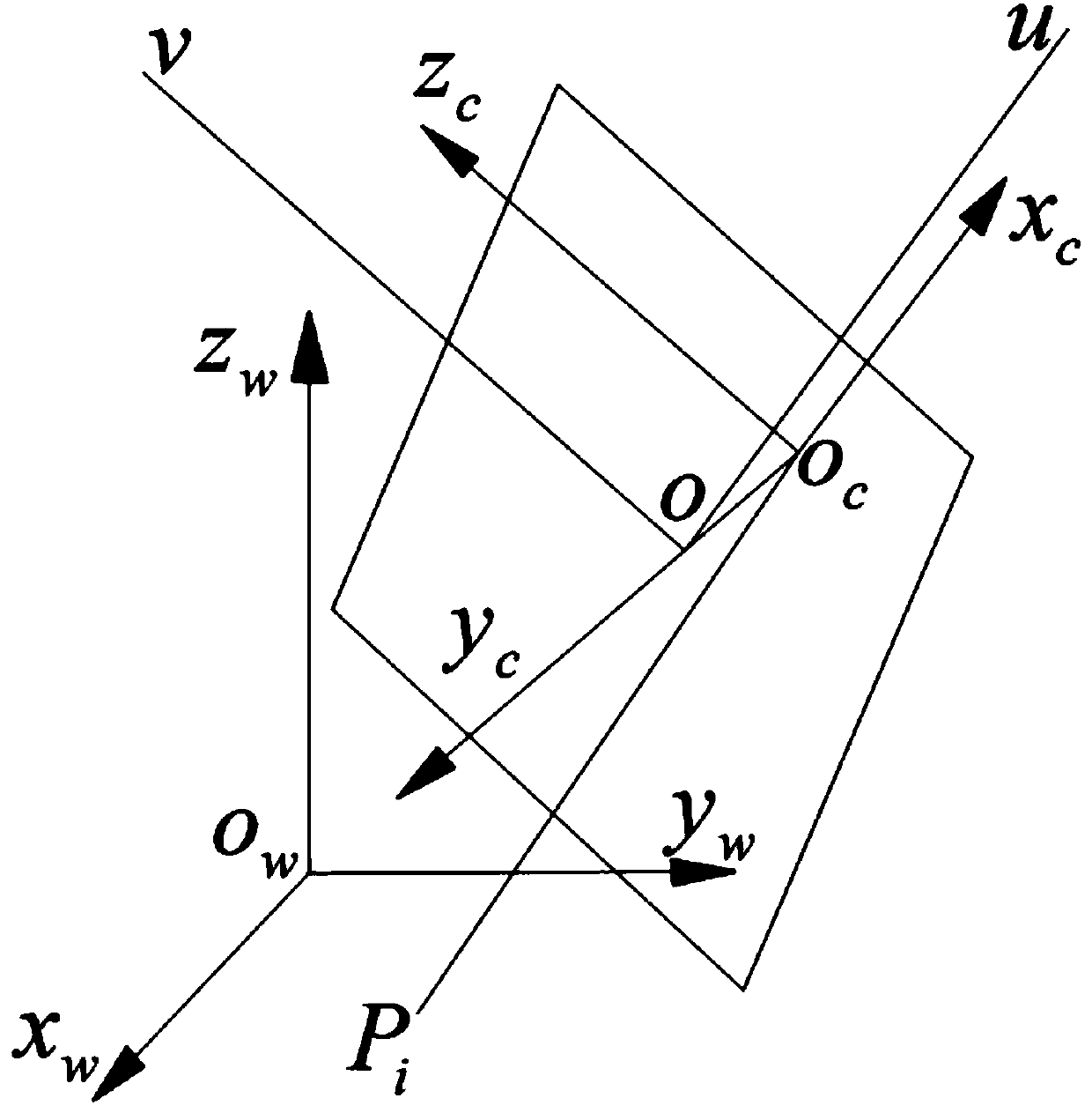
The invention discloses a real-time collapse region area measuring method based on an unmanned aerial vehicle, and relates to the field of measurement, and the method comprises the following steps: S1, enabling the unmanned aerial vehicle to carry a photoelectric pod to collect data, and storing image data and photoelectric pod parameters through a ground station; s2, reading the image data storedin the ground station, and analyzing camera internal parameters stored in the image data and external parameters during data acquisition; s3, converting an image coordinate system of the read image data into a world coordinate system; s4, according to the converted world coordinate system parameters, obtaining the related situation of the area of the collapse area to be measured. The unmanned aerial vehicle arrives at the scene at the first time when geological disasters happen, scene high-definition pictures, aircraft attitude and camera attitude information are returned in real time throughhigh-definition picture transmission, the collapse area is measured in real time, the real-time surveying and mapping of the disaster scene is achieved, the timeliness of disaster assessment is improved, and the rescue speed is improved.

Description

technical field [0001] The invention relates to the field of measurement, in particular to a real-time method for measuring the area of ​​a landslide area based on an unmanned aerial vehicle. Background technique [0002] Emergency surveying and mapping is the basic support for providing geographic information and modern surveying and mapping technology for various public emergencies. It is an important part of the national emergency response system and the guarantee and basis for command decision-making and emergency rescue. Real-time surveying and mapping information is of great significance for carrying out emergency rescue in emergencies. At present, the common method is to use drones to take orthophoto / 3D images at geological disaster sites. After the aircraft flies back to the command center, use high-performance computers to monitor the scene Orthophoto imaging / 3D reconstruction, measure the area of ​​the disaster area on the orthophoto / 3D model, but the problem is th...

Claims


Application Information

Patent Timeline
IPC IPC(8): G06T7/62G01B11/28
CPCG06T7/62G01B11/28G06T2207/10004G06T2207/30181
Inventor 刘洋冉欢欢赵瑞欣李博敬皓赵赞
Owner 成都携恩科技有限公司
Why Eureka
Try Eureka