Semi-supervised landform classification model training and geomorphologic map construction method

A classification model and training method technology, applied in neural learning methods, biological neural network models, maps/plans/charts, etc., can solve the problem of spending a lot of time collecting training samples, and achieve the effect of reducing the collection time

Active Publication Date: 2020-01-24
深圳中科保泰空天技术有限公司
View PDF2 Cites 5 Cited by
  • Summary
  • Abstract
  • Description
  • Claims
  • Application Information

AI Technical Summary

Problems solved by technology

[0004] The embodiment of the present application provides a semi-supervised landform classification model training and landform map construction method to solve the problem that it takes a lot of time to collect training samples in the existing landform construction

Method used


Image

  • Semi-supervised landform classification model training and geomorphologic map construction method
  • Semi-supervised landform classification model training and geomorphologic map construction method
  • Semi-supervised landform classification model training and geomorphologic map construction method

Examples


Embodiment Construction

[0061] In the following description, specific details such as specific system structures and technologies are presented for the purpose of illustration rather than limitation, so as to thoroughly understand the embodiments of the present application.

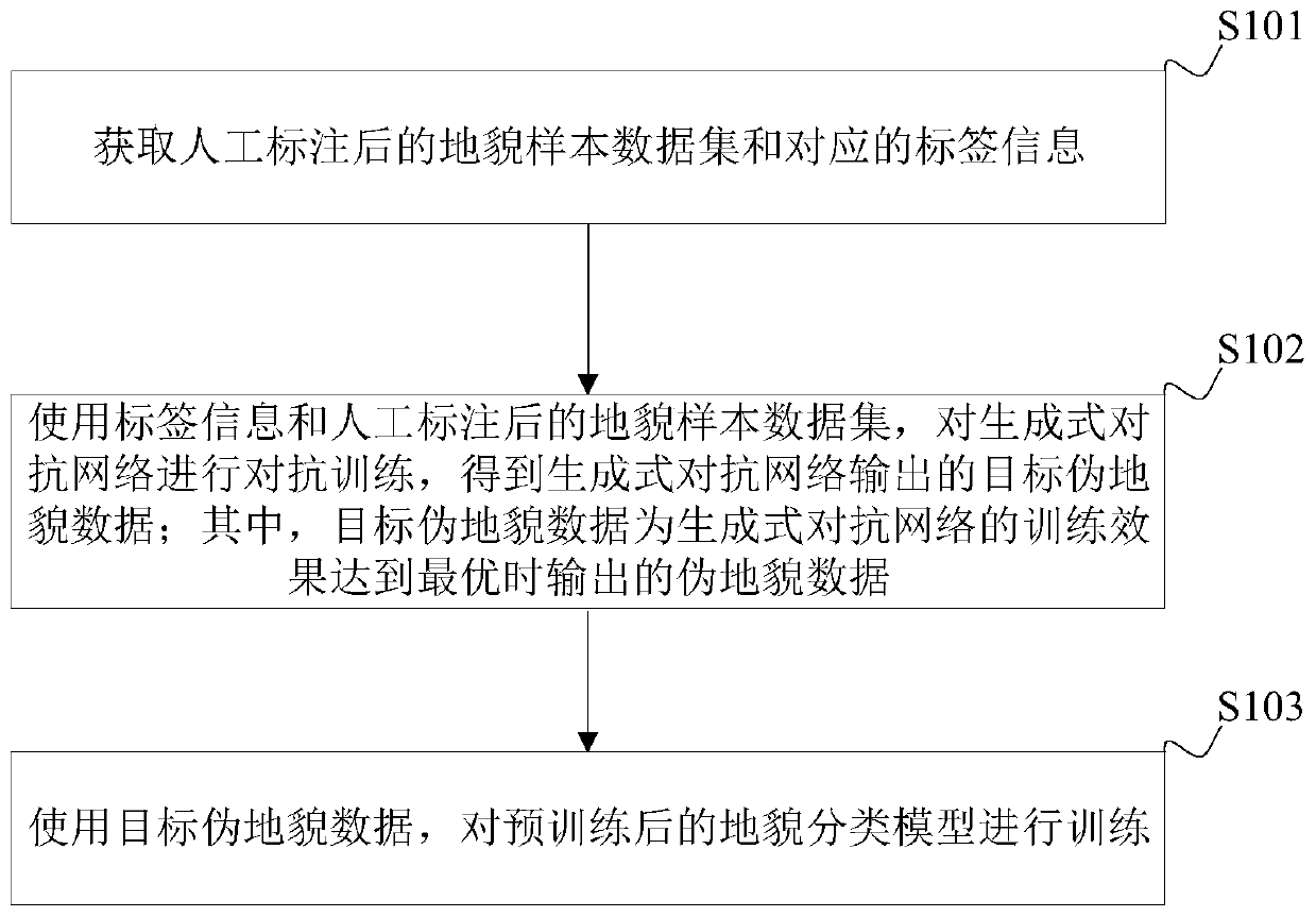
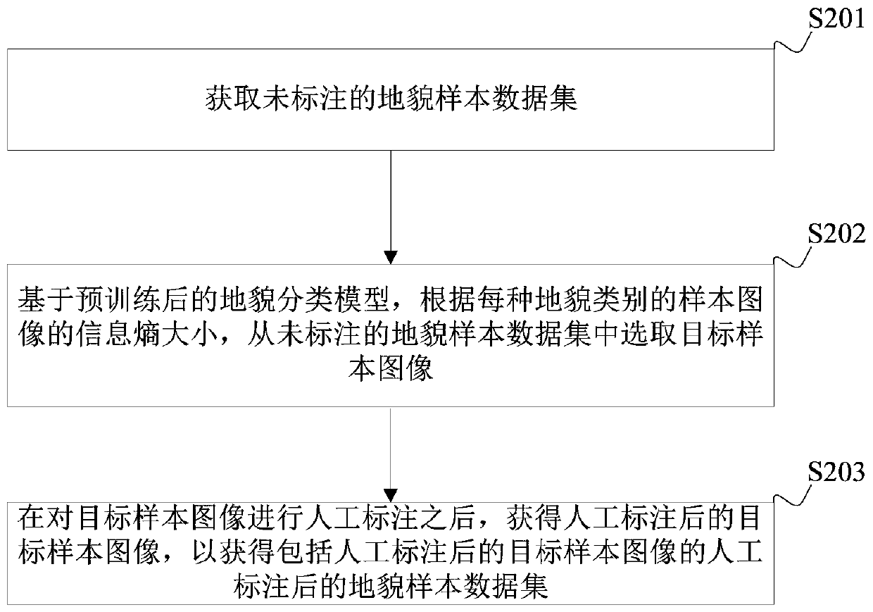
[0062] The technical solution provided by the embodiment of the present application is applied to the construction of the geomorphic map, and the construction process of the geomorphic map can be roughly divided into the training phase of the geomorphic classification model and the construction phase of the geomorphic map.

[0063] In the training phase of the landform classification model, a large number of landform sample images are generated through a generative confrontation network based on a small number of sample images manually marked. Compared with currently collecting a large number of landform sample images to train corresponding models, the embodiments of the present application can greatly reduce the sample image col...


PUM


Abstract

The embodiment of the invention is suitable for the technical field of artificial intelligence, and discloses a semi-supervised landform classification model training and geomorphologic map construction method. The semi-supervised landform classification model training and geomorphologic map construction method comprises the steps: obtaining a geomorphologic sample data set after manual labeling and corresponding label information; performing adversarial training on the generative adversarial network by using the label information and the manually labeled geomorphic sample data set to obtain target pseudo-geomorphic data output by the generative adversarial network, wherein the target pseudo-geomorphic data is pseudo-geomorphic data output when the training effect of the generative adversarial network is optimal; training the pre-trained landform classification model by using the target pseudo-geomorphologic data; and after the training is completed, using a landform classification model to construct a geomorphologic map. According to the embodiment of the invention, based on the generative adversarial network, a large amount of training data is generated by using a small amount ofmanually labeled data, so that the acquisition time of geomorphologic sample images is reduced.

Description

technical field [0001] The application belongs to the technical field of artificial intelligence, and in particular relates to a semi-supervised landform classification model training method and a landform map construction method. Background technique [0002] A geomorphic map is a map showing various geomorphic signs. It can reflect the external morphological characteristics and causes, age, development process, development degree and mutual relationship of various landforms. [0003] At present, when using a convolutional neural network model to construct a geomorphic map, it is necessary to use a large number of manually labeled geomorphic sample images to train the corresponding model, and it takes a lot of time to manually label a large number of geomorphic sample images. Contents of the invention [0004] The embodiment of the present application provides a semi-supervised method for training the landform classification model and constructing the landform map, so as...

Claims


Application Information

Patent Timeline
Patent Type & Authority Applications(China)
IPC IPC(8): G06K9/62G06N3/08G09B29/00
CPCG06N3/08G09B29/005G06F18/214
Inventor 李坚强陈杰陈壮壮曾崛
Owner 深圳中科保泰空天技术有限公司
Why Eureka
Try Eureka