Method for constructing high-precision three-dimensional point cloud map

A 3D point cloud and map construction technology, which is applied in the direction of radio wave reflection/reradiation, electromagnetic wave reradiation, satellite radio beacon positioning system, etc., can solve the problems of loss of available road surface point cloud information, leakage of key geographic information, etc. , to achieve the effect of reducing risk, shortening time and reducing labor cost

Active Publication Date: 2020-02-28
AUTOCORE INTELLIGENT TECH NANJING CO LTD
View PDF5 Cites 24 Cited by
  • Summary
  • Abstract
  • Description
  • Claims
  • Application Information

AI Technical Summary

Problems solved by technology

At the same time, it will leave the sequelae of "holes" in the road surface point cloud, and lose a certain amount of usable road surface point cloud information
From the perspective of national security, providing high-precision road surveying and mapping information to map suppliers as a reference for eliminating vehicle smear points in high-precision point cloud maps also has the risk of leaking key geographic information

Method used


Image

  • Method for constructing high-precision three-dimensional point cloud map
  • Method for constructing high-precision three-dimensional point cloud map
  • Method for constructing high-precision three-dimensional point cloud map

Examples


Embodiment Construction

[0045] The technical solutions in the embodiments of the present invention will be clearly and completely described below in conjunction with the accompanying drawings in the examples of the present invention. Obviously, the described embodiments are only some of the embodiments of the present invention, not all of them. Based on the embodiments of the present invention, all other embodiments obtained by persons of ordinary skill in the art without making creative efforts belong to the protection scope of the present invention.

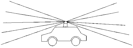
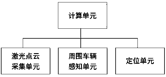
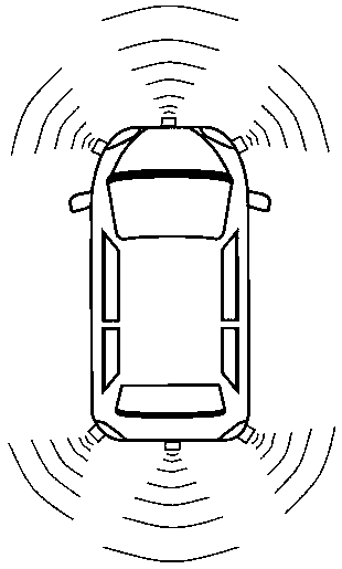
[0046] Such as figure 1 As shown, a high-precision three-dimensional point cloud map construction system is disclosed in this embodiment, which mainly includes a laser point cloud acquisition unit, a surrounding vehicle perception unit, a positioning unit and a calculation unit, wherein the laser point cloud acquisition unit, the surrounding vehicle perception unit and The positioning unit sends the collected data to the calculation unit for calculati...


PUM


Abstract

The invention discloses a method for constructing a high-precision three-dimensional point cloud map. The method includes determining a current position and a driving direction of a surveying and mapping vehicle in a high-precision vector map; according to the current position and orientation in the high-precision vector map, rotating and translating current point cloud frames scanned by a laser radar into a coordinate system of the high-precision vector map; according to a current available road region extracted from the high-precision vector map, planning a corresponding available road region in current point cloud data frames and millimeter wave radar data frames; according to speed and positon information of surrounding vehicles collected by a millimeter wave radar, deleting point clouds, which are determined as shielded, in the available road region in the current frames; and screening, splicing and optimizing key frames to acquire the high-precision point cloud map. The method has the advantages that the time for drawing the high-precision three-dimensional point cloud map is shortened, and the manual cost is reduced; the risk of leaking key geographic information is reduced;ground point cloud cavities caused by manual deletion of the point clouds of the vehicles are avoided.

Description

technical field [0001] The invention belongs to the field of automatic driving and relates to the construction of map data, in particular to a method for constructing a high-precision three-dimensional point cloud map. Background technique [0002] In the field of autonomous driving, the vehicle needs to obtain its own position and attitude at all times, and make decisions on the next behavior (acceleration, deceleration, steering) based on this. The current vehicle obtains the current position mainly through two methods. [0003] The first is to use the navigation satellite signal to calculate the current latitude and longitude of the vehicle through the three-point positioning method, and then match the current position in the two-dimensional map containing the latitude and longitude information. At the same time, calculate the body posture according to the adjacent position information. This method appeared early, and after years of improvement, the positioning accuracy ...

Claims


Application Information

Patent Timeline
IPC IPC(8): G01S17/89G01S17/02G01S17/87G01S13/89G01S13/86G01S19/43G01S19/45
CPCG01S13/86G01S13/865G01S13/89G01S17/87G01S17/89G01S19/43G01S19/45
Inventor 刘心刚李赵张旸陈诚刘洁
Owner AUTOCORE INTELLIGENT TECH NANJING CO LTD
Why Eureka
Try Eureka