

Generation and auxiliary positioning method for live-action semantic map of smart scenic spot
A semantic map and assisted positioning technology, applied in geographic information databases, special data processing applications, structured data retrieval, etc., can solve the problem of lack of feature description, identification, and inability to meet the needs of smart scenic spots. , to make up for the lack of semantic information in the real scene
- Summary
- Abstract
- Description
- Claims
- Application Information
AI Technical Summary
Problems solved by technology
Method used
Image

Examples
Embodiment Construction
[0038] In order to illustrate the technical solution of the present invention more clearly, the present invention will be described in detail below in conjunction with specific examples. The following examples will help those skilled in the art to better understand the present invention. It should be noted that other examples developed by other skilled persons on the basis of not departing from the present invention and examples all belong to the protection scope of the present invention.
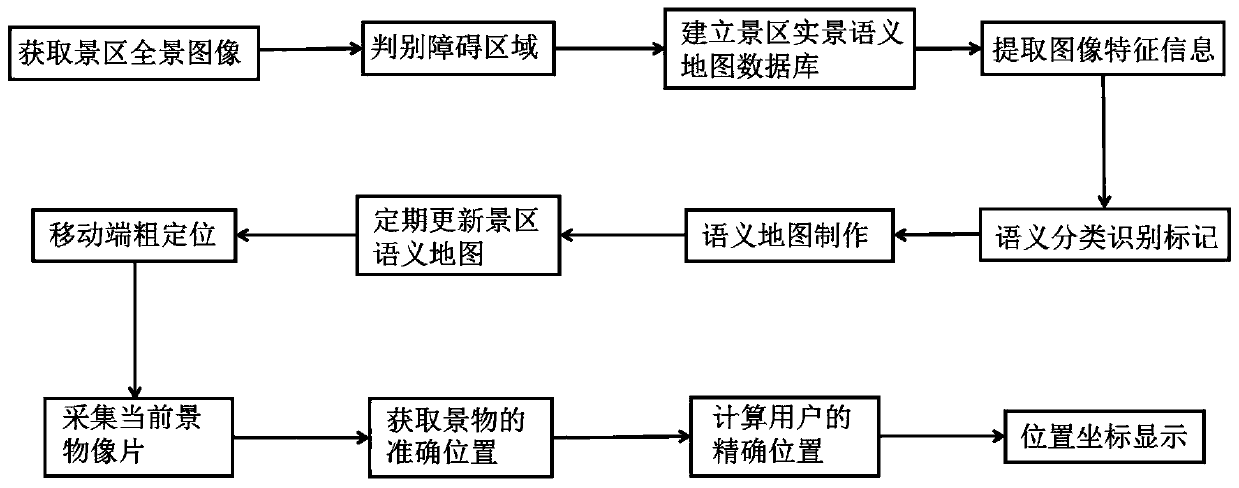
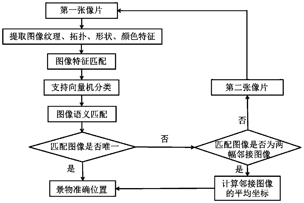
[0039] figure 1 Shown is a technical flowchart of a method for generating and assisting positioning of a real-scene semantic map of a scenic spot, including:
[0040] (1) Collect panoramic images of the scenic spot: Divide the scenic spot into multiple guide areas, and use the iSTAR 360° panoramic camera to collect high-resolution panoramic images. The panoramic camera lens collects 360° panoramic images of anchor points and stores them. Collect the panoramic image information of all the ...
PUM
 Abstract
Description
Claims
Application Information