
Autonomous course and attitude determination method based on polarization-astronomical included angle information observation

A determination method and polarization technology, applied in astronomical navigation and other directions, can solve the problems of accuracy limitation and reduced accuracy of integrated navigation system, and achieve the effect of improving concealment

Active Publication Date: 2020-03-17
BEIHANG UNIV
View PDF5 Cites 6 Cited by
  • Summary
  • Abstract
  • Description
  • Claims
  • Application Information

AI Technical Summary

Problems solved by technology

Celestial navigation is a navigation method that uses starlight information as measurement information. As the instrument with the highest attitude measurement accuracy, star sensors have always been favored by various units, but their accuracy is limited by inertial navigation systems.
[0004] The existing integrated navigation methods mostly use satellite navigation systems, such as the papers "INS / GNSS / CNS Integrated Navigation System Based on Vector Information Distribution" and "INS / CNS / GPS Integrated Navigation System Simulation Research". System constraints, in an environment with electronic interference, will easily lead to a sharp decrease in the accuracy of the integrated navigation system

Method used


Image

  • Autonomous course and attitude determination method based on polarization-astronomical included angle information observation
  • Autonomous course and attitude determination method based on polarization-astronomical included angle information observation
  • Autonomous course and attitude determination method based on polarization-astronomical included angle information observation

Examples


Embodiment Construction

[0030] The technical solutions in the embodiments of the present invention will be clearly and completely described below in conjunction with the accompanying drawings in the embodiments of the present invention. Obviously, the described embodiments are only part of the embodiments of the present invention, not all of them. Based on the embodiments of the present invention, all other embodiments obtained by persons of ordinary skill in the art without making creative efforts belong to the protection scope of the present invention.

[0031] The method of the invention can be used for fully autonomous navigation of the ground robot under the environment of GPS interference at night, and improves the survivability of the carrier.

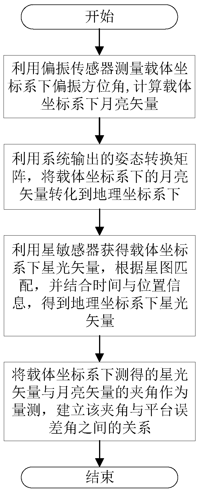
[0032] Such as figure 1 Shown, the concrete realization steps of the present invention are as follows:

[0033] Step 1. The polarization measurement unit is composed of two polarization sensors in different directions. The transformation matrix betwee...


PUM


Abstract

The invention relates to an autonomous course and attitude determination method based on polarization-astronomical included angle information observation. The method comprises the following steps: firstly, measuring a polarization vector pb under the current attitude by utilizing a polarization sensor mounted in a carrier coordinate system b system; calculating to obtain a moon vector Lb under thecarrier coordinate system b system according to polarization vectors measured by the polarization sensors in different directions, and converting the Lb into a navigation coordinate system n system by utilizing an attitude conversion matrix outputted by the system to obtain a moon vector Ln under a geographic coordinate system n system measured by the system; measuring a starlight vector Ab underthe carrier coordinate system by using a star sensor installed on the carrier coordinate system b system, obtaining a starlight vector under an inertial coordinate system i system by combining with an astronomical calendar according to star map matching, and obtaining the starlight vector An under the n system by combining with time and position information; taking an included angle alpha betweenthe starlight vector Ab and the moon vector Lb under the carrier coordinate system b system as measurement and establishing a relationship between the included angle alpha and a platform error anglephi to obtain an attitude measurement equation.

Description

technical field [0001] The invention relates to an autonomous heading and attitude determination method based on polarization-astronomical angle information observation, which can be used for fully autonomous navigation of a ground robot in a GPS interference environment at night, and improves the survivability of a carrier. Background technique [0002] The navigation system is used to guide the carrier to the destination and plays a decisive role in the completion of the task. The existing navigation methods include inertial, visual, astronomical, GPS, geomagnetic, etc., which are mostly applied in a combined way, making full use of the advantages of different navigation systems. At night, the ambient light is dark, and navigation methods based on visible light bands such as optical flow cannot be used. At the same time, due to its own concealment and anti-interference performance, GPS is vulnerable to interference and detection. For complex navigation environments, a sin...

Claims


Application Information

Patent Timeline
IPC IPC(8): G01C21/02
CPCG01C21/02
Inventor 郭雷杨悦婷杨健张青云
Owner BEIHANG UNIV
Learn More