Two-dimensional survey line seismic data closure error correction method and processing terminal

A technology of seismic data and correction method, applied in seismic signal processing and other directions, can solve problems such as low closure correction efficiency and two-dimensional survey line seismic data closure, and achieve the effect of eliminating efficiency, accuracy and low cost

Active Publication Date: 2020-03-17
GUANGZHOU MARINE GEOLOGICAL SURVEY
View PDF7 Cites 1 Cited by
  • Summary
  • Abstract
  • Description
  • Claims
  • Application Information

AI Technical Summary

Problems solved by technology

[0005] In view of the deficiencies in the prior art, one of the purposes of the present invention is to provide a method for correcting the closure error of two-dimensional survey line seismic data, which can solve the problem of low efficiency of closure error correction;
[0006] The second object of the present invention is to provide a processing terminal, which can solve the problem of low efficiency of misclosure correction;

Method used


Image

  • Two-dimensional survey line seismic data closure error correction method and processing terminal
  • Two-dimensional survey line seismic data closure error correction method and processing terminal
  • Two-dimensional survey line seismic data closure error correction method and processing terminal

Examples


Embodiment Construction

[0027] Below, the present invention will be further described in conjunction with the accompanying drawings and specific embodiments.

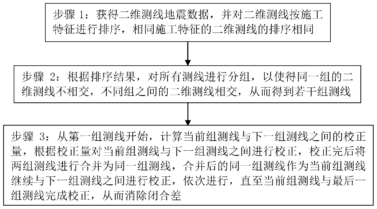
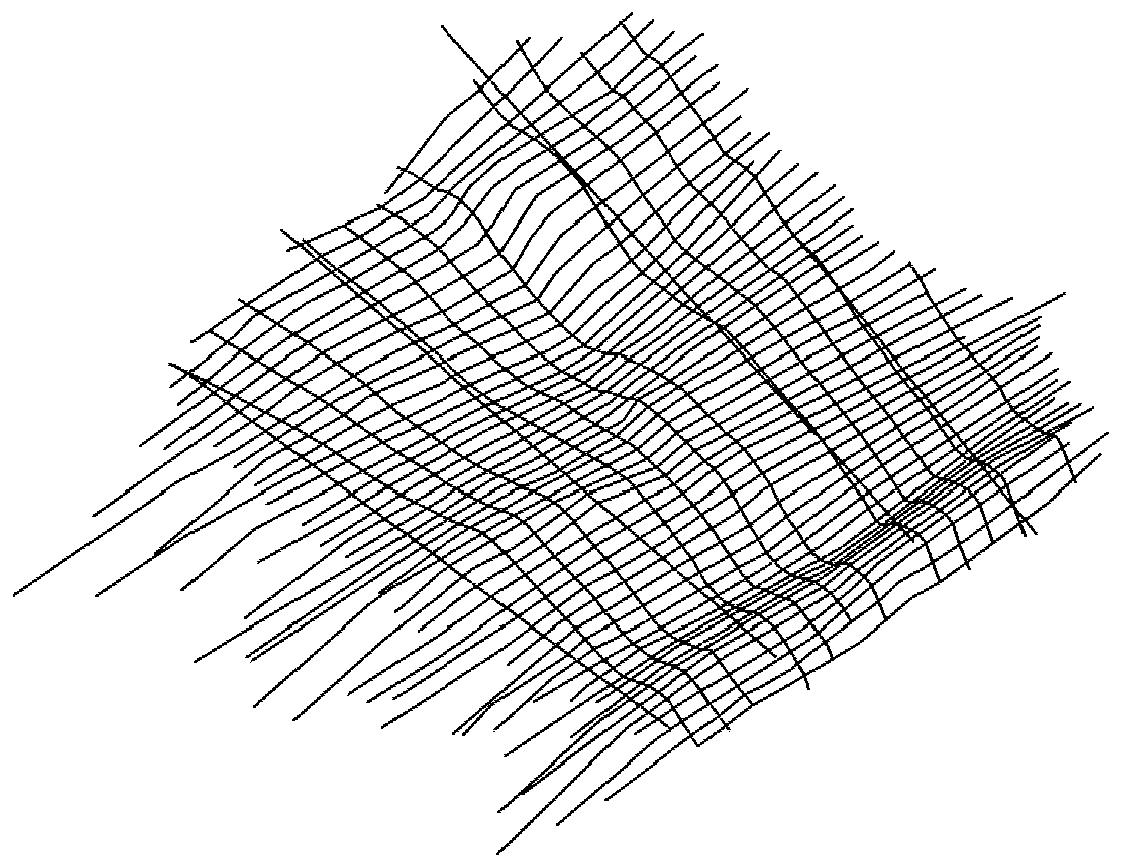
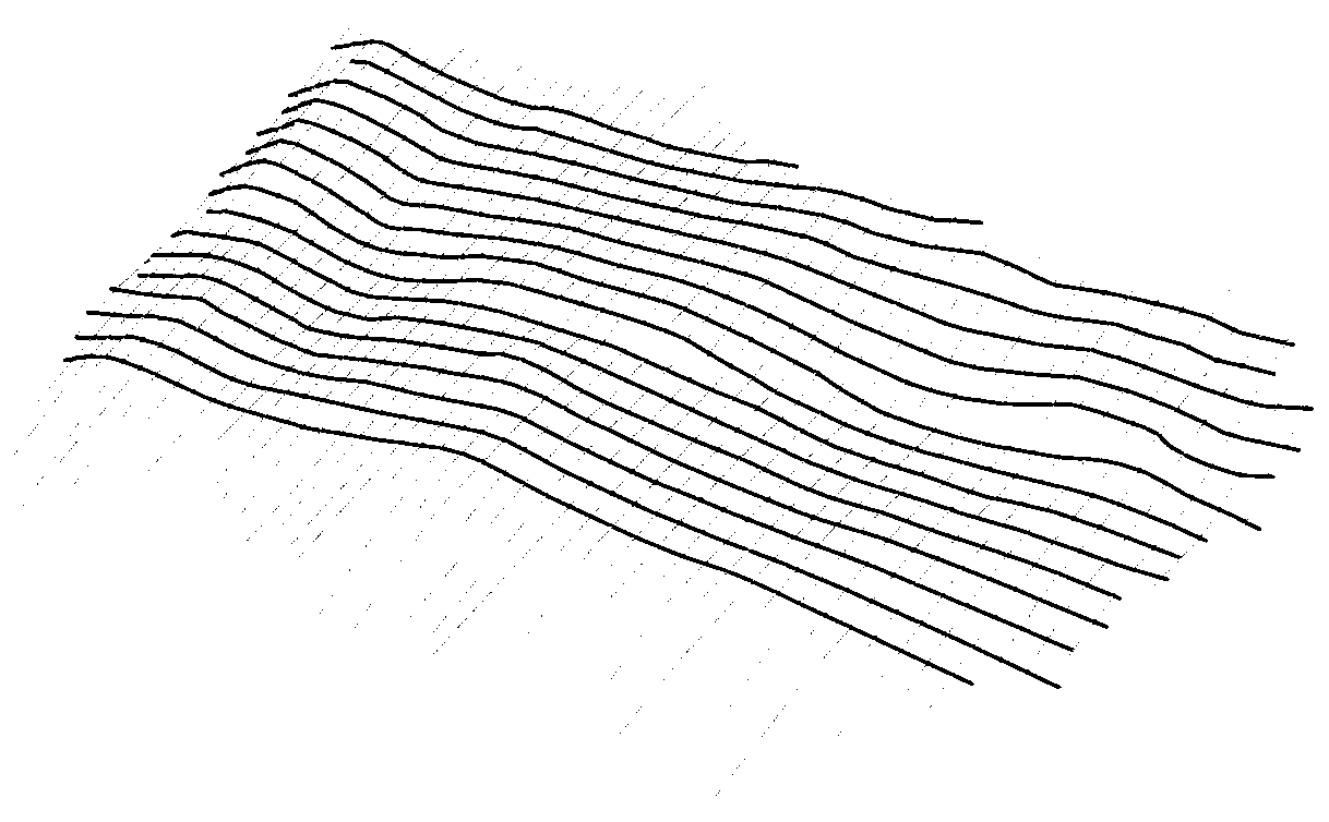
[0028] Such as Figure 1 to Figure 6 As shown, a correction method for two-dimensional survey line seismic data closure error includes the following steps:

[0029] Step 1: Obtain the seismic data of the 2D survey line, and sort the 2D survey lines according to the construction characteristics. The 2D survey lines with the same construction characteristics are sorted the same. The construction features refer to the construction characteristics during the construction of the 2D survey lines , including construction time, surveying line angle during construction, construction batch, etc. For example, a batch of two-dimensional survey line seismic data includes ten two-dimensional survey lines, which are respectively recorded as survey lines g0-g9, where survey lines g0, g2, g6, g7, and g8 are survey lines of the same batch, and the construction...


PUM


Abstract

The invention relates to a two-dimensional survey line seismic data closure error correction method and a processing terminal. The two-dimensional survey line seismic data closure error correction method comprises the steps of: step 1, acquiring two-dimensional survey line seismic data, sorting two-dimensional survey lines according to construction features, and enabling the two-dimensional surveylines with the same construction features to be the same in sorting; step 2, grouping all the survey lines according to a sorting result, so that the two-dimensional survey lines in the same group are not intersected, the two-dimensional survey lines in different groups are intersected, and a plurality of groups of survey lines are obtained; and step 3, calculating a correcting value between thecurrent group of survey lines and the next group of survey lines, performing correction between the current group of survey lines and the next group of survey lines according to the correcting value,combining the two groups of survey lines into the same group of survey lines after correction is completed, taking the combined group of survey lines as the current group of survey lines, continuing to perform correction between the current group of survey lines and the next group of survey lines, and sequentially performing correction to complete correction. The two-dimensional survey line seismic data closure error correction method is high in efficiency and precision of eliminating the closure error, can achieve the low-cost automatic correction, and is especially suitable for the closure error correction of mass seismic data.

Description

technical field [0001] The invention relates to the technical field of seismic data closure error correction, in particular to a correction method and a processing terminal for two-dimensional survey line seismic data closure error. Background technique [0002] In seismic interpretation work, it is necessary to draw horizon lines and faults on the seismic section measured by the survey line, that is, it is necessary to draw lines on each seismic section, and the result of the line drawing includes xyz data in the triaxial direction, The xy data is the position information of the plane where the survey line is located, and the z data is the longitudinal value on the corresponding plane (time value in the time domain or depth value in the depth domain). After the interpretation data of the same horizon in different seismic sections are gridded, a variety of industrial maps with production guidance can be produced, such as structural maps and reservoir distribution maps. [0...

Claims


Application Information

Patent Timeline
Patent Type & Authority Applications(China)
IPC IPC(8): G01V1/36
CPCG01V1/36
Inventor 李刚张宝金罗伟东赵斌唐江浪祝嵩张耀明韩艳飞
Owner GUANGZHOU MARINE GEOLOGICAL SURVEY
Why Eureka
Try Eureka