

Remote sensing image semantic segmentation method based on multi-modal attention and adaptive fusion
A semantic segmentation and remote sensing image technology, applied in the field of remote sensing image processing, can solve the problems of insufficient data collection and noise influence in the collection process of remote sensing image datasets
- Summary
- Abstract
- Description
- Claims
- Application Information
AI Technical Summary
Problems solved by technology
Method used
Image



Examples
Embodiment Construction
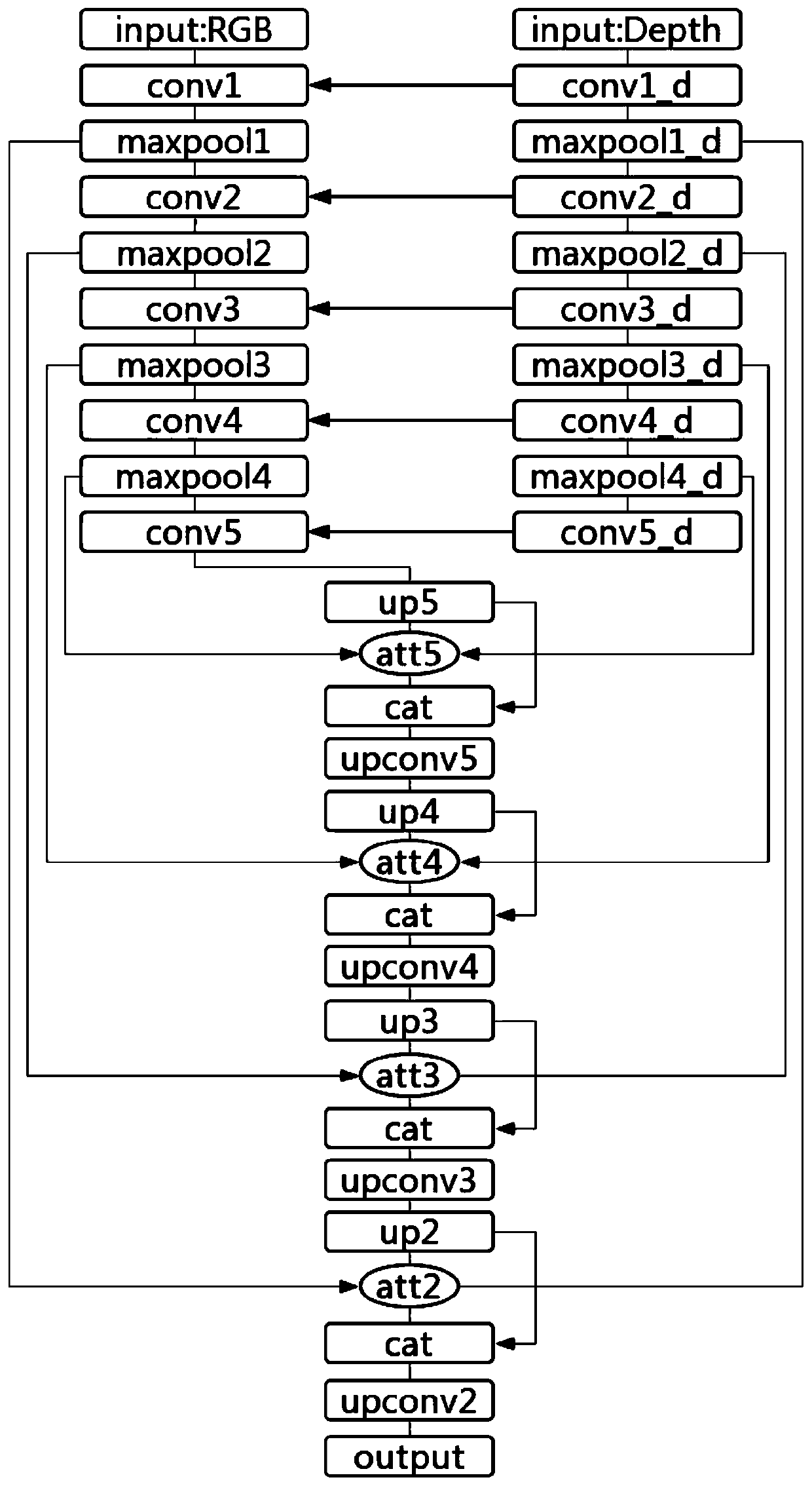
[0089] The technical solution of the present invention will be further described below in conjunction with the accompanying drawings.
[0090] refer to figure 1 , the concrete steps of the present invention are as follows:
[0091] Step 1. Build a dual-stream semantic segmentation network
[0092] (11) Constructing a feature extractor for a two-stream semantic segmentation network
[0093] (111) Delete the fully connected layer in the convolutional neural network structure to form an encoder that converts the input tensor into a small-scale tensor through convolution. Use this encoder to encode the input RGB image, and the RGB image The encoder that encodes is called the RGB map channel;
[0094] (112) Duplicate an encoder identical to that in step (111), and use this encoder to encode the depth map. The encoder that encodes the depth map is called a depth map channel.
[0095] (12) Introduce multi-layer adaptive feature fusion
[0096] (121) Calculate the feature D of the ...
PUM
 Abstract
Description
Claims
Application Information