Ship intelligent navigation digital sand table system based on electronic chart

An electronic chart and sand table technology, applied in the field of digital imaging, can solve problems such as the lack of a digital sand table system, and achieve the effect of vivid models and sharing.

Pending Publication Date: 2020-06-16
智慧航海(青岛)科技有限公司
View PDF8 Cites 4 Cited by
  • Summary
  • Abstract
  • Description
  • Claims
  • Application Information

AI Technical Summary

Problems solved by technology

[0005] In order to solve the problem that the existing technology lacks a digital sand table system capable of visually recognizing and displaying the ship navigation environment in a designated sea area in three-dimensional space, the present invention proposes a digital sand table system for intelligent navigation of ships based on electronic charts

Method used


Image

  • Ship intelligent navigation digital sand table system based on electronic chart
  • Ship intelligent navigation digital sand table system based on electronic chart

Examples


Embodiment Construction

[0031] In order to better explain the present invention and facilitate understanding, the present invention will be described in detail below through specific embodiments in conjunction with the accompanying drawings.

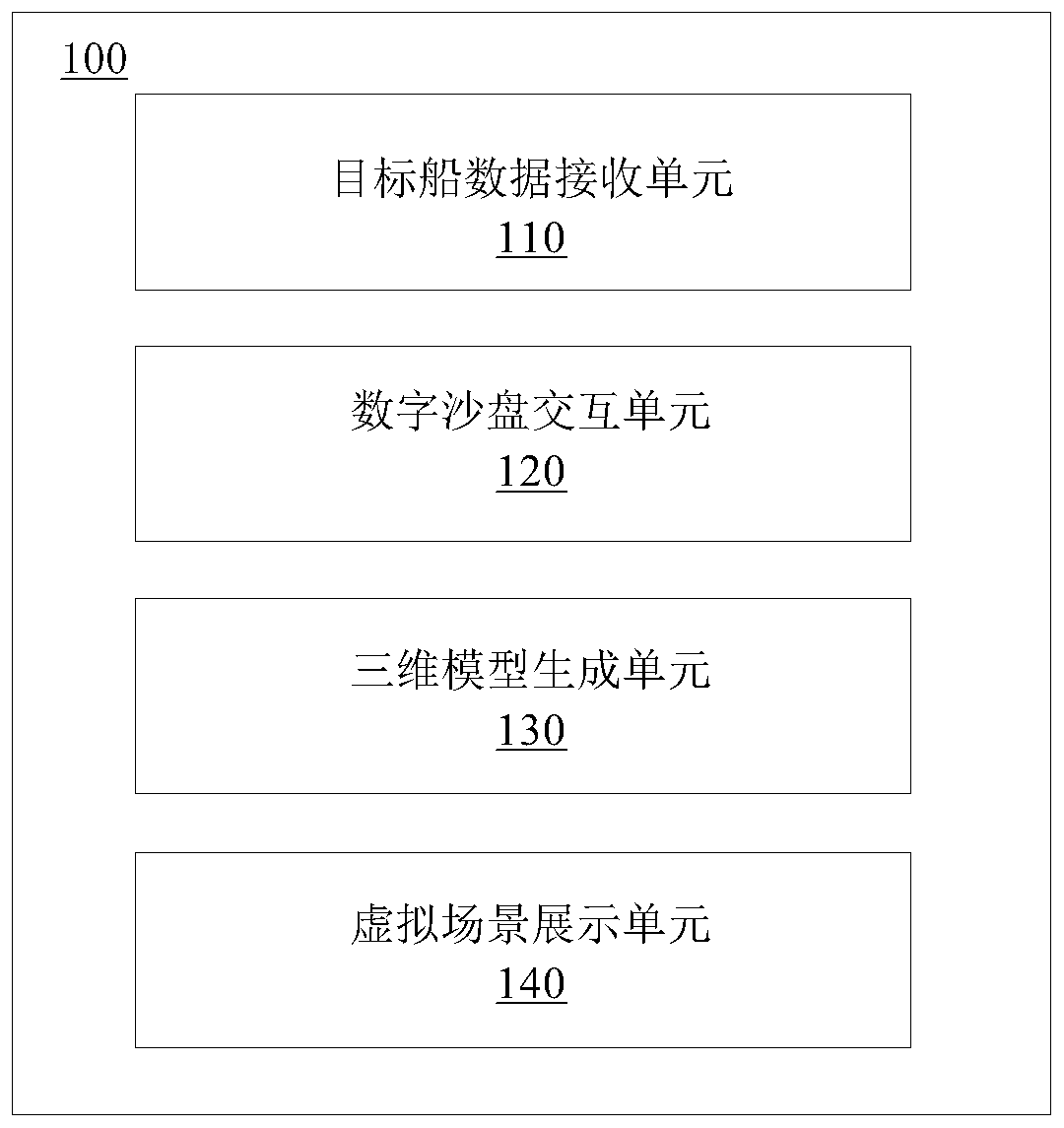
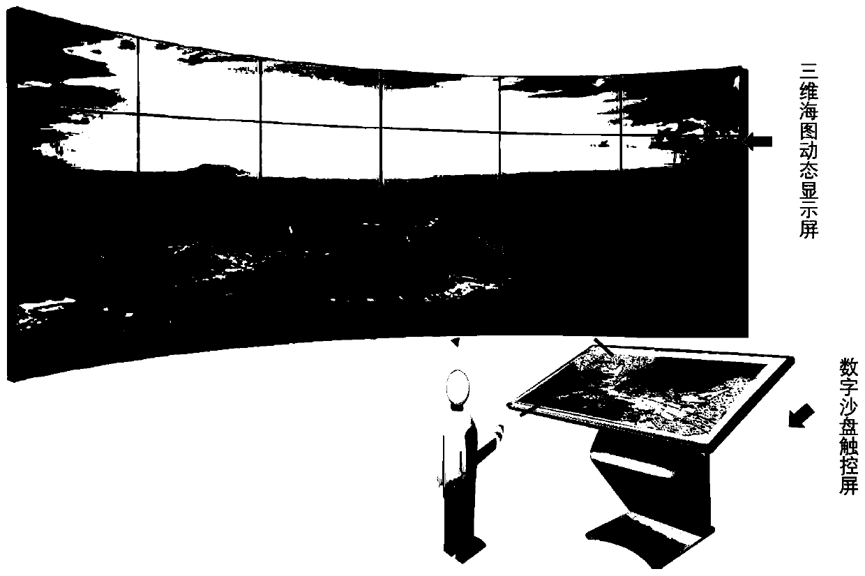
[0032] In order to realize the visual display of the ship navigation environment in the designated sea area in three-dimensional space, the present invention proposes a digital sand table system 100 for ship intelligent navigation based on electronic charts, such as figure 1 As shown, the system includes: a target ship data receiving unit 110 , a digital sand table interaction unit 120 , a three-dimensional model generating unit 130 , and a virtual scene display unit 140 .

[0033] The target ship data receiving unit 110 is used to receive the target ship information data in the preset sea area collected and sent by the radar system and the ship automatic identification system, and send the target ship information data to the digital sand table interaction unit ...


PUM


Abstract

The invention belongs to the technical field of digital imaging, particularly relates to a ship intelligent navigation digital sand table system based on an electronic chart, and aims to solve the problem that a ship navigation environment of a specified sea area cannot be visually displayed in a three-dimensional space in the prior art. According to the invention, the digital sand table interaction interface and the three-dimensional digital sand table model are generated according to the electronic chart data and the target ship information data; instruction information sent by a user is received based on the digital sand table interaction interface, the digital sand table model is dynamically adjusted in real time according to the instruction information, and the three-dimensional digital sand table model is dynamically displayed through the virtual scene display unit. Visual cognition display is performed on the ship navigation environment of the designated sea area in the three-dimensional space so that the system has the characteristics of digitization and intellectualization; the digital sand table model is dynamically adjusted according to the instruction information data,the ship operation state is visually displayed from all directions, and interestingness and interactivity are improved.

Description

technical field [0001] The invention belongs to the technical field of digital imaging, and in particular relates to a digital sand table system for intelligent navigation of ships based on electronic charts. Background technique [0002] The sand table is a model made of sand, war chess and other materials according to the topographic map, aerial photo or field terrain, according to a certain proportion. The sand table uses models to perform static performances of architecture and other themes, and the display effect is not interesting, and it also lacks interactivity for visitors. The digital sand table is realized through sound, light, electricity, image, three-dimensional animation and computer program control technology, using digital projection. The digital sand table can fully reflect the characteristics of the location and achieve a vivid and varied dynamic visual effect. It is a brand-new experience for visitors and can generate strong resonance, which is more intu...

Claims


Application Information

Patent Timeline
Patent Type & Authority Applications(China)
IPC IPC(8): G06T17/05G06F16/29
CPCG06T17/05G06F16/29
Inventor 王晓原夏媛媛姜雨函董晓斐李嗣邦伯佳更
Owner 智慧航海(青岛)科技有限公司
Why Eureka
Try Eureka