
Surveying instrument positioning equipment for engineering surveying and mapping

A technology for positioning equipment and surveying instruments, which is applied in the direction of surveying instruments, surveying and navigation, instruments, etc. It can solve the problems of a lot of mud sticking to the support rods, which is inconvenient for the operator to carry, and achieve better and thorough cleaning effects.

Active Publication Date: 2020-06-26
深圳市国测测绘技术有限公司
View PDF10 Cites 5 Cited by
  • Summary
  • Abstract
  • Description
  • Claims
  • Application Information

AI Technical Summary

Problems solved by technology

[0004] The above-mentioned existing technical solutions have the following defects: when the above-mentioned engineering surveying and mapping device is in use, the supporting rod is inserted below the ground to realize the supporting function, but after the surveying and mapping is completed, there will be a lot of soil stuck to the bottom of the supporting rod, which is not easy to operate who carry

Method used


Image

  • Surveying instrument positioning equipment for engineering surveying and mapping
  • Surveying instrument positioning equipment for engineering surveying and mapping
  • Surveying instrument positioning equipment for engineering surveying and mapping

Examples


Embodiment Construction

[0031] The present invention will be described in further detail below in conjunction with the accompanying drawings.

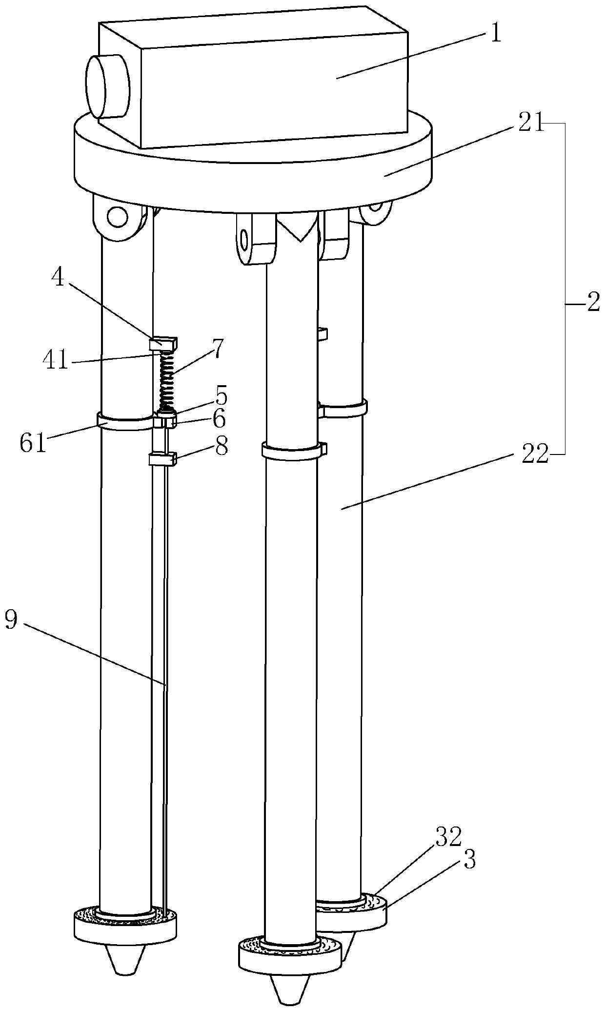
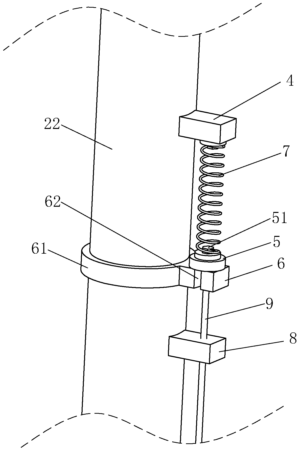
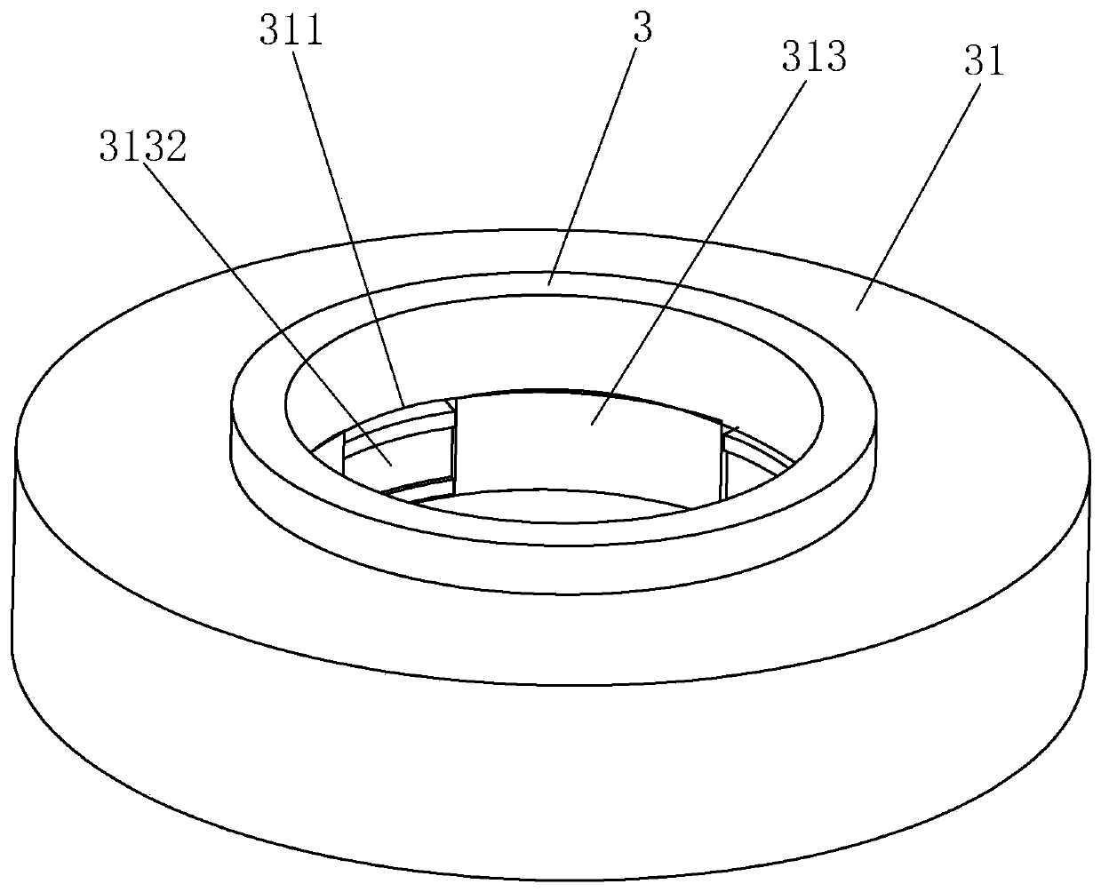
[0032] A surveying instrument positioning device for engineering surveying and mapping, such as figure 1 As shown, a tripod 2 is included. The tripod 2 includes a support platform 21 and three support rods 22 hingedly arranged around the support platform 21 . The surveying instrument body 1 is installed above the support platform 21 . The bottom end of the support rod 22 is provided with a sharp insertion end, and the bottom position of the support rod 22 near the insertion end is covered with a cleaning sleeve 3 for cleaning the insertion end. After the surveying and mapping is finished, when the insertion end is pulled out from the soil, the soil contaminated by the circumferential surface of the insertion end can be cleaned by using the cleaning sleeve 3, so as to ensure that the insertion end will not be contaminated with more soil after being pulled out,...


PUM


Abstract

The invention relates to surveying instrument positioning equipment for engineering surveying and mapping and belongs to the technical field of engineering surveying instruments. The equipment comprises a tripod and a surveying instrument body mounted at the top end of the tripod, the tripod comprises a supporting table and three supporting rods hinged to the edge of the supporting table. A sharpinserting end is integrally arranged at the bottom of the supporting rod; the bottom of the supporting rod is sleeved with a cleaning sleeve. A stepping part is fixedly arranged at the bottom of the cleaning sleeve; an inhaul cable parallel to the supporting rod is fixedly arranged on the foot stepping part; a mounting block is fixedly arranged at the position, right opposite to the foot treadingpart, of the top end of the supporting rod, a reset spring is fixedly arranged between the top end of the inhaul cable and the mounting block, and when the reset spring is in a natural state, the circumferential face, located above the inserting end, of the supporting rod is sleeved with the cleaning sleeve, and the effect of improving carrying convenience is achieved.

Description

technical field [0001] The invention relates to the technical field of engineering surveying and mapping instruments, in particular to a surveying and mapping instrument positioning device for engineering surveying and mapping. Background technique [0002] Surveying and mapping instruments are instruments and devices designed and manufactured for data acquisition, processing, and output for surveying and mapping operations. They are used for various orientation, distance measurement, angle measurement, and measurement in the planning, design, construction, and operation management stages of engineering construction. Instruments for height, mapping and photogrammetry. [0003] The existing Chinese patent application whose publication number is CN109489644A can be referred to, which discloses a portable engineering surveying and mapping device, including a support plate, a support rod A, a connecting rod, a support column and a fixing plate, and the lower surface of the suppo...

Claims


Application Information

Patent Timeline
IPC IPC(8): G01C15/00
CPCG01C15/00
Inventor 林创鸿袁秋桂罗承广
Owner 深圳市国测测绘技术有限公司
Learn More