Territorial space planning evaluation system
A technology of spatial planning and evaluation system, applied in the field of land space planning and deep learning, can solve problems such as poor reusability, and achieve the effect of improving reusability and solving poor reusability
- Summary
- Abstract
- Description
- Claims
- Application Information
AI Technical Summary
Problems solved by technology
Method used
Image
Examples
Embodiment 1
[0027] According to an embodiment of the present invention, an embodiment of a land space planning evaluation system is provided.
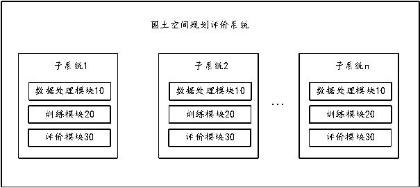
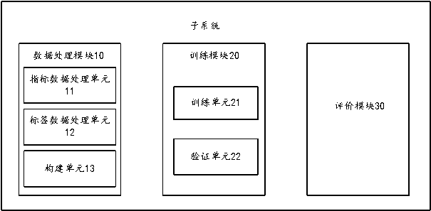
[0028] figure 1 is a schematic diagram of a national land space planning evaluation system according to an embodiment of the present invention, such as figure 1 As shown, the system includes a plurality of subsystems, wherein each of the subsystems includes: a data processing module 10, a training module 20 and an evaluation module 30;
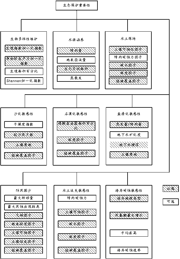
[0029] It should be noted that the multiple subsystems include: ecological protection importance evaluation subsystem, agricultural production suitability evaluation subsystem, urban construction suitability evaluation subsystem, agricultural production carrying scale evaluation subsystem, and urban construction carrying scale evaluation subsystem.
[0030] The ecological protection importance evaluation subsystem is used to evaluate the ecological protection importance of the area to be evaluated, and generate a...
PUM
 Abstract
Description
Claims
Application Information
 - R&D
- Intellectual Property
- Life Sciences
- Materials
- Tech Scout
- Unparalleled Data Quality
- Higher Quality Content
- 60% Fewer Hallucinations
Browse by: Latest US Patents, China's latest patents, Technical Efficacy Thesaurus, Application Domain, Technology Topic, Popular Technical Reports.
© 2025 PatSnap. All rights reserved.Legal|Privacy policy|Modern Slavery Act Transparency Statement|Sitemap|About US| Contact US: help@patsnap.com


