Land resource satellite calibration orbit planning and reference load orbit optimization method
An optimization method and ground calibration technology, applied in design optimization/simulation, space navigation equipment, space navigation equipment, etc., to achieve the effect of increasing the frequency of observation and ensuring the accuracy of calibration
- Summary
- Abstract
- Description
- Claims
- Application Information
AI Technical Summary
Problems solved by technology
Method used
Image

Examples
Embodiment Construction
[0066] The present invention will be further elaborated below in conjunction with embodiment.
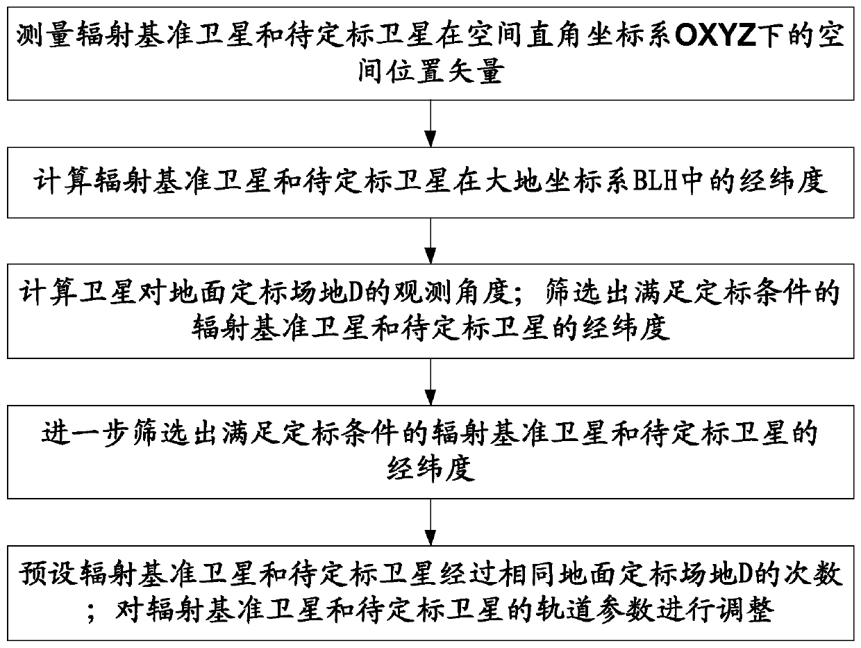
[0067] Aiming at the current situation that the accuracy of the existing on-orbit absolute calibration is not high and the joint observation frequency of the cross-radiation calibration is insufficient, the present invention provides a radiation reference satellite orbit optimization design method suitable for the land resource satellite on-orbit cross-radiation calibration, and establishes Based on the satellite orbit of the SGP4 model, combined with the calibration joint observation constraints, the calibration intersection information is accurately calculated, including the transit time and latitude and longitude information of the radiation reference satellite and the satellite to be calibrated.
[0068] Such as figure 1 As shown, the Landsat calibration orbit planning and reference load orbit optimization method specifically includes the following steps:
[0069] Step 1, the m...
PUM
 Abstract
Description
Claims
Application Information
 - R&D Engineer
- R&D Manager
- IP Professional
- Industry Leading Data Capabilities
- Powerful AI technology
- Patent DNA Extraction
Browse by: Latest US Patents, China's latest patents, Technical Efficacy Thesaurus, Application Domain, Technology Topic.
© 2024 PatSnap. All rights reserved.Legal|Privacy policy|Modern Slavery Act Transparency Statement|Sitemap