Aerial surveying and mapping robot for vegetation surveying and mapping
A robot and vegetation technology, applied in the direction of rotorcraft, aircraft, motor vehicles, etc., can solve the problems of unmanned aerial vehicle robot protection, plant damage, unable to land slowly, etc.
- Summary
- Abstract
- Description
- Claims
- Application Information
AI Technical Summary
Problems solved by technology
Method used
Image
Examples
Embodiment
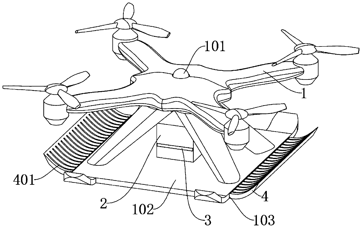
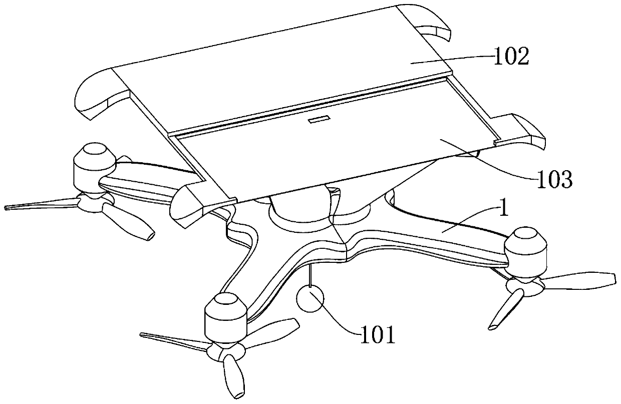
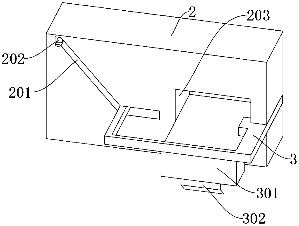
[0027] as attached figure 1 to attach Figure 5 Shown:
[0028]The invention provides an aerial surveying and mapping robot for vegetation surveying and mapping, which includes a main body 1, a mounting part 2, a moving part 3 and a buffer plate 4; hole, and the bottom bin 103 is used to make the buffer plate 4 move inside it, so that when the buffer plate 4 is released from the limit, the spring can support the buffer plate 4 in the bottom bin 103 to move outward; 2 is installed in the middle of the top of the bottom plate 102, and the moving hole at the bottom of the mounting part 2 is connected to the rectangular socket of the bottom compartment 103. A plurality of triggers 202 are arranged inside the guide groove 201 to increase the triggering of the triggers 202. probability, so that the moving part 3 can move better under force, and the moving bin 203 is used to embed and install the force plate 301, so that the force plate 301 can drive the block 302 to move inside, s...
PUM
 Abstract
Description
Claims
Application Information
 - R&D
- Intellectual Property
- Life Sciences
- Materials
- Tech Scout
- Unparalleled Data Quality
- Higher Quality Content
- 60% Fewer Hallucinations
Browse by: Latest US Patents, China's latest patents, Technical Efficacy Thesaurus, Application Domain, Technology Topic, Popular Technical Reports.
© 2025 PatSnap. All rights reserved.Legal|Privacy policy|Modern Slavery Act Transparency Statement|Sitemap|About US| Contact US: help@patsnap.com


