Three-dimensional virtual map visualization engine technology and device based on geographic position
A three-dimensional virtual and geographic location technology, applied in the field of virtual maps, can solve the problems of navigation accuracy defects, recognition defects, large data flow, etc., and achieve the effect of improving navigation accuracy, improving navigation efficiency, and reducing data flow.
- Summary
- Abstract
- Description
- Claims
- Application Information
AI Technical Summary
Problems solved by technology
Method used
Image
Examples
Embodiment 1
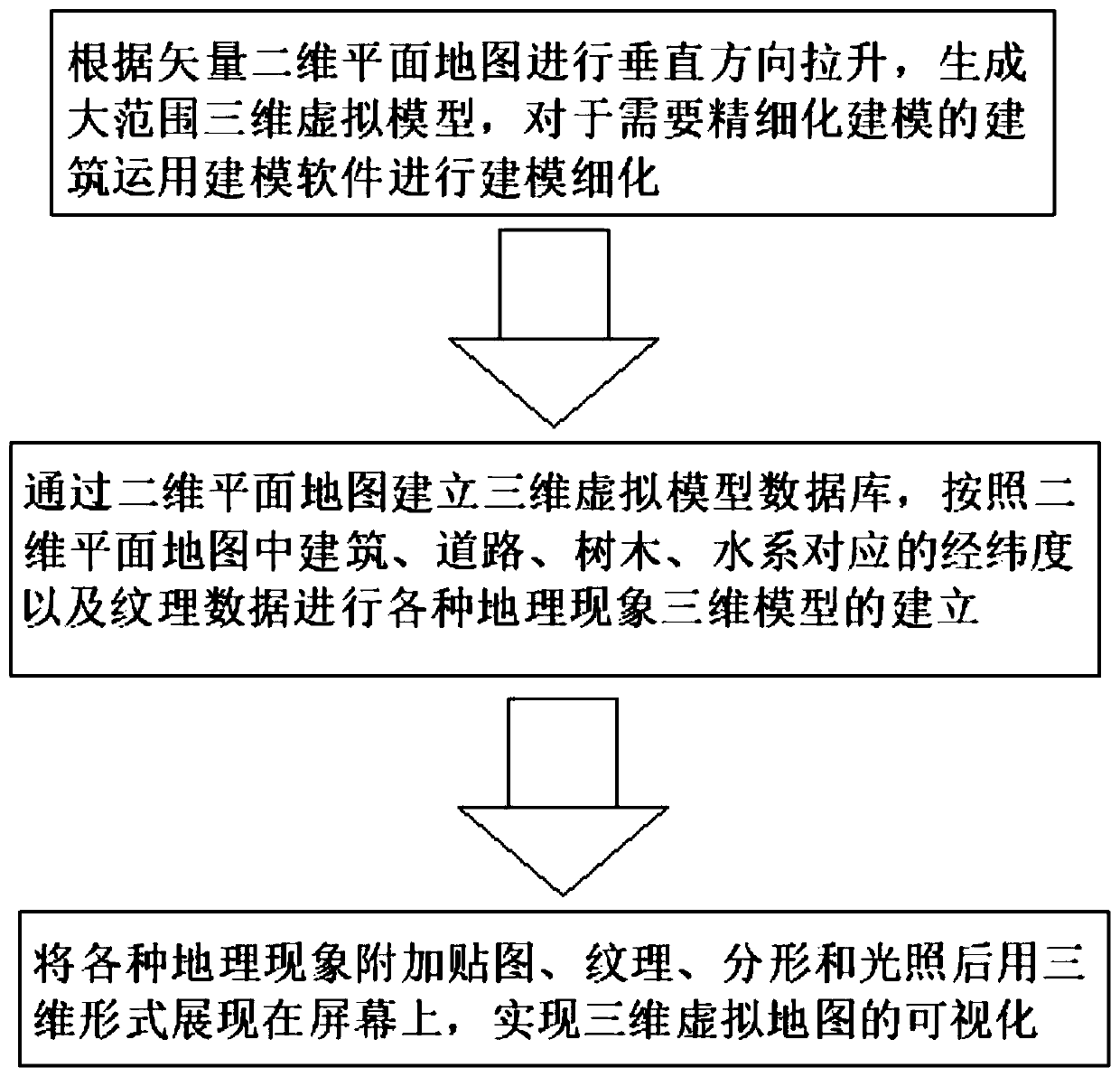
[0037] see figure 1 , a three-dimensional virtual map visualization engine technology based on geographic location, comprising the following steps:
[0038] S1. According to the vector two-dimensional planar map, the vertical direction is pulled up to generate a large-scale three-dimensional virtual model, and the modeling software is used to refine the modeling of the buildings that require refined modeling;
[0039] S2. Establish a three-dimensional virtual model database through a two-dimensional planar map, and establish three-dimensional models of various geographical phenomena according to the latitude, longitude and texture data corresponding to buildings, roads, trees, and water systems in the two-dimensional planar map;
[0040] S3. Add maps, textures, fractals and lighting to various geographical phenomena and display them on the screen in three-dimensional form to realize the visualization of three-dimensional virtual maps.
[0041] S1 and S2 are based on the two-w...
PUM
 Abstract
Description
Claims
Application Information
 - R&D
- Intellectual Property
- Life Sciences
- Materials
- Tech Scout
- Unparalleled Data Quality
- Higher Quality Content
- 60% Fewer Hallucinations
Browse by: Latest US Patents, China's latest patents, Technical Efficacy Thesaurus, Application Domain, Technology Topic, Popular Technical Reports.
© 2025 PatSnap. All rights reserved.Legal|Privacy policy|Modern Slavery Act Transparency Statement|Sitemap|About US| Contact US: help@patsnap.com


