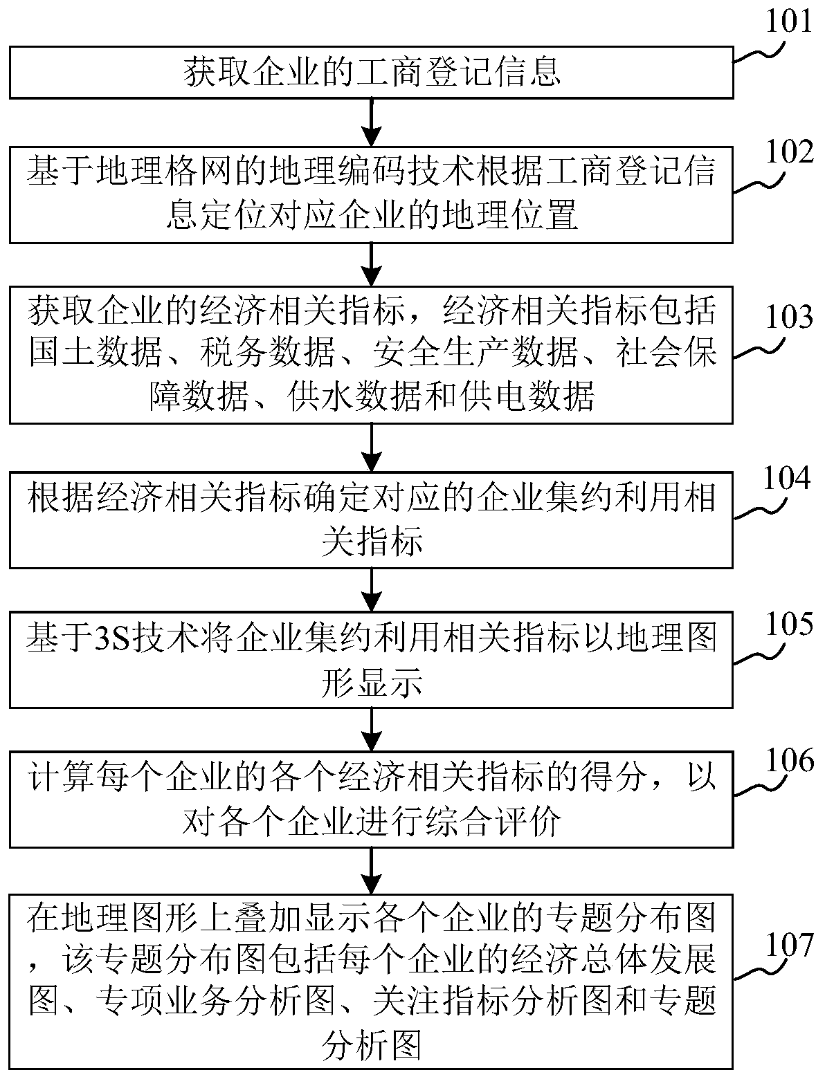
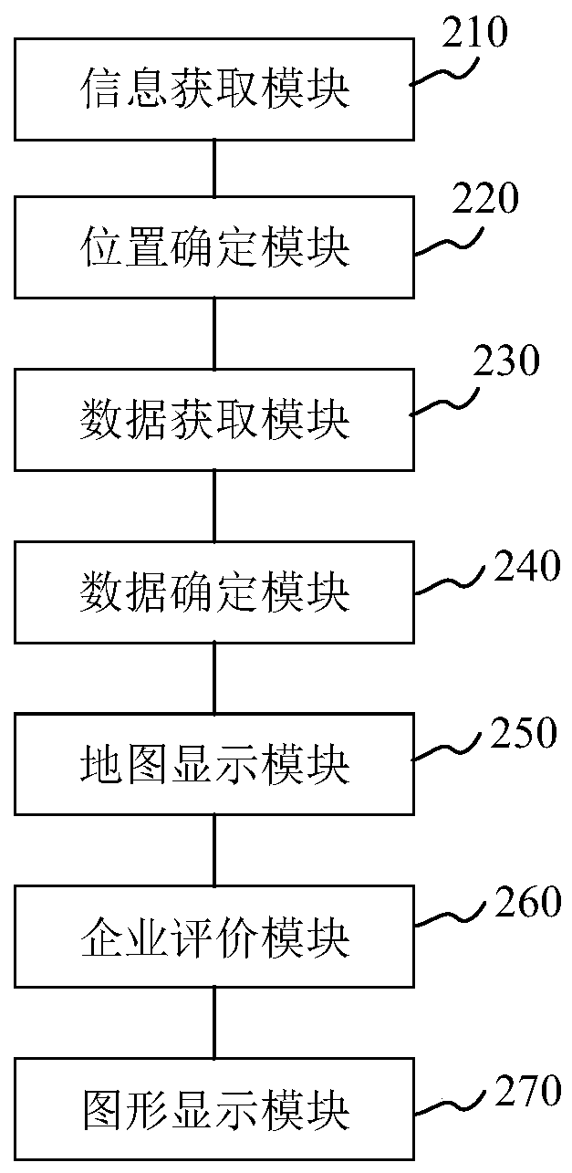
Enterprise resource intensive utilization method and device
A technology of enterprise resources and enterprises, applied in the computer field, can solve problems such as low visualization of analysis and display, lack of association between enterprises and parcels, lack of accuracy of enterprise evaluation models, etc., and achieve the effect of broadening management channels
- Summary
- Abstract
- Description
- Claims
- Application Information
AI Technical Summary
Problems solved by technology
Method used
Image
Examples
Embodiment Construction
[0057] The specific implementation manners of the present application will be further described in detail below in conjunction with the drawings and embodiments. The following examples are used to illustrate the present application, but not to limit the scope of the present application.
[0058] First, some terms involved in this application are introduced.
[0059] Geographic Information System (Geographic Information System or Geo-Information system, GIS) (or Geo-Information System): It is the product of multiple disciplines. It is based on geographic space, adopts geographic model analysis method, and provides a variety of spatial and dynamic geographic information in real time. It is a computer technology system that serves geographic research and geographic decision-making. It is a technical system that collects, stores, manages, calculates, analyzes, displays and describes the relevant geographical distribution data in the entire or part of the earth's surface (includin...
PUM
 Abstract
Description
Claims
Application Information
 - R&D
- Intellectual Property
- Life Sciences
- Materials
- Tech Scout
- Unparalleled Data Quality
- Higher Quality Content
- 60% Fewer Hallucinations
Browse by: Latest US Patents, China's latest patents, Technical Efficacy Thesaurus, Application Domain, Technology Topic, Popular Technical Reports.
© 2025 PatSnap. All rights reserved.Legal|Privacy policy|Modern Slavery Act Transparency Statement|Sitemap|About US| Contact US: help@patsnap.com


