Ecological restoration space identification method based on ecosystem service perspective
A technology of ecological system and ecological restoration, applied in the direction of instruments, data processing applications, resources, etc., can solve the problem of not correctly understanding the nature and root causes of regional ecological problems, lack of systematic and holistic considerations, and the spatial scope and scale of ecological restoration The judgment lacks scientific basis and other issues
- Summary
- Abstract
- Description
- Claims
- Application Information
AI Technical Summary
Problems solved by technology
Method used
Image
Examples
Embodiment 1
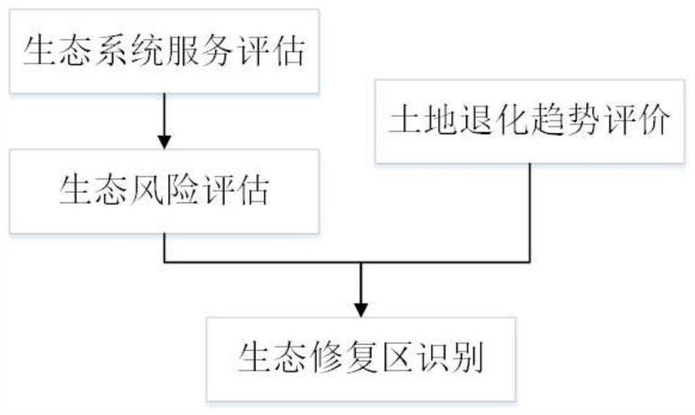
[0084] Such as figure 1 As shown, Embodiment 1 of the present invention proposes an ecological restoration space identification method based on the perspective of ecosystem services, including:
[0085] (1) Ecosystem service assessment:
[0086] In the designated area, use the water balance equation to calculate the water conservation during the assessment period; use the modified wind erosion equation (RWEQ) to calculate the windbreak and sand fixation during the assessment period; use the revised universal soil erosion equation (RUSLE) to calculate the soil conservation during the assessment period; select Vegetation net primary productivity (NPP) is used as a characterization of the carbon sequestration function of the ecosystem. The CASA model is used to calculate the NPP during the assessment period, and then the carbon sequestration amount is obtained. The assessment period is 10, 15 or 20 years.
[0087] (2) Ecological risk assessment
[0088] Divide the specified ar...
Embodiment 2
[0114] Embodiment 2 of the present invention proposes an ecological restoration space identification system based on the perspective of ecosystem services, and the system includes:
[0115] Ecosystem service assessment calculation module, which is used to select water conservation, windbreak and sand fixation, soil conservation and carbon sequestration as the dominant ecosystem services, and obtain the assessment quantity of ecosystem services in the assessment period of the designated area;
[0116] The ecological risk assessment result calculation module is used to divide the specified area into multiple grids, and determine the reverse transformation probability and loss level of each grid according to the assessment amount of each ecosystem service in the assessment period, thus forming Ecological risk assessment results for each grid;
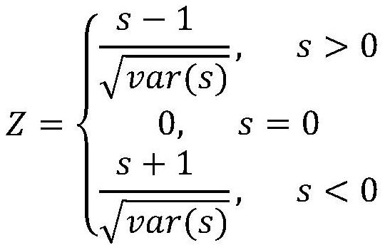
[0117] The land degradation evaluation result calculation module is used for the trend test analysis of the yearly normalized difference ...
PUM
 Abstract
Description
Claims
Application Information
 - R&D
- Intellectual Property
- Life Sciences
- Materials
- Tech Scout
- Unparalleled Data Quality
- Higher Quality Content
- 60% Fewer Hallucinations
Browse by: Latest US Patents, China's latest patents, Technical Efficacy Thesaurus, Application Domain, Technology Topic, Popular Technical Reports.
© 2025 PatSnap. All rights reserved.Legal|Privacy policy|Modern Slavery Act Transparency Statement|Sitemap|About US| Contact US: help@patsnap.com


