GIS-based satellite coverage area rapid simulation method

A simulation method and technology of coverage area, applied in the field of satellite networking communication, can solve the problems of reducing the amount of calculation, increasing the amount of calculation, and decreasing the accuracy of coverage analysis.

Pending Publication Date: 2020-11-24
INST OF MECHANICS - CHINESE ACAD OF SCI
View PDF0 Cites 6 Cited by
  • Summary
  • Abstract
  • Description
  • Claims
  • Application Information

AI Technical Summary

Problems solved by technology

[0003] Therefore, the coverage accuracy simulation is closely coupled with the grid division. When the grid division is fine, the coverage analysis accuracy is improved, but the calculation

Method used


Image

  • GIS-based satellite coverage area rapid simulation method
  • GIS-based satellite coverage area rapid simulation method
  • GIS-based satellite coverage area rapid simulation method

Examples


Embodiment Construction

[0089] The implementation mode of the present invention is illustrated by specific specific examples below, and those who are familiar with this technology can easily understand other advantages and effects of the present invention from the contents disclosed in this description. Obviously, the described embodiments are a part of the present invention. , but not all examples. Based on the embodiments of the present invention, all other embodiments obtained by persons of ordinary skill in the art without making creative efforts belong to the protection scope of the present invention.

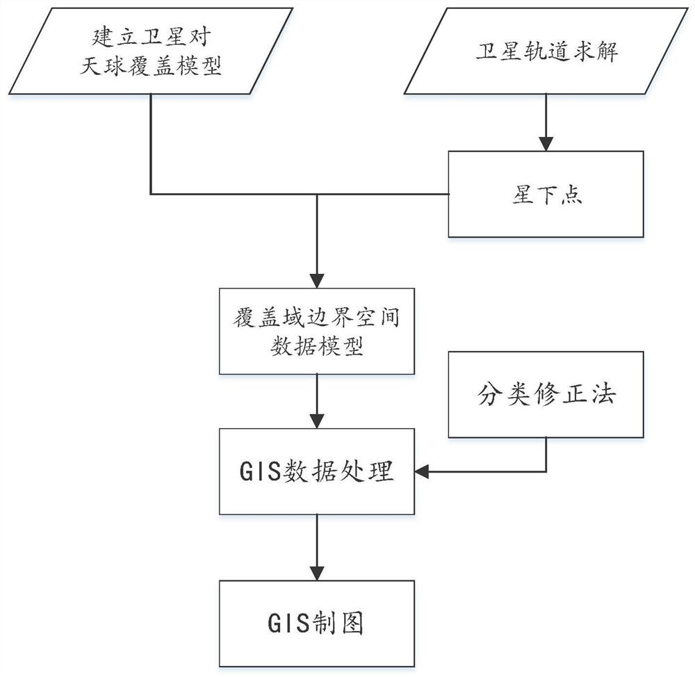
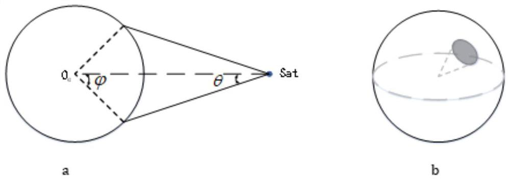
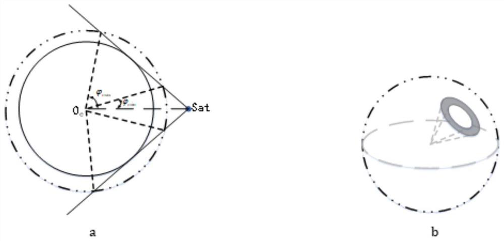
[0090] A kind of GIS-based satellite coverage domain rapid simulation method provided by the present invention mainly determines the target celestial sphere by the target task, analyzes the coverage to the ground, then the radius of the target celestial sphere is the radius of the earth, and discusses the space coverage, then the target celestial sphere radius is space sphere.

[0091] Different...


PUM


Abstract

The invention discloses a GIS-based satellite coverage area rapid simulation method, which specifically comprises the following steps of: calculating geocentric angles of a satellite to-ground coverage domain and a satellite to-air coverage domain, and obtaining the geocentric longitude and geocentric latitude of a sub-satellite point by a spherical trigonometric formula; solving spatial data models of boundaries of the satellite to-ground coverage domain and the satellite to-air coverage domain; sequentially carrying out classification correction and Mercator projection processing on the spatial data models of the boundary of the satellite to-ground coverage domain and the boundary of the satellite to-air coverage domain to obtain spatial data models of the coverage domain boundaries on aMercator graph; and processing the spatial data models of the coverage domain boundaries on the Mercator graph through a GIS mapping technology to obtain a coverage domain Mercator projection graph of the satellite to a celestial sphere and a constellation coverage image generated by superposing a plurality of satellite coverage domains. The spatial data models of the coverage domain boundaries are classified and corrected, so that the geometric objects of the coverage domain boundaries can be created directly based on the azimuth angle algorithm for region filling, and coverage judgment point by point in the region is not needed.

Description

technical field [0001] The invention relates to the technical field of satellite network communication, in particular to a GIS-based fast simulation method for satellite coverage domains. Background technique [0002] Satellite coverage analysis is widely used in space missions such as satellite mission planning, reconnaissance, and constellation design. The visual display of satellite coverage domains on two-dimensional maps will be beneficial to the coverage analysis of satellites and constellations. At present, the visualization of coverage domains is mostly based on the grid point method. This method is based on dividing the coverage area by grid and solving the coverage point by point. The basic idea of ​​sampling coverage results is that point-by-point calculations are used in the coverage analysis process. [0003] Therefore, the coverage accuracy simulation is closely coupled with the grid division. When the grid division is fine, the coverage analysis accuracy is i...

Claims


Application Information

Patent Timeline
IPC IPC(8): G06F30/23G06T11/00G06T11/20
CPCG06F30/23G06T11/206G06T11/003
Inventor 吕林立李文皓张珩肖歆昕冯冠华赵志杰
Owner INST OF MECHANICS - CHINESE ACAD OF SCI
Why Eureka
Try Eureka