Multi-unmanned aerial vehicle cooperative path planning method

A multi-UAV and path planning technology, applied in the field of UAVs, can solve the problem of not considering the overall benefits of UAV swarms, and achieve the effect of ensuring superiority, ensuring safety and efficiency, and accelerating convergence speed.

Active Publication Date: 2021-02-05
CHINA UNIV OF GEOSCIENCES (WUHAN)
View PDF9 Cites 12 Cited by
  • Summary
  • Abstract
  • Description
  • Claims
  • Application Information

AI Technical Summary

Problems solved by technology

[0009] The UAV swarm path planning based on the improved Q-learning algorithm only plans the path for each UAV individually without considering the overall benefit of its UAV swarm

Method used


Image

  • Multi-unmanned aerial vehicle cooperative path planning method
  • Multi-unmanned aerial vehicle cooperative path planning method
  • Multi-unmanned aerial vehicle cooperative path planning method

Examples


Embodiment Construction

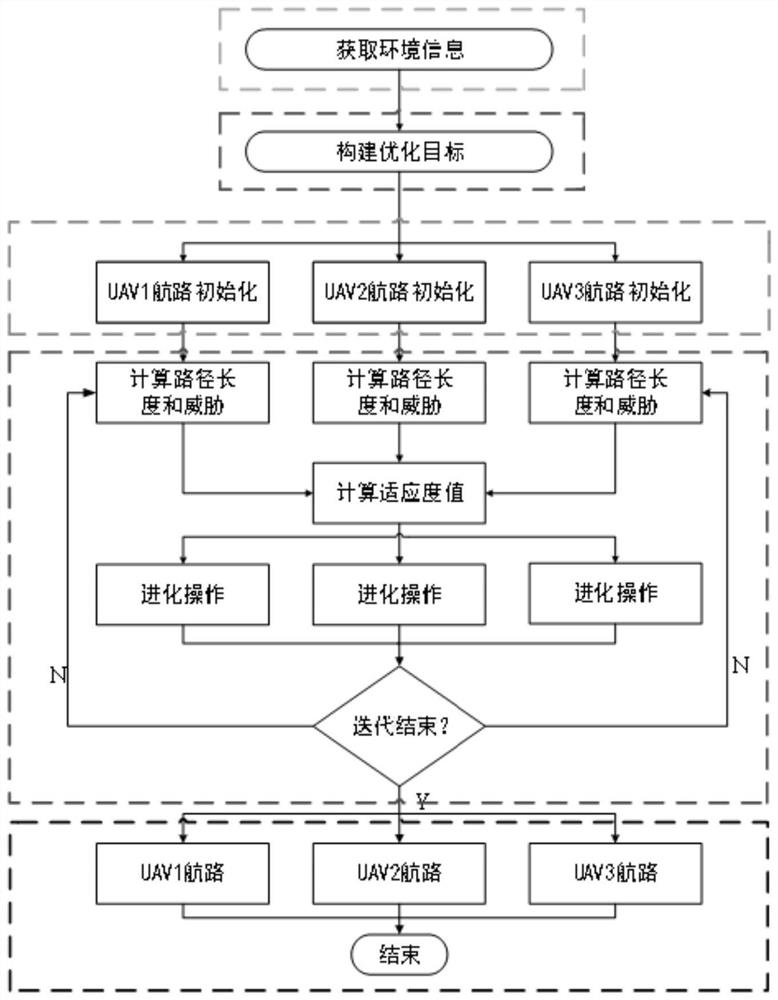
[0027] In order to make the purpose, technical solution and advantages of the present invention clearer, the embodiments of the present invention will be further described below in conjunction with the accompanying drawings.

[0028] Please refer to figure 1 , the present invention provides a multi-UAV collaborative path planning method, comprising the following steps:

[0029] S1. The UAV swarm acquires the starting point position, obstacle point and existing radar coordinates in the map environment, and establishes a two-dimensional grid map of the combat environment;

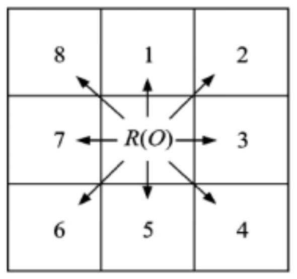
[0030] The path points are expressed in the form of coordinates in a two-dimensional grid map, and the flight environment of the UAV is described as:

[0031] {(x,y)|x min ≤x≤x max ,y min ≤y≤y max};x min 、x max 、y min and y max represented as the boundary of the drone flight;

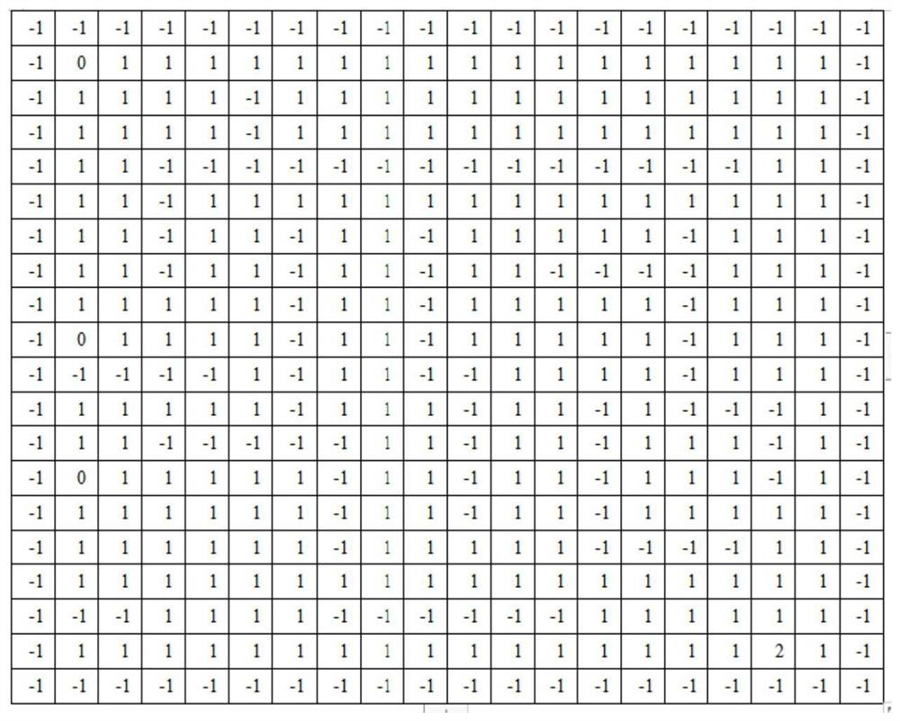
[0032] Such as figure 2 As shown, the environment is divided into 20*20 squares with the same area, and each square carri...


PUM


Abstract

The invention provides a multi-unmanned aerial vehicle cooperative path planning method. The method comprises the following steps that: an unmanned aerial vehicle group acquires a starting point position, an obstacle point and an existing radar coordinate in a map environment, and establishes a combat environment two-dimensional grid map; an optimization objective of multiple unmanned aerial vehicles is constructed through the path length of each unmanned aerial vehicle and the intensity of threats imposed on each unmanned aerial vehicle on the basis of the obtained two-dimensional grid map; population initialization is realized by combining random path point generation and Q learning, and an initial population of the paths ofeach unmanned aerial vehicle is obtained; the initial populationis optimized by adopting an improved particle swarm algorithm according to the optimization objective; and the optimal particle of the population is obtained, the route of each unmanned aerial vehicle in the unmanned aerial vehicle cluster is output. According to the method, the overall benefit of the multiple unmanned aerial vehicles is taken as the optimization objective, and the safety and high efficiency of the flight path of each unmanned aerial vehicle are ensured.

Description

technical field [0001] The invention relates to the technical field of unmanned aerial vehicles, in particular to a multi-unmanned aerial vehicle collaborative path planning method. Background technique [0002] Multi-UAV collaboration is the main form of UAV use in the future. Multi-UAV collaborative path planning largely determines the effectiveness of multi-UAV collaboration, and is the focus of current UAV path planning research. [0003] Multi-UAV cooperative path planning refers to planning paths for multiple UAVs under the consideration of cooperative constraints, so that they can cooperate to complete tasks with the minimum cost. Compared with a single UAV, it is more restricted and more difficult to implement path planning for multiple UAVs, which is both the focus and difficulty of current path planning. [0004] Traditional algorithms such as A*, Voronoi diagram and other algorithms have high computational efficiency and simple planning. MA P B et al. used Voron...

Claims


Application Information

Patent Timeline
Patent Type & Authority Applications(China)
IPC IPC(8): G05D1/10
CPCG05D1/104
Inventor 周志浪刘小波郑可心张超超杨建峰
Owner CHINA UNIV OF GEOSCIENCES (WUHAN)
Why Eureka
Try Eureka