

Image preprocessing method based on geological radar
An image preprocessing and geological radar technology, applied in the field of image processing, can solve problems such as inaccurate judgment, inability to remove high frequency, and blurred recognition, and achieve accurate results
- Summary
- Abstract
- Description
- Claims
- Application Information
AI Technical Summary
Problems solved by technology
Method used
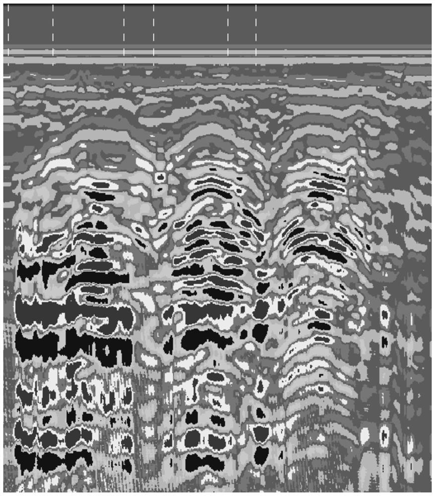
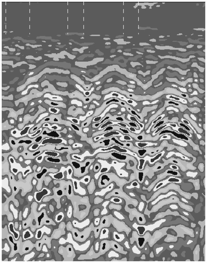
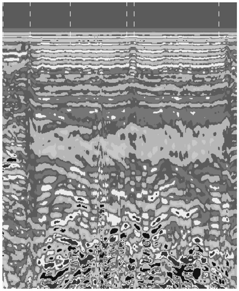
Image

Examples
Embodiment 1
[0058] A preprocessing method based on ground radar images, comprising:
[0059] Step 1: Use the Filter Based on Feature-based Dividing Symbolic Radar Images Representation (FDS-Filter) to filter the ground radar image first;
[0060] Step 2: Use image processing technology to remove reflection signals from the filtered ground radar image;
[0061] Step 3: Use image processing technology to perform offset correction on the ground radar image after reflection removal.
Embodiment 2
[0063] A kind of preprocessing method based on ground radar image, as shown in embodiment 1, difference is, the method that step 1 adopts FDS-Filter to filter comprises the following steps:
[0064] 1.1. Input the entire image into FSD-Filter;
[0065] 1.2. Using the PAA method, the ground radar image T is standardized to a standard normal distribution with an expectation of 0 and a variance of 1, denoted as The filter threshold is set to σ; the value of σ can be filtered according to the on-site distribution, the larger the value, the less detail is preserved;
[0066] 1.3. Use the SAX method to represent the characteristic symbols, and cluster and divide the sub-segment waveforms;
[0067] 1.4. Record the ground radar image A segment of the waveform in Where 1≤i<j≤n, then the maximum interval MICS of the sub-waveform CS can be calculated by the following formula, recorded as:
[0068]
[0069] 1.3. The initially segmented GPR waveform to be represented is the GPR i...
Embodiment 3
[0079] A preprocessing method based on geological radar images, as shown in Example 2, the difference is that the SAX method in step 1.3, that is, the symbolic aggregate approximation method (Symbolic Aggregate Approximation, SAX) is a method that utilizes symbols to The method of radar waveform representation and similarity measurement, for a given radar waveform length n geological radar image T, the process of symbolic aggregation approximation method is as follows:
[0080] a. Put T={d 1 , d 2 ,...,d n} normalized to a radar image with mean 0 and standard deviation 1
[0081] b. Using the piecewise aggregation approximation method (Piecewise Aggregate Approximation, PAA) to Expressed as N equal-length waveform segments, namely in, is the mean value corresponding to the i-th segment, which can be obtained by the following formula:
[0082]
[0083] c. Normalized radar waveform Meet the Gaussian distribution, select the character set size a, and find the corr...
PUM
 Abstract
Description
Claims
Application Information