Method for creating and updating three-dimensional grid map based on roadside laser radar
A technology of laser radar and grid map, which is applied in the direction of road network navigator, electromagnetic wave re-radiation, measuring device, etc., can solve the problems of inability to meet the requirements of non-line-of-sight environment perception and limited perception distance
- Summary
- Abstract
- Description
- Claims
- Application Information
AI Technical Summary
Problems solved by technology
Method used
Image
Examples
Embodiment Construction
[0020] In order to better illustrate the method for creating and updating the three-dimensional grid map proposed by the present invention, the specific implementation will be described in detail in conjunction with the patent drawings:
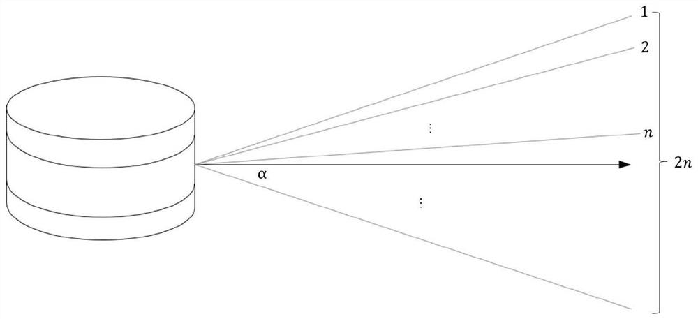
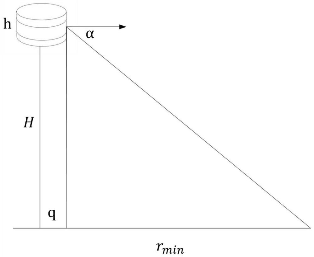
[0021] Step1: Layout of roadside lidar: such as figure 2 and 3 As shown, since the laser in the lidar has the maximum pitch angle ±α, it has the minimum range r m , that is, obstacles within the distance r will not be detected. When laying on the roadside, the minimum measuring range r min It will change with the height H of the lidar bracket, assuming that the height of the lidar itself is h and the radius is q:
[0022] r min =q+(h / 2+H) / tanα
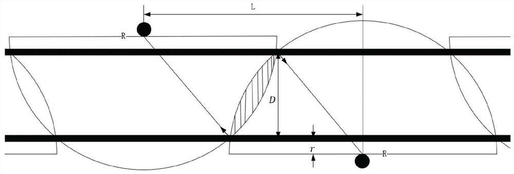
[0023] In addition, the roadside layout also needs to ensure that the lidar has no blind spots, so it is deployed on both sides of the road at intervals. Assuming that the maximum range of the lidar is R and the road width is D, then as figure 2 As shown, the distance between two adjacent lid...
PUM
 Abstract
Description
Claims
Application Information
 - R&D
- Intellectual Property
- Life Sciences
- Materials
- Tech Scout
- Unparalleled Data Quality
- Higher Quality Content
- 60% Fewer Hallucinations
Browse by: Latest US Patents, China's latest patents, Technical Efficacy Thesaurus, Application Domain, Technology Topic, Popular Technical Reports.
© 2025 PatSnap. All rights reserved.Legal|Privacy policy|Modern Slavery Act Transparency Statement|Sitemap|About US| Contact US: help@patsnap.com


